mail_outline sales@mediastorehouse.com
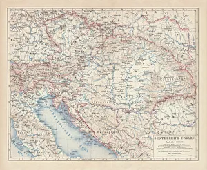
Austro-Hungarian Empire, Habsburg Monarchy, lithograph, published in 1877Ancient map of Austro-Hungarian Empire. Habsburg Monarchy. Lithograph, published in 1877
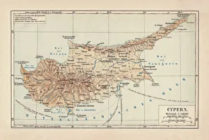
Map of Cyprus, published in 1880Ancient map of Cyprus. Lithograph, published in 1880
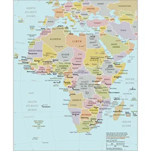
Political Map of AfricaVector Illustration of the policital map of Africa Reference map as created by the US Central Intelligence Agency
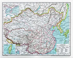
China mapillustration of a South Eastern Asia map
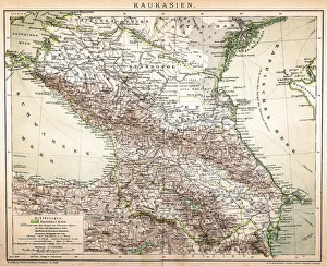
Old Caucasus mapAntique map of Caucasus
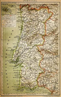
Map of PortugalAntique illustration engraving map og Portugal
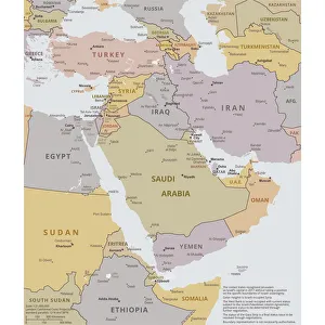
Political map of The Middle EastVector illustration of the policital map of The Middle East Reference map was created by the US Central Intelligence Agency
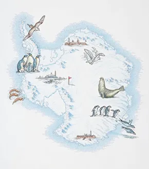
Map of Antarctica overlaid with illustrations of Sea Gulls, Penguins, Elephant Seal, Shrimp and buildings
Antique map of Hadrians wall
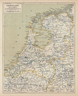
Map of the Netherlands, lithograph, published in 1877Map of the Netherlands. Lithograph, published in 1877
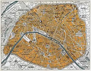
City map of Paris, lithograph, published in 1877City map of Paris, France. Lithograph, published in 1877
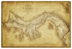
Map of Panama 1864Map of Panama - combined with 2 different texture overlays
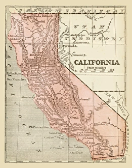
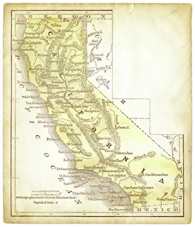
Old map of California 1855System of Geography for the use of schools by Sidney E. Morse - Published by Harper & Brothers - New York 1855
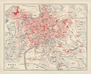
City map of Rome, lithograph, published in 1878City map of Rome, Italy. Lithograph, published in 1878
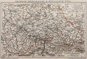
Kingdom of Saxony, Eastern partAntique illustration of a Kingdom of Saxony, Eastern part
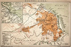
Buenos Aires mapAntique engraving map of Buenos Aires
City map of ParisAntique illustration of a City map of Paris
Illustration of world map showing sites of volcanic activity
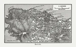
Historic city map of Beirut, Lebanon, wood engraving, published 1897Historic city map of Beirut - capital and largest city of Lebanon. Wood engraving, published in 1897
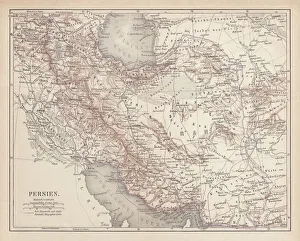
Ancient map of Persia, lithograph, published in 1877Ancient map of Persia. Lithograph, published in 1877
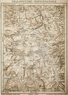
Map of Yellowstone National Park, USA
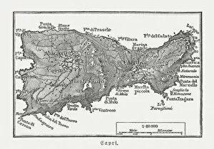
Map of Capri, Italian island, wood engraving published in 1897Map of Capri, Italian island. Wood engraving, published in 1897
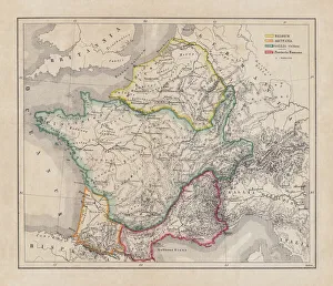
Gaul in the time of Julius Caesar, published in 1867Gaul in the time of Roman politican Gaius Iulius Caesar (100 - 44 BC). Steel engraving with hand-colored borderlines and Latin legend, published in 1867
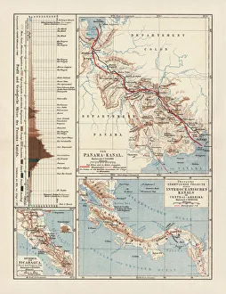
Panama Canal Project, lithograph, published in 1880Ancient map of the Panama Canal Project. Lithograph, published in 1880
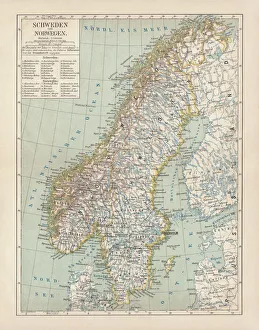
Sweden and Norway, lithograph, published in 1878Ancient map of Sweden and Norway. Lithograph, published in 1878
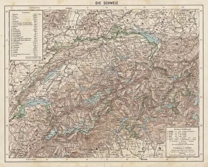
Switzerland, Topographic map, published in 1881Topographic map of Switzerland. Facsimile, published in 1881
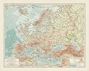
Topographic map of Europe, lithograph, published in 1897Topographic map of Europe. Lithograph, published in 1897
Historical map of Palestine with the twelve tribes of Israel. Colored steel engraving, published in 1886
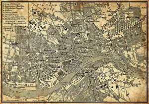
Map of Newcastle Upon TyneAntique illustration of old Newcastle Upon Tyne map
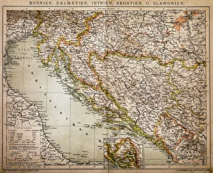
Bosnia, dalmatia, istria, croatia, slavoniaAntique illustration of a Bosnia, dalmatia, istria, croatia, slavonia map
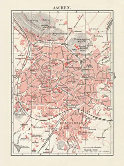
City map of Aachen, Germany, lithograph, published in 1897City map of Aachen, Germany. Lithograph, published in 1897
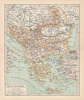
Balkan Peninsula in 1878, lithographAncient map Balkan. The political classification of the Balkan Peninsula after the Treaty of Berlin in 1878. Lithograph, published in 1878
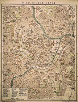
Vienna inner cityAntique map of Vienna from 1898
Loch na h-Achlaise Reflections, Rannoch Moor ScotlandSpectacular dramatic weather creates a moody atmosphere over the Mountains of Loch na h-Achlaise. The tranquil water of the loch reflects the distant mountains, islands of trees
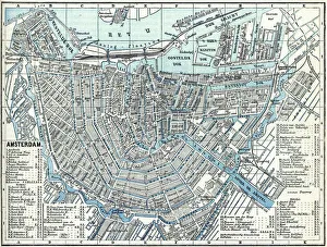
Map of city Amsterdam Netherlands from 1881 Original edition from my own archives Source : Illustriertes Konversations Lexikon 1881
Old map of California 1856Colton and Fitchs Modern School Geography by George W. Fitch - New York 1856
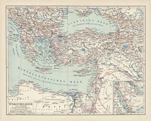
Ottoman Empire, lithograph, published in 1878Ancient map of Ottoman Empire. Lithograph, published in 1878
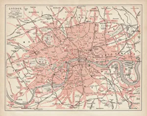
City map of London, lithograph, lithograph, published in 1877City map of London, United Kingdom. Lithograph, published in 1877
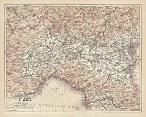
Ancient map of Northern Italy, lithograph, published in 1876Ancient map of Northern Italy. Lithograph, published in 1876
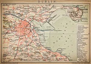
DublinAntique map of Dublin
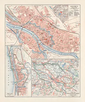
City map of Bremen, Germany, lithograph, published 1897City map of Bremen, Germany. Lithograph, published in 1897
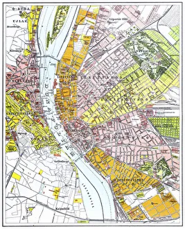
Budapest city mapIllustration of a Budapest city map
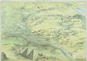
Antique engraving depicting birds eye view of Cairo
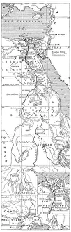
Antique map of Nile River
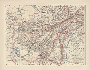
Afghanistan, lithograph, published in 1881Ancient map of Afghanistan. Lithograph, published in 1881
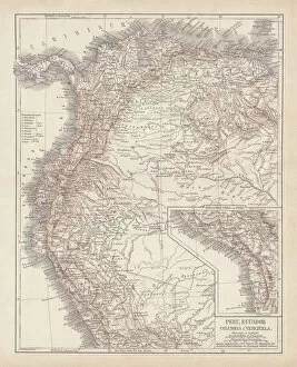
Peru, Ecuador, Colombia, Venezuela, lithograph, published in 1877Ancient map of Peru, Ecuador, Colombia, and Venezuela. Lithograph, published in 1877
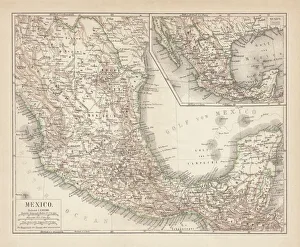
Mexico, ancient map, lithograph, published in 1877Ancient map of Mexico. Lithograph, published in 1877
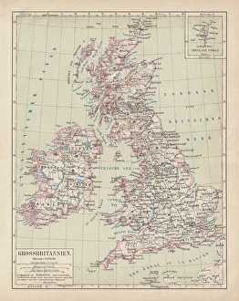
Map of British Isles, lithograph, lithograph, published in 1876Map of British Isles. Lithograph, published in 1876