mail_outline sales@mediastorehouse.com
1,517 Items
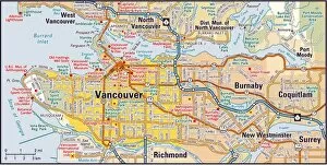
Vancouver, British Columbia area2009 edition
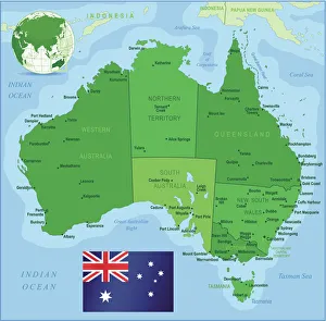
Map of Australia with states, cities and flagHighly detailed vector map of Australia with states, capitals and big cities
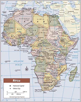
Africa continent map2011 edition
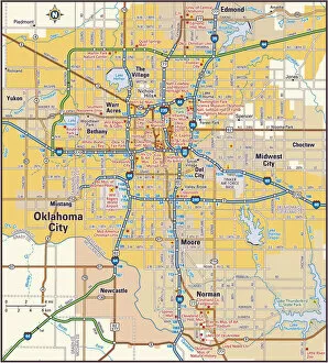
Oklahoma City, Oklahoma area2011 edition
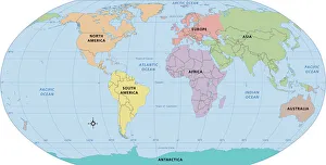
World map, continent labels2011 edition
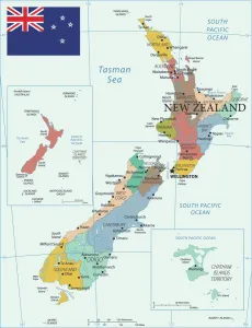
Map of New ZealandLabelled Map of New Zealand with flag illustration
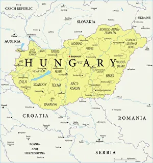
Map of Hungary - Vector illustration
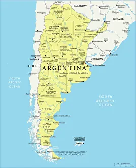
Map of Argentina - Vector illustration
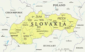
Map of Slovakia - Vector illustration
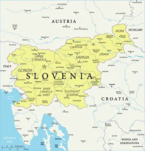
Map of Slovenia - Vector illustration
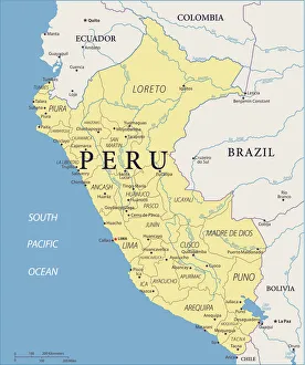
Map of Peru - Vector illustration
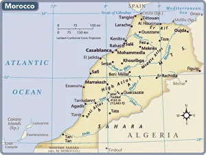
Morocco country map2011 edition
Democratic Republic of the Congo locator mapFine Art Storehouse Maps: Reference Maps
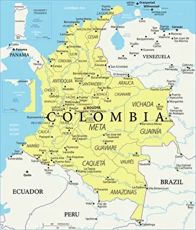
Colombia Reference Map
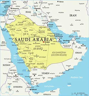
Saudi Arabia Reference Map974230500
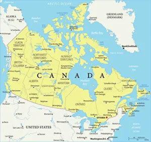
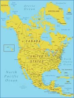
Canada Reference Map935511898
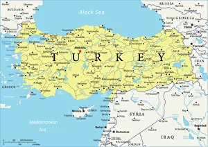
Turkey Reference Map966251888
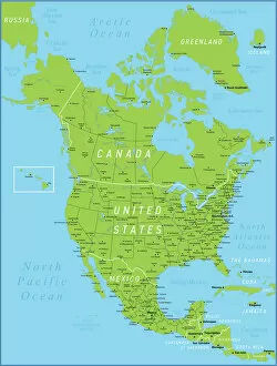
North America Green Map with United States, Canada, Mexico, geographical borders and riversNorth America Map with United States, Canada, Mexico and Cuba Map was found: Map was found: Created with Adobe Illustrator with splines
Map of North America. High detailed orange vector map with Borders and RiversNorth America Map with United States, Canada, Mexico and Cuba Map was found: Map was found: Created with Adobe Illustrator with splines
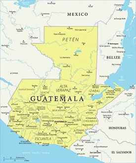
Map of Guatemala - Vector illustration
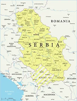
Map of Serbia - Vector illustration
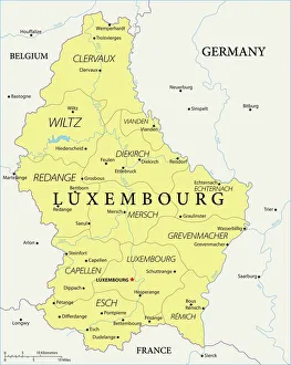
Map of Luxembourg - Vector illustration
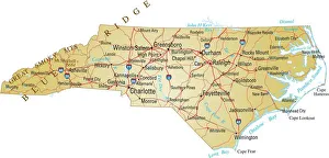
Full map of North Carolina with cities and towns markedVector illustration of map of North Carolina with major roads, rivers and lakes
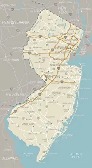
New Jersey MapA detailed map of New Jersey state with cities, roads, major rivers, and lakes. Includes neighboring states and surrounding water
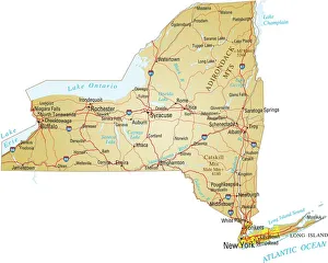
Map of New YorkVector illusttration of map of New York state with major roads, river and lakes
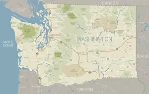
Washington State MapA detailed map of Washington state with major rivers, lakes, roads and cities plus National Parks, national forests and indian reservations
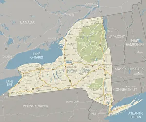
New York State MapA detailed map of the New York State, including surrounding states. Includes major highways, cities, rivers and lakes. Elements are grouped and separate for easy changes
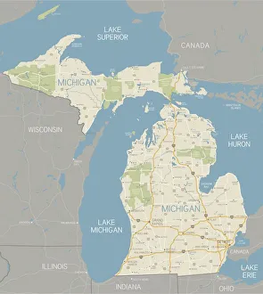
Michigan MapA detailed map of the Michigan. Includes major highways, cities, rivers and lakes. Elements are grouped and separate for easy color changes
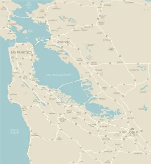
San Francisco Bay Area MapA map of the Bay Area, including San Francisco, Oakland and San Jose. Includes highways and freeways, the main cities in the region and bodies of water. Includes CS3 file and an extra-large JPG
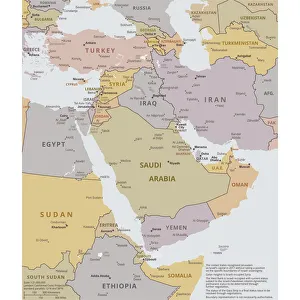
Political map of The Middle EastVector illustration of the policital map of The Middle East Reference map was created by the US Central Intelligence Agency
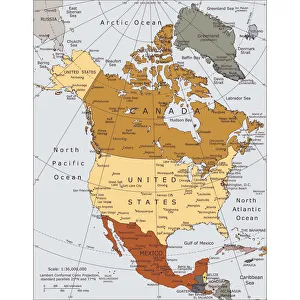
Political map of North AmericaVector illustration of the political map of North America. Reference map was created by the US Central Intelligence Agency
102890909Reference Maps, 102890909
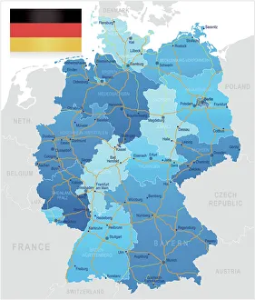
Germany - road mapHighly detailed map of Germany with roads, administrative divisions and cities
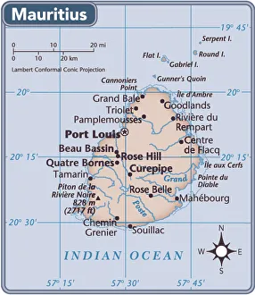
Mauritius country map2011 edition
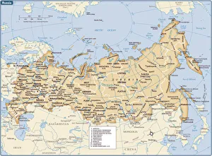
Russia country map2011 edition
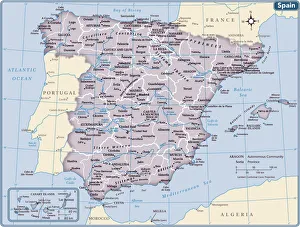
Spain country map2011 edition
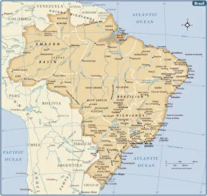
Brazil country map2011 edition
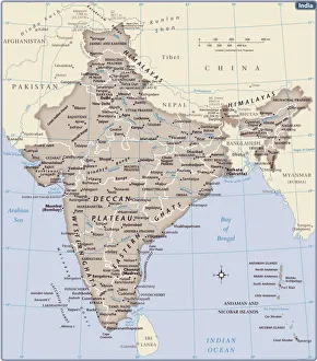
India country map2011 edition
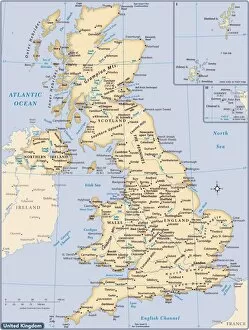
United Kingdom country map2011 edition
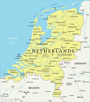
Netherlands Reference Map950857474
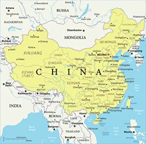
China Reference Map949100300
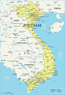
Vietnam Reference Map
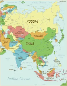
Asia Map with national borders and riversAsia Vintage Map with national borders and rivers Map
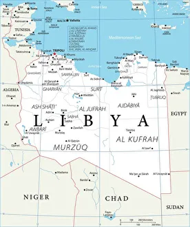
Map of LibyaReference Map of Libya
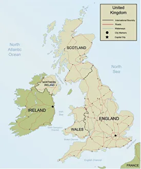
Map of the United KingdomDetailed Hand drawn map of the United Kingdom and Ireland. Map includes Main roadways, waterways, as well as city and Capital Markers.(All separate Layers)
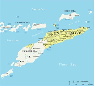
Map of East Timor - Vector illustration
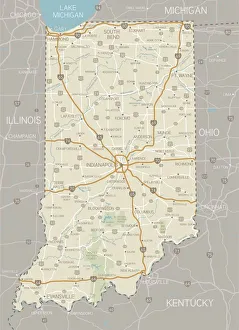
Indiana MapA detailed map of Indiana state with cities, roads, major rivers, and lakes plus National Forests. Includes neighboring states and surrounding water
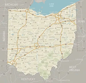
Ohio MapA detailed map of Ohio state with cities, roads, major rivers, and lakes plus National Forests. Includes neighboring states and surrounding water