mail_outline sales@mediastorehouse.com
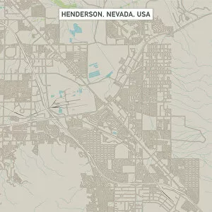
Henderson Nevada US City Street MapVector Illustration of a City Street Map of Henderson, Nevada, USA. Scale 1:60, 000. All source data is in the public domain. U.S
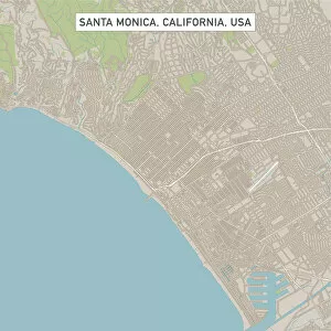
Santa Monica California US City Street MapVector Illustration of a City Street Map of Santa Monica, California, USA. Scale 1:60, 000. All source data is in the public domain. U.S
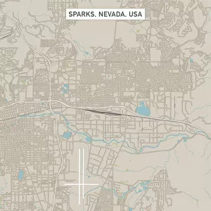
Sparks Nevada US City Street MapVector Illustration of a City Street Map of Sparks, Nevada, USA. Scale 1:60, 000. All source data is in the public domain. U.S
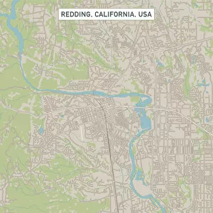
Redding California US City Street MapVector Illustration of a City Street Map of Redding, California, USA. Scale 1:60, 000. All source data is in the public domain. U.S
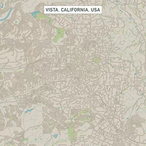
Vista California US City Street MapVector Illustration of a City Street Map of Vista, California, USA. Scale 1:60, 000. All source data is in the public domain. U.S
Hillsboro Oregon US City Street MapVector Illustration of a City Street Map of Hillsboro, Oregon, USA. Scale 1:60, 000. All source data is in the public domain. U.S
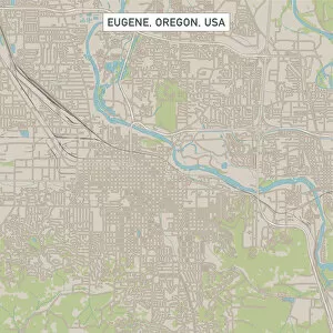
Eugene Oregon US City Street MapVector Illustration of a City Street Map of Eugene, Oregon, USA. Scale 1:60, 000. All source data is in the public domain. U.S
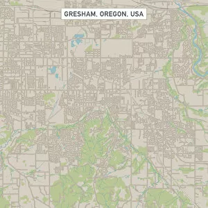
Gresham Oregon US City Street MapVector Illustration of a City Street Map of Gresham, Oregon, USA. Scale 1:60, 000. All source data is in the public domain. U.S
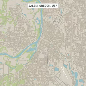
Salem Oregon US City Street MapVector Illustration of a City Street Map of Salem, Oregon, USA. Scale 1:60, 000. All source data is in the public domain. U.S
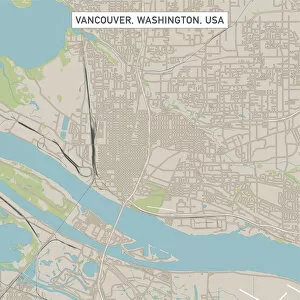
Vancouver Washington US City Street MapVector Illustration of a City Street Map of Vancouver, Washington, USA. Scale 1:60, 000. All source data is in the public domain. U.S
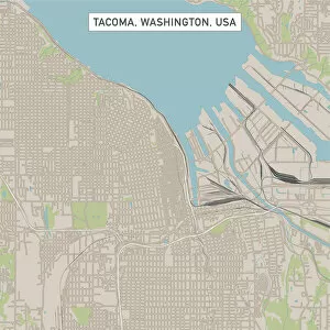
Tacoma Washington US City Street MapVector Illustration of a City Street Map of Tacoma, Washington, USA. Scale 1:60, 000. All source data is in the public domain. U.S
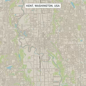
Kent Washington US City Street MapVector Illustration of a City Street Map of Kent, Washington, USA. Scale 1:60, 000. All source data is in the public domain. U.S
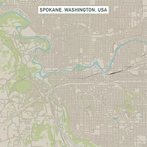
Spokane Washington US City Street MapVector Illustration of a City Street Map of Spokane, Washington, USA. Scale 1:60, 000. All source data is in the public domain. U.S
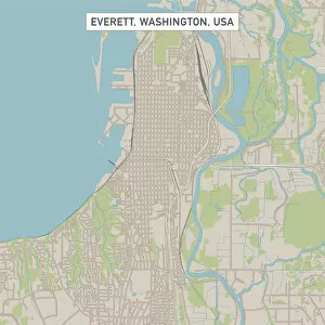
Everett Washington US City Street MapVector Illustration of a City Street Map of Everett, Washington, USA. Scale 1:60, 000. All source data is in the public domain. U.S
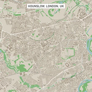
Hounslow London UK City Street MapVector Illustration of a City Street Map of Hounslow, London, UK. Included files are EPS (v10) and Hi-Res JPG. Data courtesy from Ordnance Survey: VectorMap District https
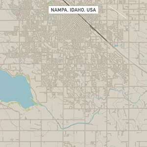
Nampa Idaho US City Street MapVector Illustration of a City Street Map of Nampa, Idaho, USA. Scale 1:60, 000. All source data is in the public domain. U.S
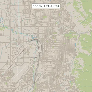
Ogden Utah US City Street MapVector Illustration of a City Street Map of Ogden, Utah, USA. Scale 1:60, 000. All source data is in the public domain. U.S
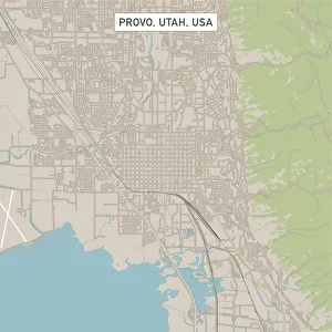
Provo Utah US City Street MapVector Illustration of a City Street Map of Provo, Utah, USA. Scale 1:60, 000. All source data is in the public domain. U.S
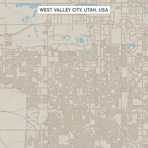
West Valley City Utah US City Street MapVector Illustration of a City Street Map of West Valley City, Utah, USA. Scale 1:60, 000. All source data is in the public domain. U.S
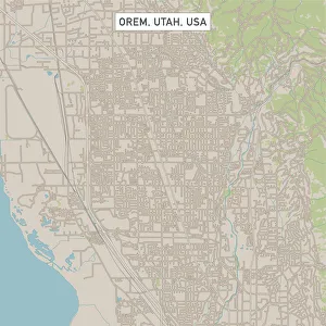
Orem Utah US City Street MapVector Illustration of a City Street Map of Orem, Utah, USA. Scale 1:60, 000. All source data is in the public domain. U.S
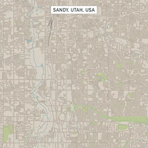
Sandy Utah US City Street MapVector Illustration of a City Street Map of Sandy, Utah, USA. Scale 1:60, 000. All source data is in the public domain. U.S
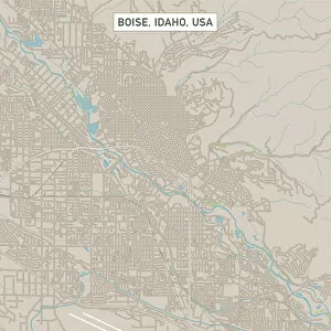
Boise Idaho US City Street MapVector Illustration of a City Street Map of Boise, Idaho, USA. Scale 1:60, 000. All source data is in the public domain. U.S
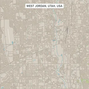
West Jordan Utah US City Street MapVector Illustration of a City Street Map of West Jordan, Utah, USA. Scale 1:60, 000. All source data is in the public domain. U.S
Idaho Falls Idaho US City Street MapVector Illustration of a City Street Map of Idaho Falls, Idaho, USA. Scale 1:60, 000. All source data is in the public domain. U.S
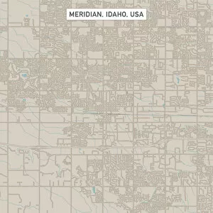
Meridian Idaho US City Street MapVector Illustration of a City Street Map of Meridian, Idaho, USA. Scale 1:60, 000. All source data is in the public domain. U.S
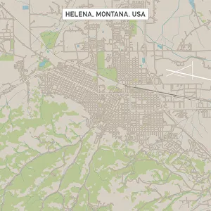
Helena Montana US City Street MapVector Illustration of a City Street Map of Helena, Montana, USA. Scale 1:60, 000. All source data is in the public domain. U.S
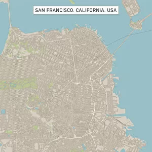
San Francisco California US City Street MapVector Illustration of a City Street Map of San Francisco, California, USA. Scale 1:60, 000. All source data is in the public domain. U.S
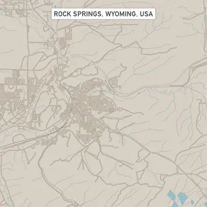
Rock Springs Wyoming US City Street MapVector Illustration of a City Street Map of Rock Springs, Wyoming, USA. Scale 1:60, 000. All source data is in the public domain. U.S
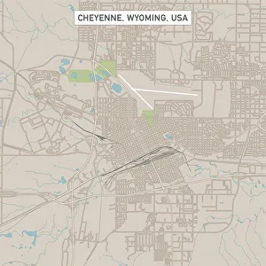
Cheyenne Wyoming US City Street MapVector Illustration of a City Street Map of Cheyenne, Wyoming, USA. Scale 1:60, 000. All source data is in the public domain. U.S
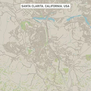
Santa Clarita California US City Street MapVector Illustration of a City Street Map of Santa Clarita, California, USA. Scale 1:60, 000. All source data is in the public domain. U.S
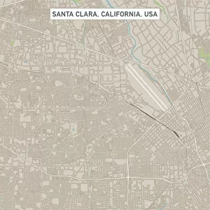
Santa Clara California US City Street MapVector Illustration of a City Street Map of Santa Clara, California, USA. Scale 1:60, 000. All source data is in the public domain. U.S
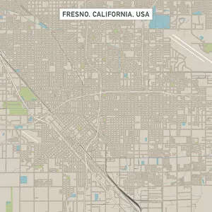
Fresno California US City Street MapVector Illustration of a City Street Map of Fresno, California, USA. Scale 1:60, 000. All source data is in the public domain. U.S
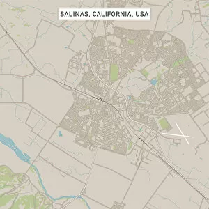
Salinas California US City Street MapVector Illustration of a City Street Map of Salinas, California, USA. Scale 1:60, 000. All source data is in the public domain. U.S
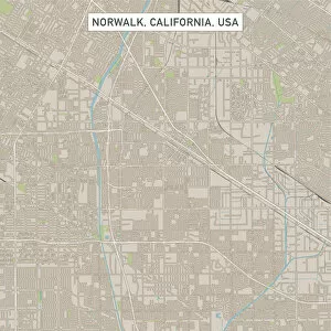
Norwalk California US City Street MapVector Illustration of a City Street Map of Norwalk, California, USA. Scale 1:60, 000. All source data is in the public domain. U.S
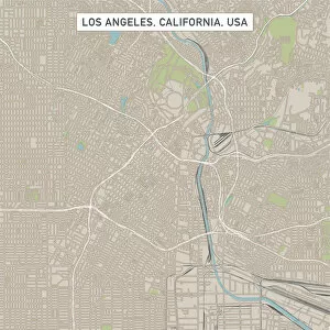
Los Angeles California US City Street MapVector Illustration of a City Street Map of Los Angeles, California, USA. Scale 1:60, 000. All source data is in the public domain. U.S
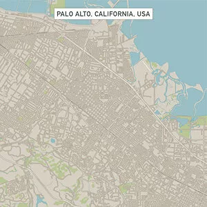
Palo Alto California US City Street MapVector Illustration of a City Street Map of Palo Alto, California, USA. Scale 1:60, 000. All source data is in the public domain. U.S
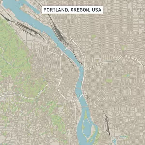
Portland Oregon US City Street MapVector Illustration of a City Street Map of Portland, Oregon, USA. Scale 1:60, 000. All source data is in the public domain. U.S
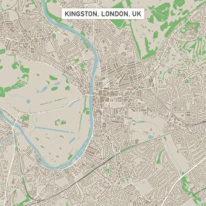
Kingston London UK City Street MapVector Illustration of a City Street Map of Kingston, London, UK. Included files are EPS (v10) and Hi-Res JPG. Data courtesy from Ordnance Survey: VectorMap District https
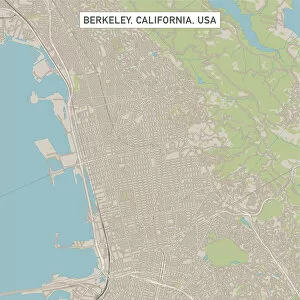
Berkeley California US City Street MapVector Illustration of a City Street Map of Berkeley, California, USA. Scale 1:60, 000. All source data is in the public domain. U.S
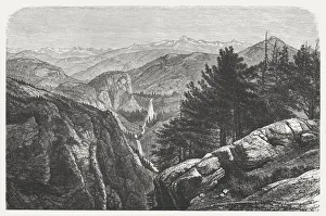
Yosemite National Park, USA, wood engraving, published in 1872Yosemite National Park, California, USA. Wood engraving, published in 1872
Aerial drone view of famous Gullfoss waterfall, IcelandAerial overhead view of Gullfoss waterfall at daytime, Iceland
Aerial view of Tavarua, heart shaped island, FijiAerial view of Tavarua, heart shaped island, Mamanucas islands, Fiji
Adnet, Nobody, Outdoors, Night, Color Image, Horizontal, Photography, Aerial ViewAerial view of City of London, Square mile, Bank, Mansion House, London, at night
Overhead aerial of Golden gate bridge, San Francisco, USAOverhead aerial image of Golden gate bridge, San Francisco, California, USA
Aerial of the Statue of Liberty at sunset, New York, USA
Sunset over the islands on Lake Maggiore, ItalyBorromean islands in the gulf of Pallanza, Lake Maggiore, Piedmont, Italy
Aerial view of Manhattan skyline at sunset, New York City, USA
Residential red brick building in Lower East Side, Manhattan, New York City, NY, United States