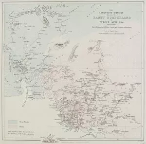
19th century, antique, archival, border, cameroon, cameroons district bantu borderland in west africa, cartography, coast, coastline, detail, distribution, document, geography, historical, key
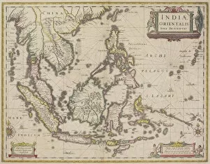
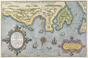
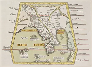
antique, archival, border, burma, cambodia, cartography, country, document, geography, historic, historical, india orientalis, indian ocean, indonesia, islands, latitude, legend, longitude, malaysia
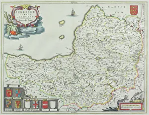
Map of Somerset, England
1662, antique, archival, cartography, coat of arms, england, europe, geographical, geography, historic, map, nobody, peerage, somerset, text, uk, vintage, Somerset, 87626075
Antique county map of Somerset, England
nobody, map, antique, vintage, archival, document, historical, cartography, somerset, england, county, district, words, text, cartouches, title, geography, key, legend, scale, latitude, longitude
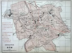
City map of Rome from 1880, Italy, digitally restored reproduction of an original 19th century template
1900s, 19th-century, accurate, archive, atlas, atlases, attraction, attractions, black, black-and-white, black-white, central italy, character, city maps, concept, concept image, contemporary, copy
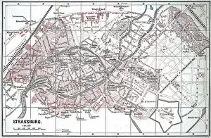
City map of Strasbourg in 1885, France, Historic, digitally restored reproduction of a 19th century original
1900s, 19th-century, accurate, alsace-champagne-ardenne-lorraine, archive, atlas, atlases, black, black-and-white, black-white, character, city maps, concept, concept image, contemporary, copy
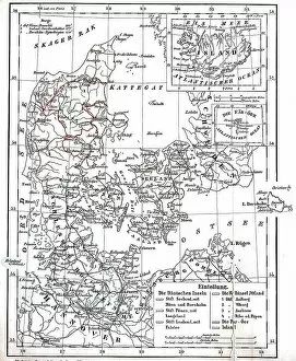
Map of Denmark and Prussian Province of Schleswig-Holstein circa 1890, Germany, Historical
1900s, 19th-century, accurate, archive, atlas, atlases, black, black-and-white, black-white, character, concept, concept image, contemporary, copy, danish, depiction, depictions, deserted, digital
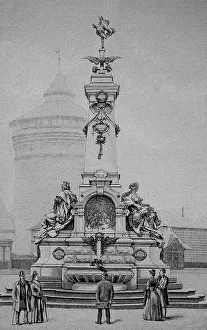
The traditional art fountain at the Plaerrer in Nuremberg, Bavaria, Germany, Historic
1900s, 19th-century, art fountain, art work, arts, artwork, artworks, attraction, attractions, bayern, black, black-and-white, black-white, characteristic, cities, countries, country, culture
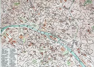
Street Map of Paris, 1890, France, Historic, digitally restored reproduction of an original 19th century original
1900s, 19th-century, art work, arts, artwork, artworks, black, black-and-white, black-white, card, cards, depiction, depictions, deserted, digital, digitally, drawing, drawings, drawn, early
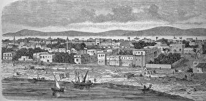
Dunqula, Dongola, Dungula, Dongla, Town in Nubia, Sudan, in 1880, Historic
1900s, 19th-century, african, black, black-and-white, black-white, cities, contemporary, countries, country, depiction, depictions, deserted, digital, digitally, drawing, drawings, drawn, dunqula
The Mausoleum of Potsdam in 1880, Germany, Historic, digital reproduction of an original 19th-century painting
1900s, 19th-century, art work, arts, artwork, artworks, attraction, attractions, black, black-and-white, black-white, brandenburg, burial ground, burial site, burial sites, cities, commemorating
Ministry of Culture in Berlin, 1890, Germany, Historical, digital reproduction of an original from the 19th century
1900s, 19th-century, administration, administrations, art work, arts, artwork, artworks, attraction, attractions, authorities, black, black-and-white, black-white, cities, countries, country
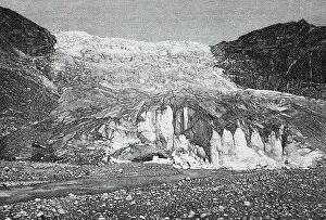
Rhone Glacier, Rottengletscher, a glacier in the Swiss Alps and the source of the Rhone, 1888, Switzerland, History
1900s, 19th-century, acreage, acreages, african, alpine landscape, alps, arable land, art work, arts, artwork, artworks, body of water, canton of valais, canton valais, cap, caps, cold, countries
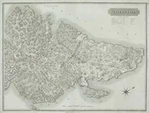
Antique map of the Western Isles off Scotland
antique, archival, border, cartography, coordinates, document, geography, historical, island, key, latitude, legend, longitude, map, nobody, orientation, outer hebrides, scale, scotland, uk
Antique map of the western isles
antique, archipelago, archival, azores, border, cartography, coordinates, document, geography, historical, islands, key, latitude, legend, longitude, map, nobody, orientation, scale, text, vintage
Antique map of Buteshire county in Scotland
antique, archival, border, buteshire, cartography, continent, coordinates, county, district, document, geography, historical, islands, key, legend, map, nobody, ocean, orientation, scale, scotland
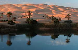
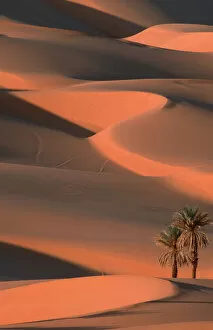
Oasis with Date Palms, Sahara, Erg Ubari, Lybia / (Phoenix dactylifera)
africa, body, date, desert, deserts, erg, format, geography, lake, landscapes, libya, lybia, oasis, palms, phoenix, pond, sahara, sandy, water, waters, Travel Destinations, 130863951
Date Palms, Sahara, Erg Ubari, Lybia / (Phoenix dactylifera)
africa, date, desert, deserts, dune, dunes, erg, format, geography, landscapes, libya, lybia, palms, phoenix, sahara, sand, sandy, single, tree, upright, Abstract Sand Dunes, 130863967
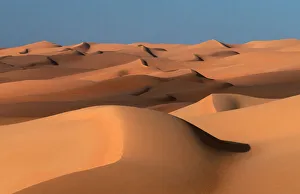
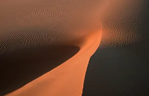
Sand Dunes, Sahara, Erg Ubari, Lybia
africa, desert, deserts, dune, dunes, erg, format, geography, landscapes, libya, lybia, sahara, sand, sandy, Abstract Sand Dunes, 130864087
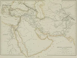
Antique map of the Empire of Alexander the Great
afghanistan, antique, arabia, arabian, azerbijan, black, border, cartography, caspian, coordinates, countries, document, empire of alexander the great, geography, historic, historical, iran, iraq
Sand Dunes, Sahara, Erg Ubari, Libya
abstract, africa, desert, deserts, dune, dunes, erg, format, geography, landscapes, libya, sahara, sand, sandy, Sand dune abstract, 130864088
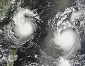
bopha, china, disaster, eye of storm, geography, meteorology, nobody, ocean, saomai
bopha, china, disaster, eye of storm, geography, meteorology, nobody, o, 82047888
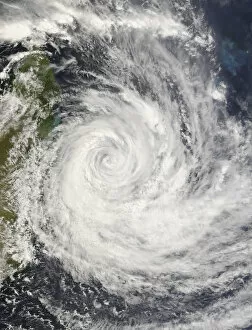
cyclone, disaster, eye of storm, gamede, geography, madagascar, meteorology, nobody
cyclone, disaster, eye of storm, gamede, geography, madagascar, meteor, 82047887
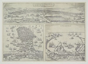
16th century, antique, archival, barbarie coast, barbary coast, battles, borders, boundaries, cartography, depicted, depicting, depiction, geography, historic, map, nobody, northern africa, ocean
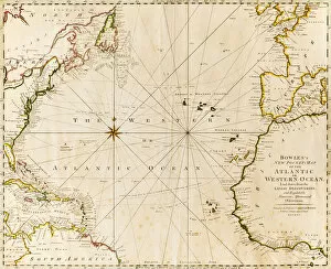
direction, antique, atlantic ocean, close-up, crossing, europe, geography, guidance, historic, history, horizontal, map, no people, north africa, north america, paper, physical geography, planning
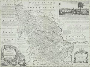
antique, archival, art, border, cartography, cartouche, coordinates, county, district, document, england, geography, historical, illustrations, inset, key, latitude, legend, longitude, map, nation
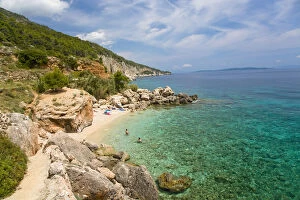
adriatic, attendant, bath, bathe, bay, beach, beaches, blue, bluish, coast, coasts
Bath bay Milna, Island Hvar, Dalmatia, Croatia
antique, archival, bay of bengal, border, cartography, country, document, geography, historic, historical, inaccurate, india, indian ocean, malaysia, map, nobody, peninsula, scale, text, thailand