mail_outline sales@mediastorehouse.com
Antique map of holy land with Nile River Delta
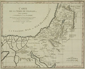
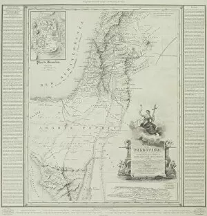
Antique map of the holy land
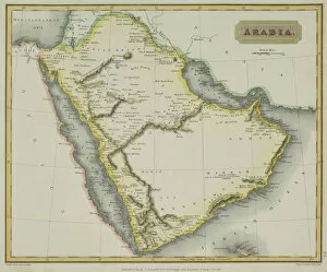
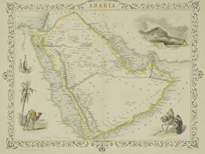
Antique map of Arabia
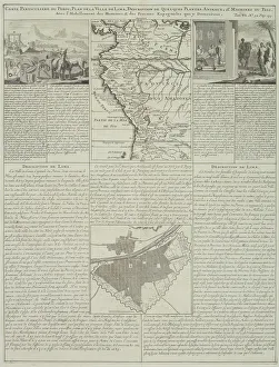
Antique map of Peru and Ecuador with plans for Lima
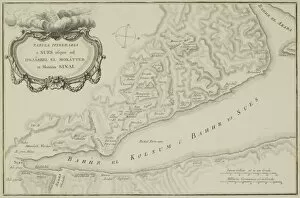
Antique map of the Gulf of Suez and Mount Sinai
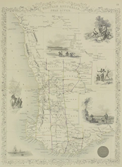
Antique map of Western Australia and the Swan River
Antique map of Arabia with vignettes
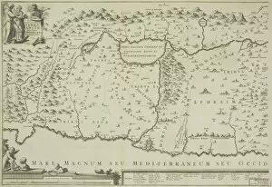
Antique map of the holy land of Sinai peninsula
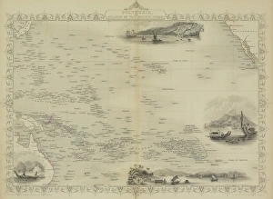
Antique map of Polynesia with vignettes
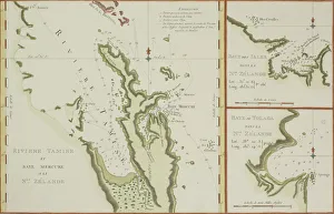
Antique maps of New Zealand
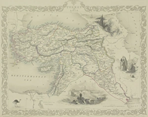
Antique map of Turkey with vignettes
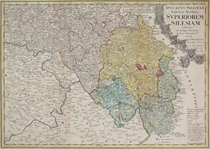
Antique map of Silesia
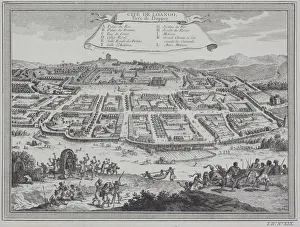
Antique print of city of Loango in the Congo, Africa
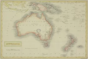
Antique map of Australasia
Map of Denmark
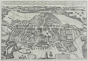
Map of Odense, Denmark
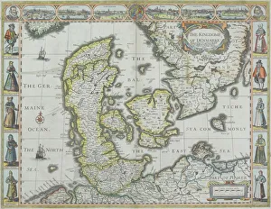
Map of Denmark with Germaine Ocean
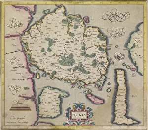
Antique map of island of Fionia in Denmark
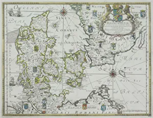
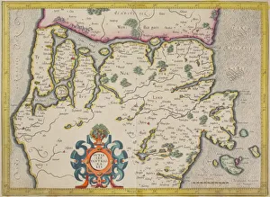
Antique map of Denmark and vicinity
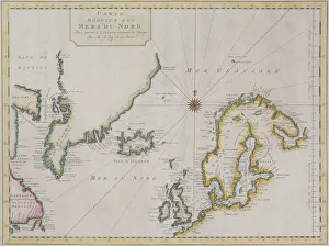
Antique map of Scandinavian region with Iceland and Greenland
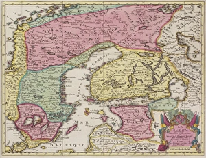
Antique map of Sweden and adjacent countries
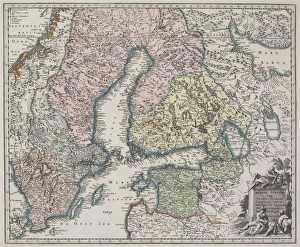
Antique map of Scandinavian region
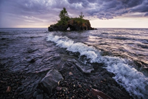
Hollow Rock MinnesotaHollow Rock is an iconic structure located just south of Grand Portage Minnesota on Lake Superior about 10 miles south of the Canada
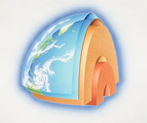
Cross-section diagram of quarter of the earths sphere illustrating subterranean layers of matter, side view
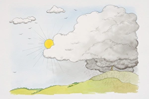
Sun emerging from behind grey cloud from which rain falls over green hillscape, front view
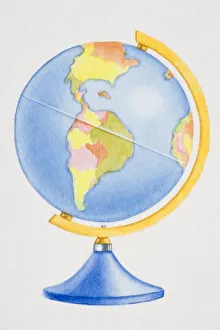
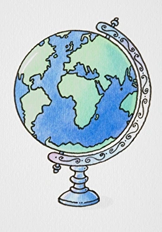
Colourful globe, side view
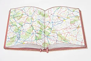
Open atlas, showing road map across double page
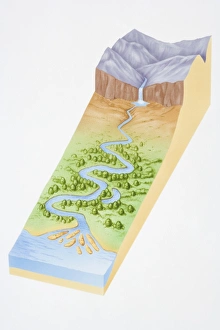
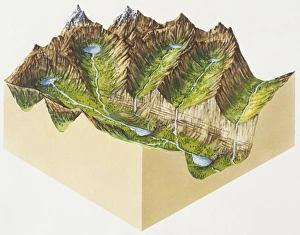
Illustration, three dimensional section of landscape showing river flowing out of mountains, through woodland valley and into sea
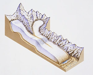
Artwork showing an area of landscape moulded by glaciers
Glacier, cross section
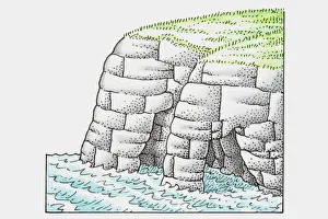
Illustration of base of cliffs worn away by water erosion, forming arches
Globe on ornate axis
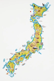
Map of Japan
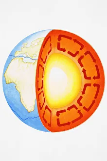
Earth showing Eurasian plate, African, Antarctic plates, and Earths core, cross-section
Igneous rock, weathering and erosion, deposition and metamorphism, and recycled rocks, cross-section
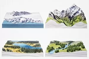
Arctic and mountainous, regions, lake and winding river, cross-sections
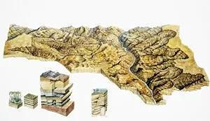
River meandering through canyon, elevated view
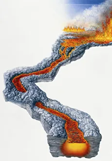
Lava flow, molten rock expelled by volcano during effusive eruption
Globe of the World
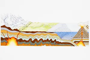
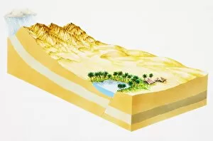
Rain storm above mountains in desert region, and oasis, cross-section
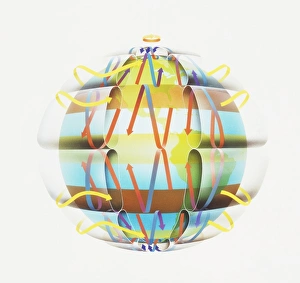
World globe with directional arrows showing trade wind patterns
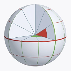
Illustration of coordinate system on cross-section globe
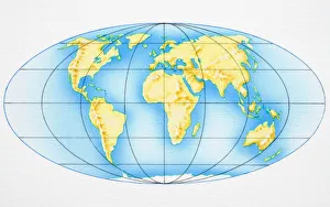
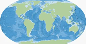
Map of the World
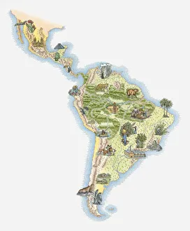
Illustrated map of Central and Southern America
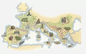
Illustrated map of France, Southern and Southeastern Europe
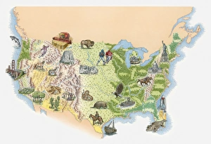
Illustrated map of the USA
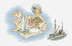
Illustrated map of Iceland
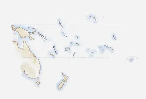
Illustration of scattered group of islands in Pacific Ocean