mail_outline sales@mediastorehouse.com
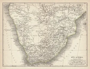
Ancient map of South Africa, lithograph, published in 1876Ancient map of South Africa. Lithograph, published in 1876
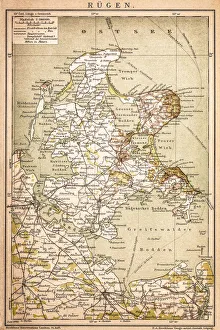
RAOEgenAntique map of RAOEgen
RomaniaAntique map of Romania
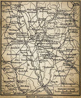
Potteries mapAntique illustration of a Potteries map
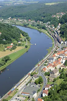
Festung Koenigstein fortress on the river Elbe, overlooking the town of Koenigstein, Elbsandsteingebirge Elbe Sandstone Mountains, Nationalpark Saechsische Schweiz national park, Saxon Switzerland
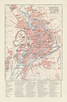
City map of Erfurt, Germany, lithograph, published in 1897City map of Erfurt with street directory, Thuringia, Germany. Lithograph, published in 1897
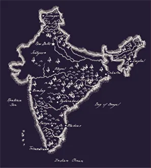
Antique India MapIndia Map, - Antique style. Includes mountains and water bodies. High detail - vector illustration
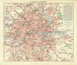
London and Environs Historical Map, Engraving, 1892Very rare, beautifully detailed engraving of London and Environs Historical Map, Engraving, Published in 1892. Original edition from my own archives. Copyright has expired on this artwork
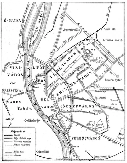
Budapest city mapIllustration of a Budapest city map
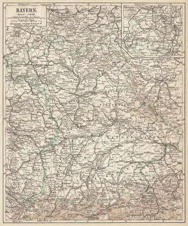
German federal state of Bavaria, lithograph, published in 1874Map of German federal state of Bavaria. Lithograph, published in 1874
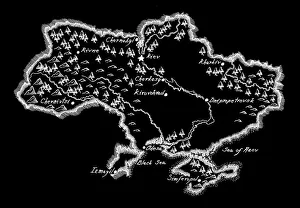
Antique Ukraine MapUkraine Map, - Antique style. Includes mountains and water bodies. High detail - vector illustration
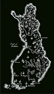
Antique Finland MapFinland Map, - Antique style. Includes mountains and water bodies. High detail - vector illustration
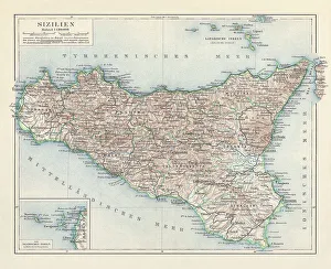
Topographic map of Sicily, Italy, lithograph, published in 1897Topographic map of Sicily, Italy - largest island in the Mediterranean Sea. Lithograph, published in 1897
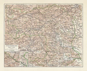
Topographic map of Styria, Austria, lithograph, published in 1897Topographic map of Styria - state (Bundesland) located in the southeast of Austria. Lithograph, published in 1897
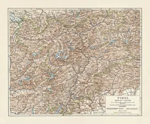
Tyrol, historical region in Austria and Italy, lithograph, published 1897Tyrol - historical region in the Alps; in northern Italy and western Austria. Lithograph, published in 1897
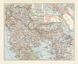
Historical map of the Ottoman Empire (Turkey), European part, 1897Historical map of European part of the Ottoman Empire (Turkey) at the end of the 19th century. Lithograph, published in 1897
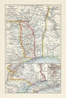
Historical map of Togo during the German colonial period (1884-1916)Historical map of Togo in West Africa during the German colonial period from 1884 to 1916. Lithograph, published in 1897
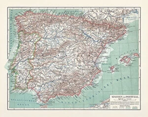
Topographic map of Spain and Portugal, lithograph, published in 1897Topographic map of Spain and Portugal. Lithograph, published in 1897
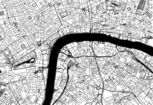
City of London Road MapBlack and white illustration of geographical, road map of London, UK
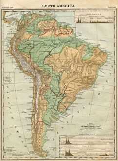
South America Map Illustration, Travel, Exploration, Antique 1871 IllustrationColor stock photo of an antique South America map illustration. Salvaged from an 1871 geography book
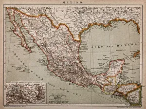
Map of MexicoAntique map of Mexico
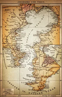
Yokohama and TokyoOld illustration map of Yokohama and Tokyo
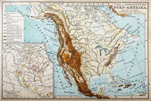
River and mountains map of North AmericaIllustration of a River and mountains map of North America
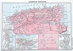
Antique map of Algeria and Tunisia
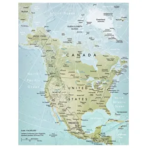
North America mapVector illustration of a detailed map of North America. Reference map was created by the US Central Intelligence Agency and is available as a public domain map at the University of Texas Libraries
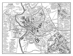
Old map showing Rome arround 1st century BCOld map showing Rome circa 1st century bc Original edition from my own archives Source : Illustriertes Konversations Lexikon 1878
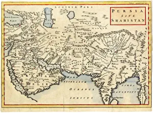
Antique map of Persia and Arabia 1730Original antique copper engraved map by H. Moll, titled Persia Sive Shahistana, published in 1747 for the Universal History (London, T. Osborne & J. Shipton, 8 vols. 1747)
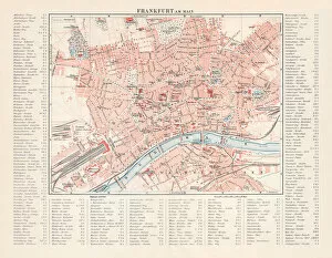
City map of Frankfurt am Main, Hesse, Germany, lithograph, 1897City map of Frankfurt am Main - largest city of the German state of Hesse (with street directory). Lithograph, published in 1897
Lochan na h-Achlaise Reflections Panoramic #2 cropSpectacular dramatic weather creates an amazing light show over the Mountains of Loch na h-Achlaise. The tranquil water of the loch reflects the distant mountains, islands of trees
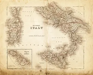
map of italy 1855an old map of southern italy (inset showing malta) - 1855
map of italy 1863an old map of italy - 1863
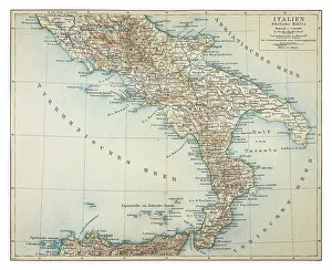
Map of southern Italy 1895
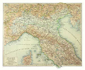
Map of northern Italy 1895
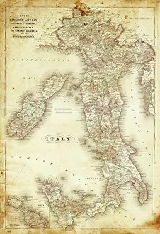
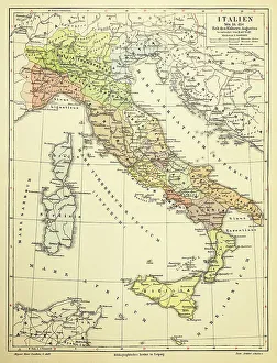
Map of Italy 1895
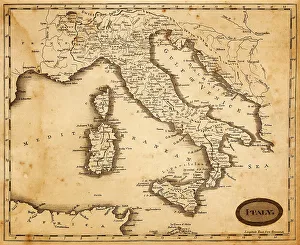
map of italy 1812an old map of italy - 1812
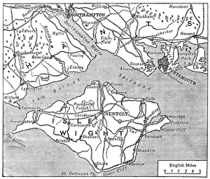
Antique map of Isle of Wight
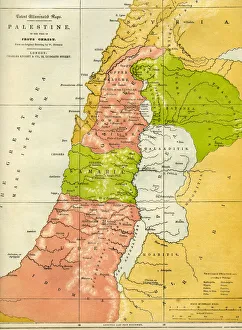
Palestine antique in the time of Jesus ChristPalestine in the time of Jesus Christ
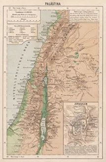
Map of Palestine and Jerusalem, lithograph, published in 1881Detailed topographic map of Palestine and Jerusalem. Facsimile from my archive, published in 1881
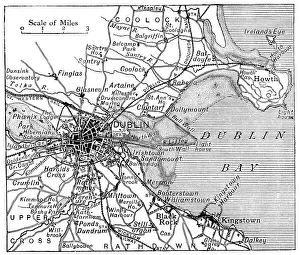
Antique map of Dublin
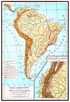
South America, river and mountains mapIllustrator of a South America, river and mountains map
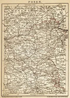
PoznanAncient map of Poznan from 1898
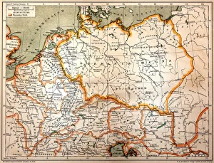
Germania in 2 century after Christ
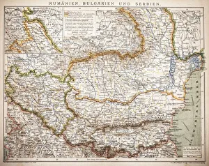
Balkan StatesMap of Rumania, Bulgaria, Serbia, Montenegro
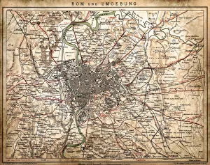
Rome and surroundingsAntique illustration of Rome and surroundings
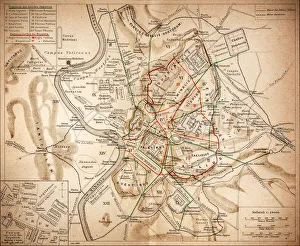
Ancient RomeAntique illustration Map of Ancient Rome from 1898
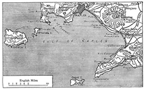
Antique map of Gulf of Naples
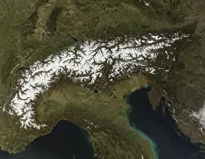
topography, satellite view, nobody, alpen, alpes, alps, austria, europe, france, mountainstopography, satellite view, nobody, alpen, alpes, alps, austria, europe, 82047884
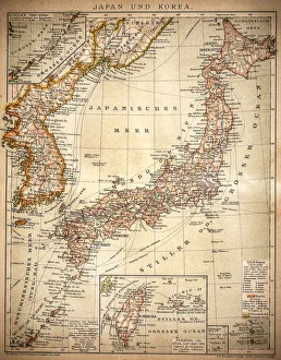
Japan and Korea 1898Antique map of Japan and Korea from 1898