mail_outline sales@mediastorehouse.com
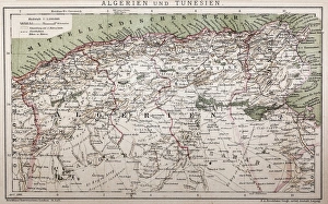
Antique map of Algeria and TunisiaIllustration of a Antique map of Algeria and Tunisia
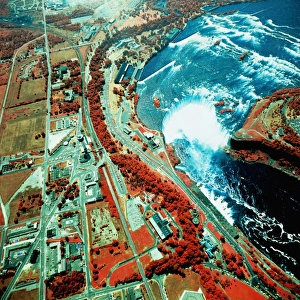
USA, New York, Niagara Falls, satellite imagea014085
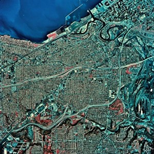
USA, Ohio, Cleveland and Lake Erie, satellite imagea014087
USA, Florida, Jacksonville, satellite imagea014092
USA, New York, Buffalo, satellite imagea014430
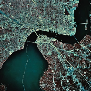
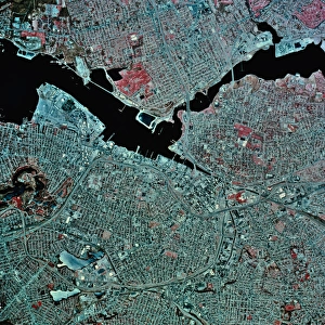
USA, Pennsylvania, Providence, satellite imagea014088
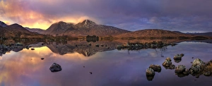
Lochan na h-Achlaise Sunset PanoramicSpectacular panoramic image showcasing dramatic weather creates an amazing light show over the Mountains of Loch na h Achlaise
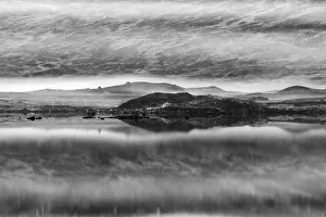
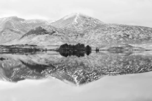
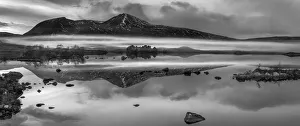
Loch na h-Achlaise #8 in BWSpectacular dramatic weather creates an amazing light show over the Mountains of Loch na h Achlaise. The tranquil water of the loch reflects the distant mountains, islands of trees
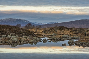
Loch na h-Achlaise #7 in ColorSpectacular dramatic weather creates an amazing light show over the Mountains of Loch na h Achlaise. The tranquil water of the loch reflects the distant mountains, islands of trees
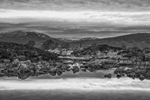
Loch na h-Achlaise #6 in BWReflections at Rannoch Moor, near Glencoe Scotland
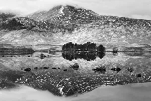
Loch na h-Achlaise #5 in BWReflections at Rannoch Moor, near Glencoe Scotland
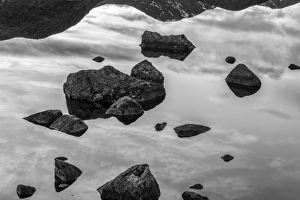
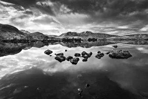
Loch na h-Achlaise #3 in BWReflections at Rannoch Moor, near Glencoe Scotland
Loch na h-Achlaise #2 in BWReflections at Rannoch Moor, near Glencoe Scotland
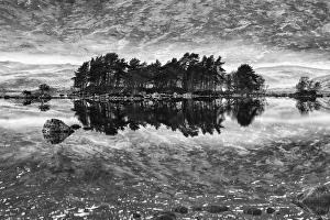
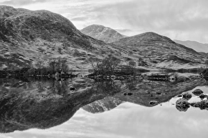
Loch na h-Achlaise in BWReflections at Rannoch Moor, near Glencoe Scotland
Loch na h-Achlaise #4 in BWReflections at Rannoch Moor, near Glencoe Scotland
Loch na h-Achlaise #5 in ColorReflections at Rannoch Moor, near Glencoe Scotland
Loch na h-Achlaise #8 in ColorSpectacular dramatic weather creates an amazing light show over the Mountains of Loch na h Achlaise. The tranquil water of the loch reflects the distant mountains, islands of trees
Loch na h-Achlaise #7 in BWSpectacular dramatic weather creates an amazing light show over the Mountains of Loch na h Achlaise. The tranquil water of the loch reflects the distant mountains, islands of trees
Loch na h-Achlaise #1 in BWSpectacular dramatic weather creates an amazing light show over the Mountains of Loch na h Achlaise. The tranquil water of the loch reflects the distant mountains, islands of trees
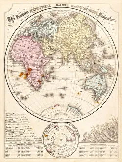
Eastern Hemisphere map 1856Mitchells Modern Atlas - Published by E.H. Buttler & Co - Philadelphia 1867
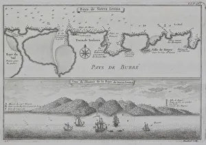
Antique print of map and illustration of coastal Sierra Leone
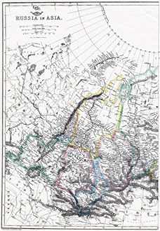
Russia Map, Asian PartPhoto of an original map published in the Weekly Dispatch Atlas in 1846 in London
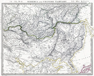
Russian Siberia and Chinese Tartary 1846 MapPhoto of an original map published in the Weekly Dispatch Atlas in 1846 in London
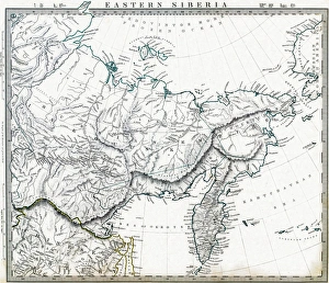
Eastern Russian Siberia 1846 MapPhoto of an original map published in the Weekly Dispatch Atlas in 1846 in London
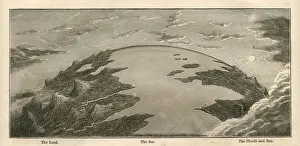
Topographical Land Sea Sky Earth Globe, Antique 1871 IllustrationColor stock photo of an antique illustration of a topographical earth globe showing land, sea and sky examples. Salvaged from an 1871 geography book
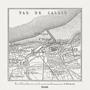
Calais, France, wood engraving, published in 1882City map of Calais, France. Wood engraving, published in 1882
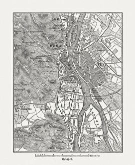
Budapest, wood engraving, published in 1882City map Budapest, capital of Hungary. Wood engraving, published in 1882
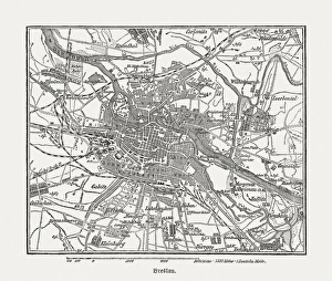
Breslau (Wrocaw, Poland), wood engraving, published in 1882Breslau (formerly German Empire), today Wrocaw, Poland. Wood engraving, published in 1882
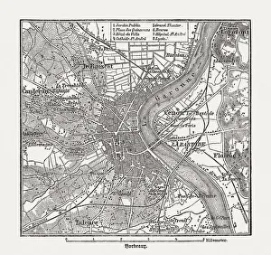
Bordeaux, France, wood engraving, published in 1882City map of Bordeaux, France. Wood engraving, published in 1882
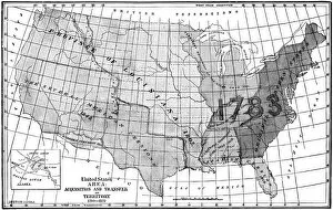
United States area: Acquisition and transfer of territory 1780 to 1870United States area: Acquisition and transfer of territory 1780 to1870
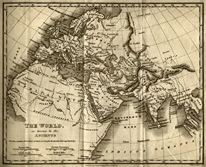
The World as Known to the Ancients (steel engraving)A creased and stained steel engraving of a map which shows The World as Known to the Ancientsa which aŠcontains all the Parts of which it is thought the Ancients had any knowledgea
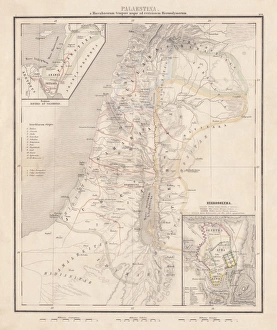
Map of Palestine, steel engraving, published in1861Ancient topographic map of Palestine and seperate map of Jerusalem in three eras: 1) Judges 2) Juda and Israel, 3) Maccabees to Titus (70 AD)
Assyria and Phersia Empire c. 500 BC, steel engraving, published 1661Antique map from Assyrian and Persian Empire, c. 500 BC. Legend in Latin language. Steel engraving with hand colored borderlines, published in 1861
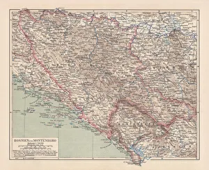
Bosnia and Montenegro, lithograph, published in 1881Ancient map of Bosnia and Montenegro. Lithograph, published in 1881
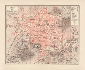
City map of Athens, lithograph, published in 1881City map of Athens. Lithograph, published in 1881
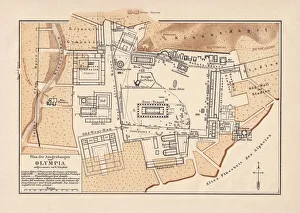
Excavations of Olympia, lithograph, published in 1880Old map of the plan of the excavations of Olympia. Lithograph, published in 1880
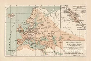
Pestilence in Europe, mid-14th century, lithograph, published in 1880Ancient map of the area of pestilence in Europe, Western Asia, and North Africa in the years 1346 - 1351. Lithograph, published in 1880
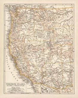
United States of America, West Coast, ithograph, published in 1878United States of America, States on the Pacific Ocean. Lithograph, published in 1878
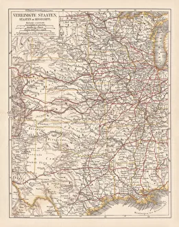
United States of America, States on Mississippi river, lithograph published 1878United States of America, States on the Mississippi river. Lithograph, published in 1878
United States of America, Atlantic coast, lithograph, published in 1878United States of America, Atlantic coast. Lithograph, published in 1878
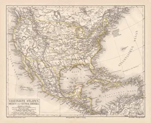
United States of America, Mexico and Central America, published in 1878United States of America, Mexico and Central America. Lithograph, published in 1878
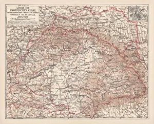
Hungary, lithograph, published in 1878Ancient map of Hungarian Monarchy, Galicia and Bukovina. Lithograph, published in 1878
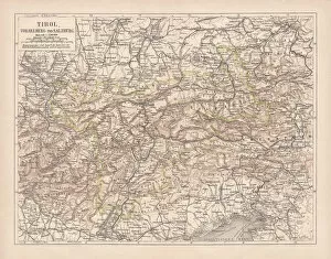
Tirol, Vorarlberg and Salzburg in Austria, lithograph, published in 1878Ancient map of Tirol, Vorarlberg and Salzburg in Austria. Lithograph, published in 1878
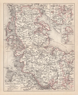
Schleswig-Holstein, lithograph, published in 1878Map of Schleswig-Holstein. Lithograph, published in 1878
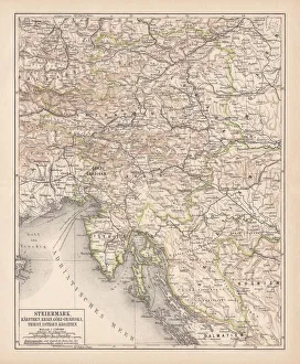
Styria, lithograph, published in 1878Ancient map of Styria: Carinthia, Carniola, GradiAaka, Croatia, Istria, Triest. Lithograph, published in 1878
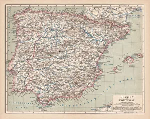
Spain and Portugal, lithograph, published in 1878Ancient map of Spain and Portugal. Lithograph, published in 1878
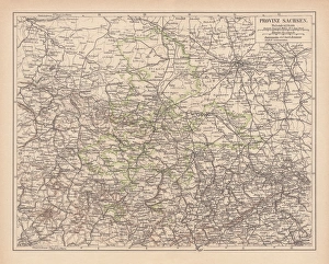
Province of Saxony, lithograph, published in 1878Province of Saxony, former territory of Prussia from 1816 to 1945. Lithograph, published in 1878
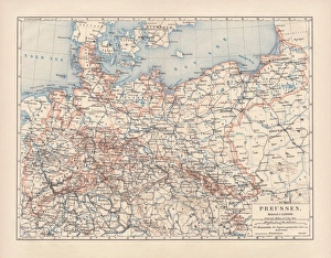
Prussia, lithograph, lithograph, published in 1878The Kingdom of Prussia at its greatest extent, after 1866. Lithograph, published in 1878