mail_outline sales@mediastorehouse.com
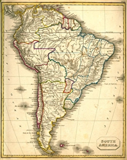
Antquie Map of South AmericaVintage map of South America from 1837
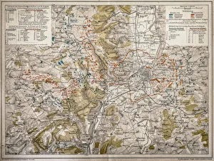
Map of MetzAntique map of fighting around Metz on the 14th, 16th and 18 August 1870th
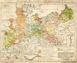
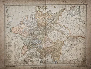
Prussia historical mapIllustration of a Prussia historical development map
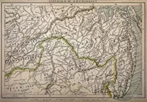
Siberia map, the Amur regionIllustration of a Siberia map, the Amur region
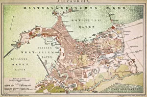
Alexandria mapAntique illustration of a Mediterranean Sea
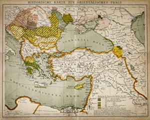
Historical map of the Oriental part of worldAntique illustration of a Historical map of the Oriental part of world
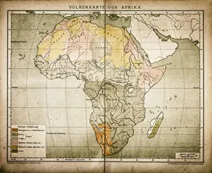
Ethnic map of AfricaAntique illustration of a ethnic map of Africa
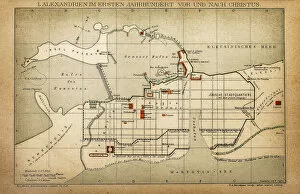
Alexandria in the first century before and after ChristAntique illustration of a Alexandria in the first century before and after Christ
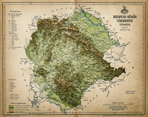
Belovar-koros, Croatio map from 1893Antique illustration of a Belovar-koros, Croatio map from 1893
Hot Air Balloon Over Lochan na h-AchlaiseA majestic hot air balloon soars over the spectacular moody atmosphere of the Mountains of Loch na h-Achlaise. The tranquil water of the loch reflects the distant mountains, islands of trees
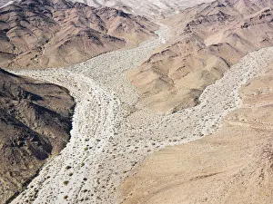
Dry Valley
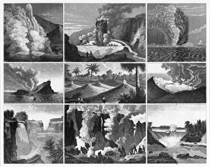
Volcanoes, Geysers and Water Falls EngravingEngraved Illustrations of Forests, Lakes, Caves and Unusual Rock Formations from Iconographic Encyclopedia of Science, Literature and Art, Published in 1851. Copyright has expired on this artwork
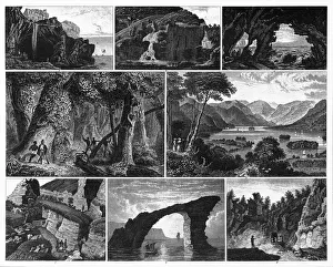
Forests, Lakes, Caves and Unusual Rock Formations EngravingEngraved Illustrations of Forests, Lakes, Caves and Unusual Rock Formations from Iconographic Encyclopedia of Science, Literature and Art, Published in 1851. Copyright has expired on this artwork
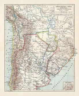
Argentina, Chile, Bolivia, Uruguay, and Paraguay, lithograph, published in 1897Argentina, Chile, Bolivia, Uruguay, and Paraguay. Lithograph, published in 1897
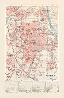
City map of Augsburg, Bavaria, Germany, lithograph, published in 1897
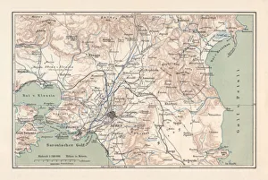
Map of Athens and surroundings, lithograph, published in 1897Map of Athens and surroundings, Greece. Lithograph, published in 1897
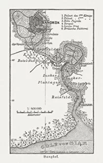
Historic map of Bangkok and surrounding, wood engraving, published 1897Historic map of Bangkok and surrounding, Thailand. Wood engraving, published in 1897
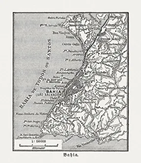
Salvador and surrounding, Bahia, Brazil, wood engraving, published in 1897Map of Salvador and surrounding, Bahia, Brazil. Wood engraving, published in 1897
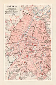
Brussels - capital of Belgium, lithograph, published in 1897Brussels - capital of Belgium. Lithograph, published in 1897
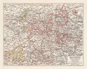
Duchy of Brunswick, Principalities Schaumburg-Lippe, and Waldeck, published 1897Duchy of Brunswick, Principalities Schaumburg-Lippe, and Waldeck in Germany. Lithograph, published in 1897
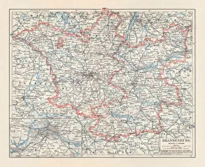
Brandenburg in Germany, mainland, province, and Berlin, lithograph, published 1897The state of Brandenburg in Germany, mainland, province, and Berlin. Lithograph, published in 1897
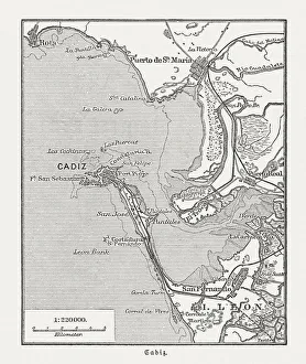
City map of CAadiz, Spain, wood engraving, published in 1897City map of CAadiz, Spain.Wood engraving, published in 1897
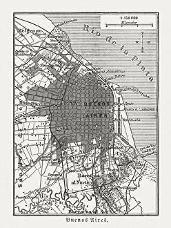
City map of Buenos Aires, Argentina, wood engraving, published 1897City map of Buenos Aires, capital of Argentina. Wood engraving, published in 1897
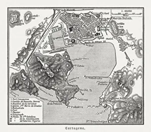
City map of Cartagena, Murcia, Spain, wood engraving, published 1897City map of Cartagena, Murcia, Spain. Wood engraving, published in 1897
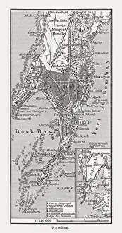
Bombay (Mumbai), India, wood engraving, published in 1897Bombay (Mumbai), India. Wood engraving, published in 1897
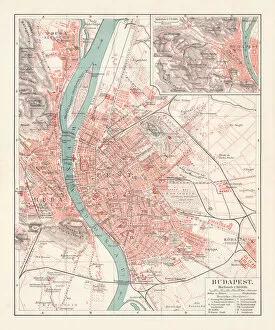
City map of Budapest, capital of Hungary, lithograph, published 1897City map of Budapest - the capital of Hungary. Lithograph, published in 1897
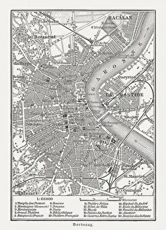
City map of Bordeaux, France, wood engraving, published in 1897City map of Bordeaux, France. Wood engraving, published in 1897
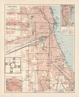
City map of Chicago, Illinois, USA, lithograph, published in 1897City map of Chicago, Illinois, USA. Lithograph, published in 1897
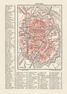
City map of Danzig (now Gdsk, Poland), lithograph, published 1897City map of Danzig with street directory, Prussia, Germany (now Gdsk, Poland). Lithograph, published in 1897
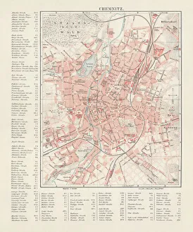
City map of Chemnitz, Germany, lithograph, published in 1897City map of Chemnitz with street directory, Saxony, Germany. Lithograph, published in 1897
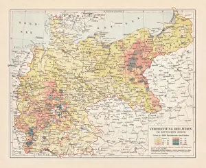
Distribution of the Jews in Germany, lithograph, published in 1897Map of the distribution of the Jews in Germany at the end of the 19th century. Lithograph, published in 1897
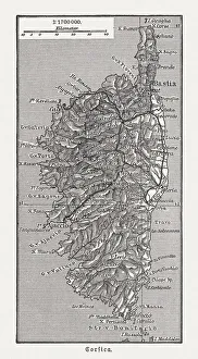
Map of the island Corsica, France, wood engraving, published in 1897Map of the island Corsica, France. Wood engraving, published in 1897
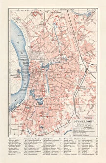
City map of DAOEsseldorf, Germany, lithograph, published in 1897City map of DAOEsseldorf - capital city of the German state of North Rhine-Westphalia (with street directory). Lithograph, published in 1897
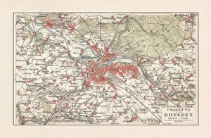
Map of Dresden and surroundings, Saxony, Germany, lithograph, published 1897Map of Dresden and surroundings - capital city of the German state Saxony. Lithograph, published in 1897
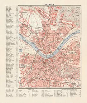
City map of Dresden, Saxony, Germany, lithograph, published in 1897City map of Dresden - capital city of the German state of Saxony (with street directory). Lithograph, published in 1897
Germany until the Thirty Years War. (1493-1618)Illustration of a Germany until the Thirty Years War. (1493-1618)
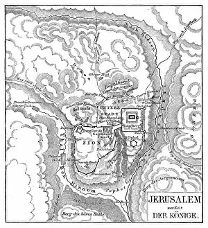
Map of JerusalemIllustration of a Map of Jerusalem
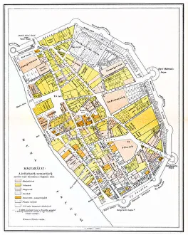
Pest old mapIllustration of a Pest old map
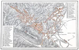
Brasov manIllustration of a Brasov map
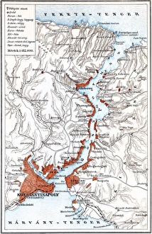
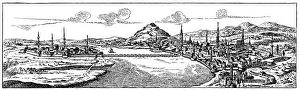
Bosporus mapIllustration of a Bosporus map
Buda and Pest old mapBudapest, a famously, is the combination of the cities Buda and Pest
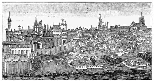
Buda and Pest from 17 century
Buda 1470Illustartion of a Buda 1470
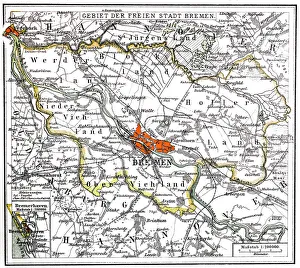
Bremen and BremerhavenIllustration of a Bremen and Bremerhaven
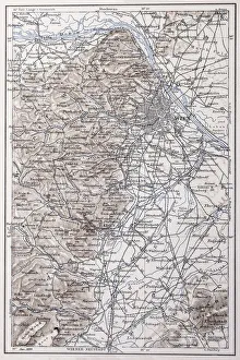
Vienna and surroundingsIllustration of a Vienna and surroundings
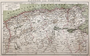
Antique map of Algeria and TunisiaIllustration of a Antique map of Algeria and Tunisia
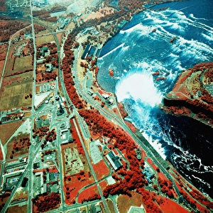
USA, New York, Niagara Falls, satellite imagea014085
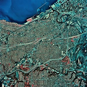
USA, Ohio, Cleveland and Lake Erie, satellite imagea014087