mail_outline sales@mediastorehouse.com
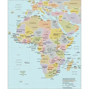
Political Map of AfricaVector Illustration of the policital map of Africa Reference map as created by the US Central Intelligence Agency
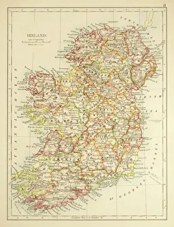
Map of Ireland 1897Map of Ireland
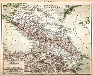
Old Caucasus mapAntique map of Caucasus
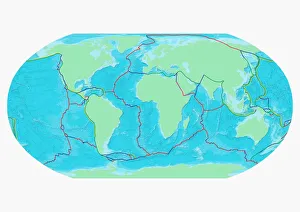
Map of the Word with lines marking boundaries of tectonic plates
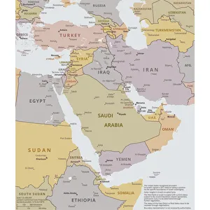
Political map of The Middle EastVector illustration of the policital map of The Middle East Reference map was created by the US Central Intelligence Agency
Antique map of Hadrians wall
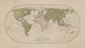
Map of the world 1800
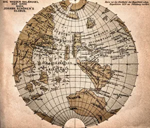
World map from 1520Western hemisphere of the Johannes SchAoner globe from 1520. expedition
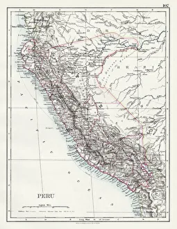
Peru map 1897The World-Wide Atlas of Modern Geography, Political and Physical W. & A.K. Johnston - London 1897
Map of the world 1869Cornells Grammars-School Geography - S.S. Cornell - New York D. Appleton and Company 1869
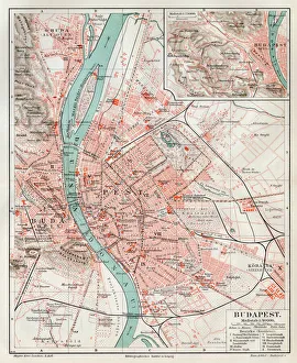
Budapest city map 1895Meyers Konversations-Lexikon. Ein Nachschlagewerk des allgemeinen Wissens, 5th edition 17 volumes Bibliographisches Institut - Leipzig 1895-1897
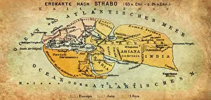
Map of the world according to Strabo 63 B.C
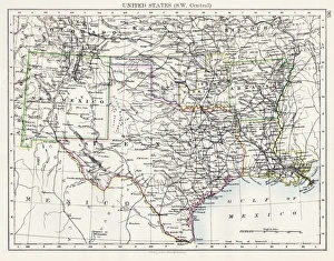
United States South West Central map 1897The World-Wide Atlas of Modern Geography, Political and Physical W. & A.K. Johnston - London 1897
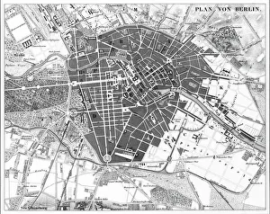
Berlin, Germany MapEngraved illustrations of a Map of the City of Berlin, Germany from Iconographic Encyclopedia of Science, Literature and Art, Published in 1851. Copyright has expired on this artwork
World map by Martin Behaim, 1492, wood engraving, published 1884World map by Martin Behaim, 1492. Woodcut engraving from my archive, published in 1884
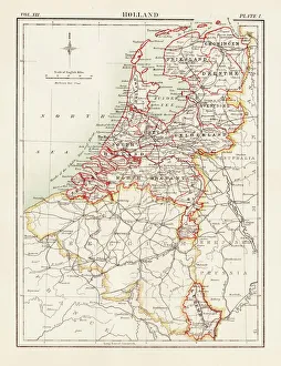
Holland map 1881Encyclopedia Britannica 9th Edition Vol XII Philadelphia j.M. Stoddart & Co 1881
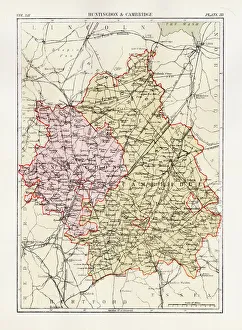
Huntingdon and Cambridge map 1881Encyclopedia Britannica 9th Edition Vol XII Philadelphia j.M. Stoddart & Co 1881
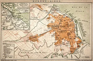
Buenos Aires mapAntique engraving map of Buenos Aires
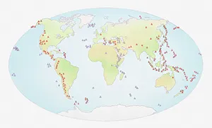
Illustration of world map showing sites of volcanic activity
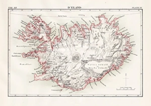
Iceland map 1881Encyclopedia Britannica 9th Edition Vol XII Philadelphia j.M. Stoddart & Co 1881
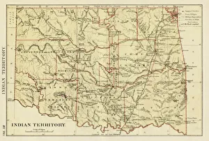
USA indian territories map 1881Encyclopedia Britannica 9th Edition Vol XII Philadelphia j.M. Stoddart & Co 1881
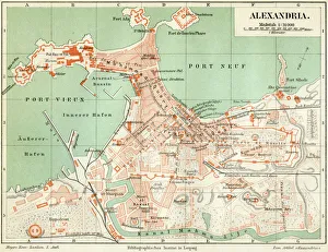
Plan of the old city Alexandria 1895Meyers Konversations-Lexikon. Ein Nachschlagewerk des allgemeinen Wissens, 5th edition 17 volumes Bibliographisches Institut - Leipzig 1895-1897
The world in 1900 showing how it was governed by different nationsDigital illustration of the world in 1900 showing how it was governed by different nations
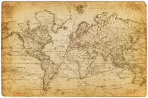
Vintage Map of the WorldVintage map of the world from 1837
Antique map of the world, 1873Vintage engraving of a Victorian Antique map of the world, 1873
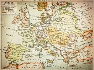
Map of Europe 1721
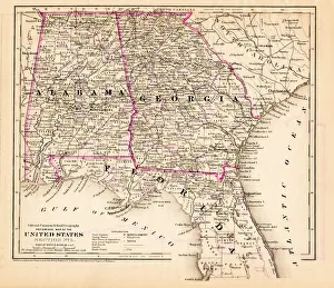
Alabama Florida Georgia map 1881Coltons Common School Geography 1881 New York Sheldon and Co
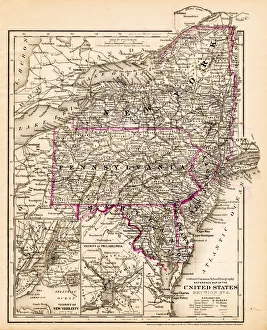
New York Maryland Pennsylvania map 1881Coltons Common School Geography 1881 New York Sheldon and Co
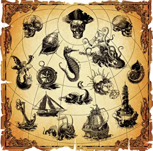
Old Map ElementsOld map icons, eps 9
World map by Mathieu Albert Lotter, Augsburg, 1778World map from 1778. Original hand-colored copper engraving by Matthieu Albert Lotter (1741 - 1810, Augsburg) with route of James Cooks First Circumnavigation (1770), through Tahiti
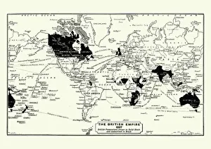
Map of the British Empire in 1837. At its height, the British Empire was the largest empire in history and, for over a century, was the foremost global power
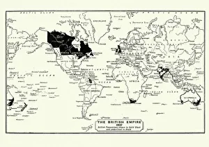
Map of the British Empire in 1897. At its height, the British Empire was the largest empire in history and, for over a century, was the foremost global power
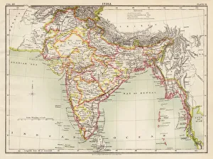
India map 1881Encyclopedia Britannica 9th Edition Vol XII Philadelphia j.M. Stoddart & Co 1881
Map of city Amsterdam Netherlands from 1881 Original edition from my own archives Source : Illustriertes Konversations Lexikon 1881
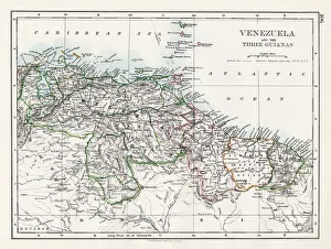
Venezuela and the Guayanas map 1897The World-Wide Atlas of Modern Geography, Political and Physical W. & A.K. Johnston - London 1897
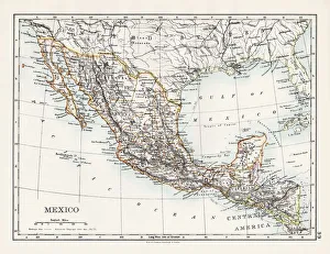
Mexico map 1897The World-Wide Atlas of Modern Geography, Political and Physical W. & A.K. Johnston - London 1897
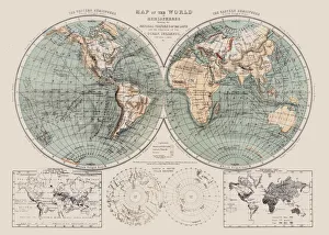
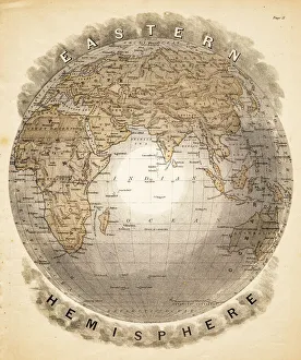
World eastern hemispheres 1883Warrens Common School Geography
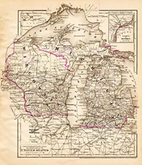
Wisconsin Michigan map 1881Coltons Common School Geography 1881 New York Sheldon and Co
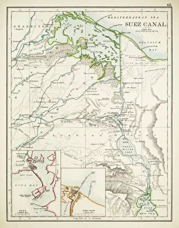
Map of Suez Canal 1897
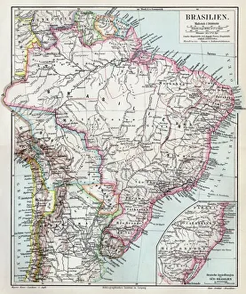
Brazil map 1895Meyers Konversations-Lexikon. Ein Nachschlagewerk des allgemeinen Wissens, 5th edition 17 volumes Bibliographisches Institut - Leipzig 1895-1897
Wroclaw city map 1895Meyers Konversations-Lexikon. Ein Nachschlagewerk des allgemeinen Wissens, 5th edition 17 volumes Bibliographisches Institut - Leipzig 1895-1897
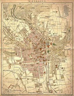
Wiesbaden, germanyAntique illustration of a Wiesbaden, Germany from 1898
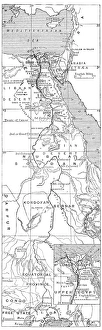
Antique map of Nile River
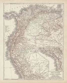
Peru, Ecuador, Colombia, Venezuela, lithograph, published in 1877Ancient map of Peru, Ecuador, Colombia, and Venezuela. Lithograph, published in 1877
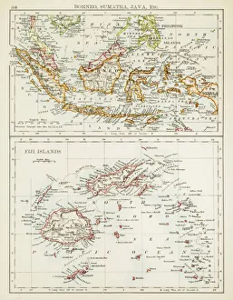
Map of Fiji Sumatra Borneo 1897Map of Fiji, Borneo, Sumatra, java
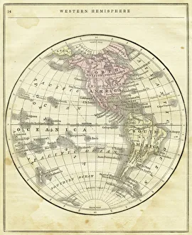
Western Hemisphere map 1856Colton and Fitchs Modern School Geography by George W. Fitch - New York 1856
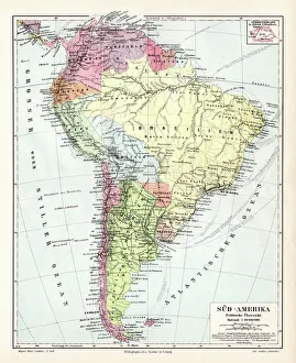
South America political map 1895Meyers Konversations-Lexikon. Ein Nachschlagewerk des allgemeinen Wissens, 5th edition 17 volumes Bibliographisches Institut - Leipzig 1895-1897
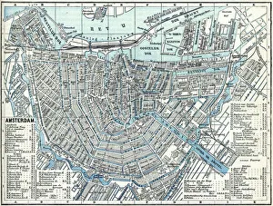
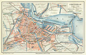
Amsterdam city map 1895Meyers Konversations-Lexikon. Ein Nachschlagewerk des allgemeinen Wissens, 5th edition 17 volumes Bibliographisches Institut - Leipzig 1895-1897