mail_outline sales@mediastorehouse.com
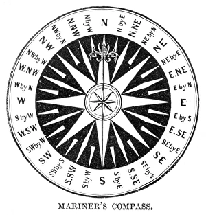
Old Compass Windrose 1881Coltons Common School Geography 1881 New York Sheldon and Co
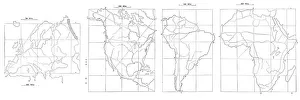
Map drawing technique 1881Coltons Common School Geography 1881 New York Sheldon and Co
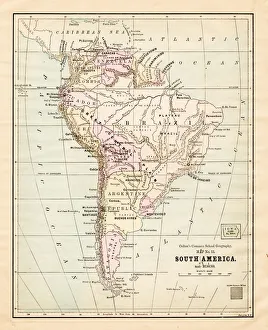
South America map 1881Coltons Common School Geography 1881 New York Sheldon and Co
Dominion of Canada map 1881Coltons Common School Geography 1881 New York Sheldon and Co
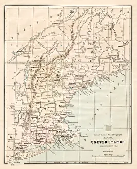
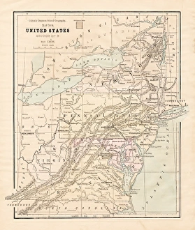
North Eastern States USA map 1881Coltons Common School Geography 1881 New York Sheldon and Co
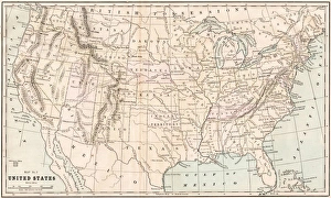
United States map 1881Coltons Common School Geography 1881 New York Sheldon and Co
New England States USA map 1881Coltons Common School Geography 1881 New York Sheldon and Co
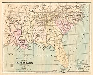
Souther States USA map 1881Coltons Common School Geography 1881 New York Sheldon and Co
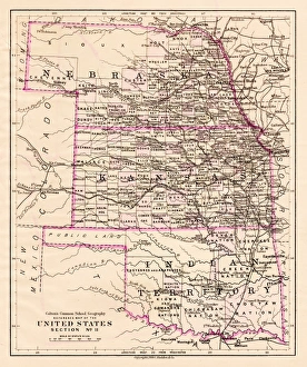
Kansas and Nebraska map 1881Coltons Common School Geography 1881 New York Sheldon and Co
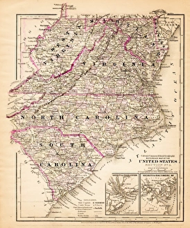
Virginia North Carolina map 1881Coltons Common School Geography 1881 New York Sheldon and Co
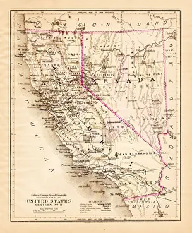
California Nevada map 1881Coltons Common School Geography 1881 New York Sheldon and Co
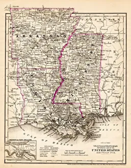
Arkansas Louisiana Pississippi map 1881Coltons Common School Geography 1881 New York Sheldon and Co
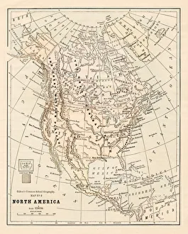
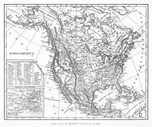
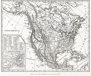
North America map 1881Coltons Common School Geography 1881 New York Sheldon and Co
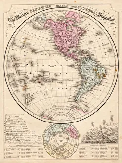
Western Hemisphere map 1867Mitchells Modern Atlas - Published by E.H. Buttler & Co - Philadelphia 1867
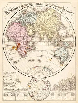
Eastern Hemisphere map 1856Mitchells Modern Atlas - Published by E.H. Buttler & Co - Philadelphia 1867
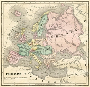
Map of Europe 1856Colton and Fitchs Modern School Geography by George W. Fitch - New York 1856
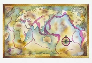
Illustration of earthquake zones around the globe
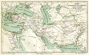
Map of the reign of Alexandre the Great 1895Meyers Konversations-Lexikon. Ein Nachschlagewerk des allgemeinen Wissens, 5th edition 17 volumes Bibliographisches Institut - Leipzig 1895-1897
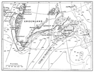
Antique illustration of Greenland and Iceland bathymetry map
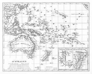
Victorian Map of AustraliaEngraved illustrations of the Map of Australia from Iconographic Encyclopedia of Science, Literature and Art, Published in 1851. Copyright has expired on this artwork. Digitally restored
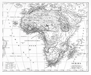
Victorian Map of AfricaEngraved illustrations of a Map of Africa from Iconographic Encyclopedia of Science, Literature and Art, Published in 1851. Copyright has expired on this artwork. Digitally restored
Map of North AmericaEngraved illustrations of a Map of North America from Iconographic Encyclopedia of Science, Literature and Art, Published in 1851. Copyright has expired on this artwork. Digitally restored
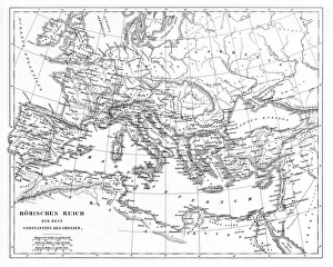
Victorian Map of The Roman EmpireEngraved illustrations of the Roman Empire Under Constantine the Great from Iconographic Encyclopedia of Science, Literature and Art, Published in 1851. Copyright has expired on this artwork
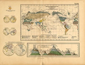
Map of Global Distribution of Plants, Victorian Botanical IllustrationVery Rare, Beautifully Illustrated Antique Engraved Victorian Botanical Illustration of Map of Global Distribution of Plants: Plate 60
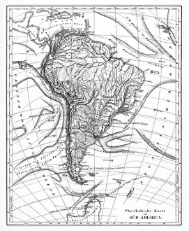
Victorian Map of North AmericaEngraved illustrations of the Physical Map of South America from Iconographic Encyclopedia of Science, Literature and Art, Published in 1851. Copyright has expired on this artwork. Digitally restored
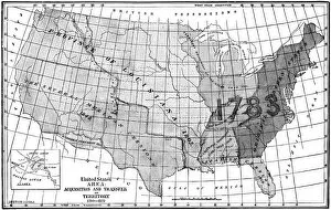
United States area: Acquisition and transfer of territory 1780 to 1870United States area: Acquisition and transfer of territory 1780 to1870
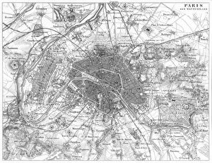
Fortifications of Paris Map EngravingEngraved illustrations of the Fortifications of Paris from Iconographic Encyclopedia of Science, Literature and Art, Published in 1851. Copyright has expired on this artwork. Digitally restored
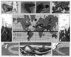
Volcanic and Hurricane Charts; Craters; and Antarctica EngravingEngraved Illustrations of Volcanic and Hurricane Charts; Craters; and Antarctica from Iconographic Encyclopedia of Science, Literature and Art, Published in 1851
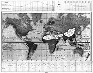
Historical Rainfall and Temperature Charts EngravingEngraved Illustrations of Historical Rainfall and Temperature Map; Temperature Charts of the World from Iconographic Encyclopedia of Science, Literature and Art, Published in 1851
Climate and Weather Charts EngravingEngraved Illustrations of Climate and Weather Charts of the World from Iconographic Encyclopedia of Science, Literature and Art, Published in 1851. Copyright has expired on this artwork
North America 1850 EngravingEngraved illustrations of the Physical Map of North America from Iconographic Encyclopedia of Science, Literature and Art, Published in 1851. Copyright has expired on this artwork. Digitally restored
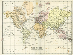
Antique Map of the WorldVintage map of the World from 1884
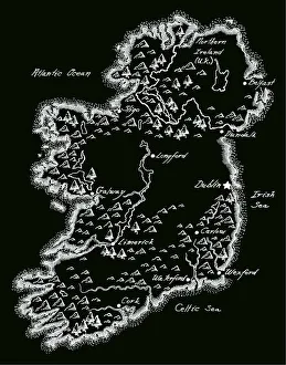
Antique Ireland MapIreland Map, - Antique style. Includes mountains and water bodies. High detail - vector illustration
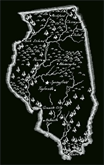
Antique Illinois MapIllinois Map, - Antique style. Includes mountains and water bodies. High detail - vector illustration
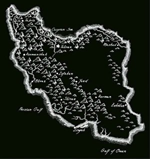
Antique Iran MapIran Map, - Antique style. Includes mountains and water bodies. High detail - vector illustration
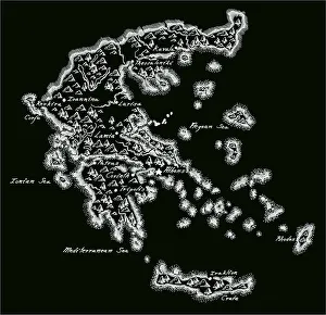
Antique Greece MapGreece Map, - Antique style. Includes mountains and water bodies. High detail - vector illustration
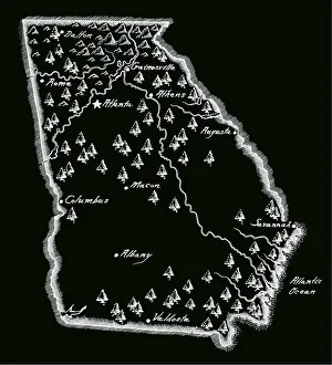
Antique Georgia MapGeorgia Map, - Antique style. Includes mountains and water bodies. High detail - vector illustration
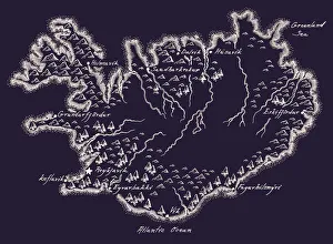
Antique Iceland MapIceland Map, - Antique style. Includes mountains and water bodies. High detail - vector illustration
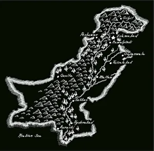
Antique PakistanPakistan Map, - Antique style. Includes mountains and water bodies. High detail - vector illustration
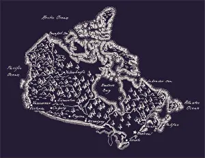
Antique Canada MapCanada Map, - Antique style. Includes mountains and water bodies. High detail. - vector illustration
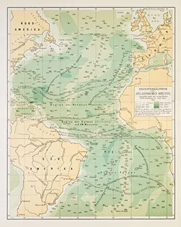
Map of deep Atlantic ocean 1895Different deep zones of the Atlantic ocean Chromolithograph
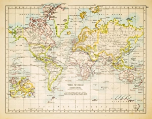
Map of the world 1897Map of the world in Mercator projection
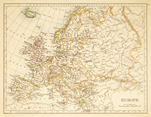
Map of Europe 1897Map of Europe
Map of the world horizontal projection 1856Colton and Fitchs Modern School Geography by George W. Fitch - New York 1856
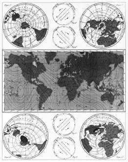
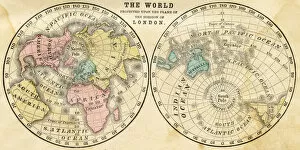
Polar projection of the world map 1856Colton and Fitchs Modern School Geography by George W. Fitch - New York 1856
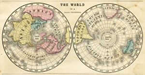
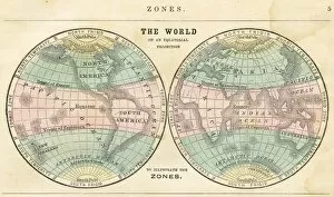
Map of the world in zones 1856Colton and Fitchs Modern School Geography by George W. Fitch - New York 1856
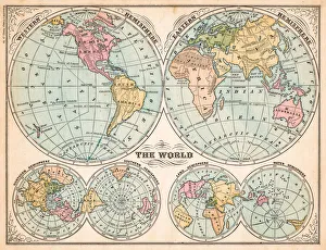
The world in hemispheres map 1875The Independent Course Comprehensive Geography by James Monteith, A.S. Barnes & Co, New York & Chicago 1875
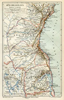
South Brazil map 1895Meyers Konversations-Lexikon. Ein Nachschlagewerk des allgemeinen Wissens, 5th edition 17 volumes Bibliographisches Institut - Leipzig 1895-1897