mail_outline sales@mediastorehouse.com
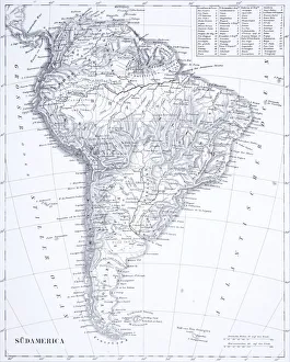
Engraving: South AmericaEngraved illustrations of South America from Iconographic Encyclopedia of Science, Literature and Art, Published in 1851. Copyright has expired on this artwork. Digitally restored
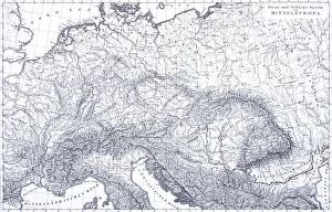
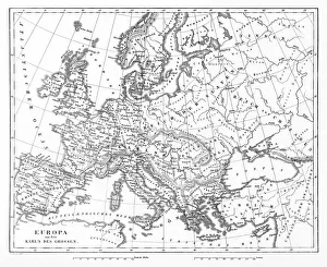
Engraving: Mountains and River Systems of EuropeEngraved illustrations of the Mountains and River Systems of Central Europe from Iconographic Encyclopedia of Science, Literature and Art, Published in 1851. Copyright has expired on this artwork
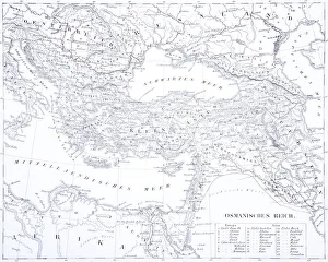
Engraving: The Turkish EmpireEngraved illustrations of the Turkish Empire from Iconographic Encyclopedia of Science, Literature and Art, Published in 1851. Copyright has expired on this artwork. Digitally restored
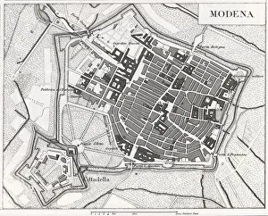
Engraving: ModenaEngraved illustrations of the Provence of Modena from Iconographic Encyclopedia of Science, Literature and Art, Published in 1851. Copyright has expired on this artwork. Digitally restored
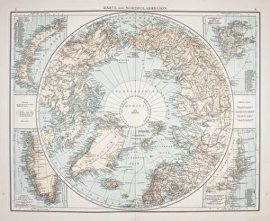
North Polar Chart 1895Meyers Konversations-Lexikon
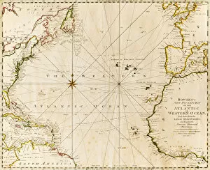
direction, antique, atlantic ocean, close-up, crossing, europe, geography, guidance, historic, history, horizontal, map, no people, north africa, north america, paper, physical geography, planning
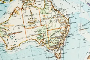
Antique German atlas map close up: Australia
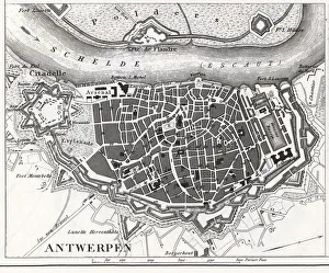
Engraving: Map of AntwerpEngraved illustrations of the Map of Antwerp from Iconographic Encyclopedia of Science, Literature and Art, Published in 1851. Copyright has expired on this artwork. Digitally restored
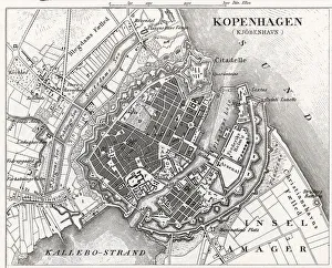
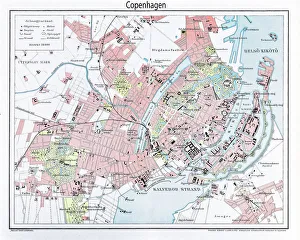
Engraving: Map of CopenhagenEngraved illustrations of the Map of Copenhagen from Iconographic Encyclopedia of Science, Literature and Art, Published in 1851. Copyright has expired on this artwork. Digitally restored
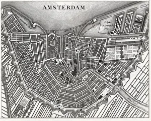
Engraving: AmsterdamEngraved illustrations of the city of Amsterdam from Iconographic Encyclopedia of Science, Literature and Art, Published in 1851. Copyright has expired on this artwork. Digitally restored
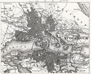
Engraving: StockholmEngraved illustrations of the City of Stockholm from Iconographic Encyclopedia of Science, Literature and Art, Published in 1851. Copyright has expired on this artwork. Digitally restored
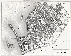
Engraving: Livorno, ItalyEngraved illustrations of the city of Livorno, Italy from Iconographic Encyclopedia of Science, Literature and Art, Published in 1851. Copyright has expired on this artwork. Digitally restored
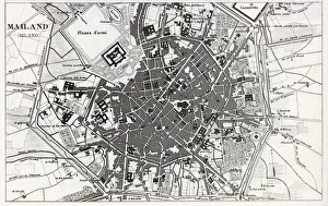
Engraving: Milan, ItalyEngraved illustrations of the city of Milan, Italy from Iconographic Encyclopedia of Science, Literature and Art, Published in 1851. Copyright has expired on this artwork. Digitally restored
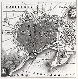
Engraving: Barcelona, SpainEngraved illustrations of the City of Barcelona, Spain from Iconographic Encyclopedia of Science, Literature and Art, Published in 1851. Copyright has expired on this artwork. Digitally restored
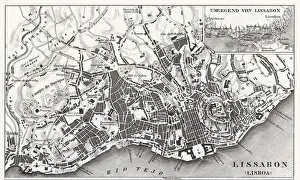
Engraved image of Lisbon, PortugalEngraved illustrations of the City of Lisbon, Portugal from Iconographic Encyclopedia of Science, Literature and Art, Published in 1851. Copyright has expired on this artwork. Digitally restored
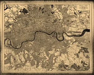
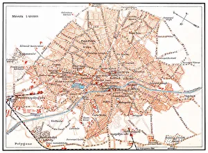
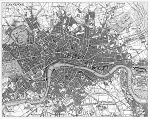
London city map
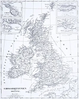
Engraving: Great Britain and IrelandEngraved illustrations of the Countries of Great Britain and Ireland from Iconographic Encyclopedia of Science, Literature and Art, Published in 1851. Copyright has expired on this artwork
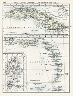
Cuba lesser antilles map 1897The World-Wide Atlas of Modern Geography, Political and Physical W. & A.K. Johnston - London 1897
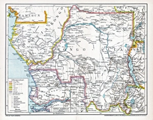
Congo map, central Africa from 1895Illustration of a Congo map, central Africa from 1895
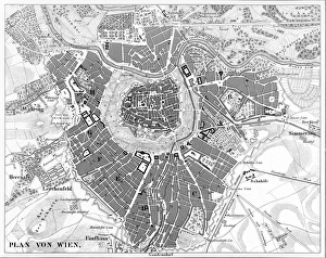
A black-and-white aerial map of Vienna, AustriaEngraved illustrations of a Map of the City of Vienna, Austria from Iconographic Encyclopedia of Science, Literature and Art, Published in 1851. Copyright has expired on this artwork
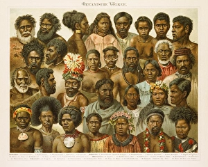
Oceanic People Chromolithograph 1896Ozeanische Volker (Oceanic People) Chromolithograph 1896
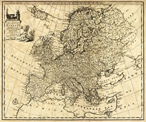
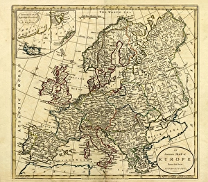
Antique Map of Europe 1744An engraved map of Europe with ornamental cartouche and relief shown pictorially by Emanuel Bowen 1744, London, Geographer to His Majesty
Antique Map of Europe, 1785An accurate map of Europe from the best authorities. London: C. Dilly & G. Robinson: 1785. Original size: 35.7 x 37.4 cm. Coloured, Inset: Spitsbergen, East and West Greenland, and Iceland
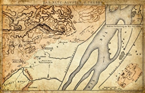
Ancient Egypt Map - Thebes
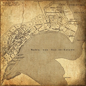
Dar es Salaam, TanzaniaAntique illustration of a Dar es Salaam, Tanzania
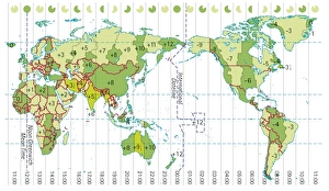
Digital illustration of world map showing time zones
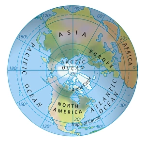
Digital illustration of map of northern hemisphere
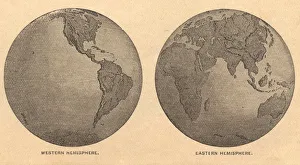
Old, Map of Eastern and Western Hemispheres, From 1875Old black and white illustration of the Eastern Hemisphere and the Western Hemisphere, from the 1800 s
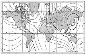
Antique map of lines of equal magnetic declination, 1885
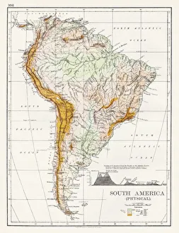
South America Physical map 1897The World-Wide Atlas of Modern Geography, Political and Physical W. & A.K. Johnston - London 1897
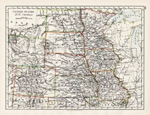
United States NW Central 1897The World-Wide Atlas of Modern Geography, Political and Physical W. & A.K. Johnston - London 1897
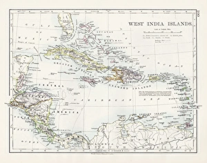
West indies map 1897The World-Wide Atlas of Modern Geography, Political and Physical W. & A.K. Johnston - London 1897
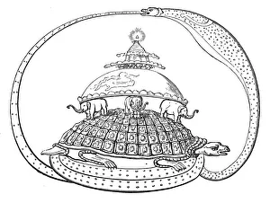
Hindu concept of the universe, showing it encircled by a serpent, the symbol of eternity. Mount Meru represents paradise, earth
Bucharest mapIllustration of a Bucharest map
Engraving: Map of Copenhagen from 1895illustration of a Engraving: Map of Copenhagen from 1895
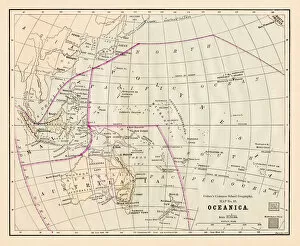
Oceania Australia map 1881Coltons Common School Geography 1881 New York Sheldon and Co
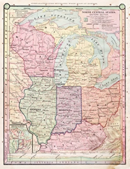
North Central states map 1886North Central states map Maps Monteith Physical Geography 1886
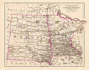
North Dakota and MInnesota map 1881Coltons Common School Geography 1881 New York Sheldon and Co
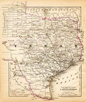
Texas map 1881Coltons Common School Geography 1881 New York Sheldon and Co
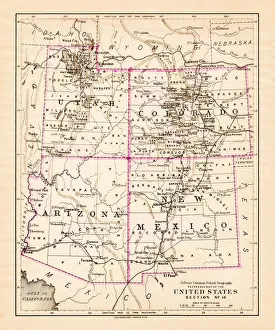
Utah Arizona New Mexico Colorado map 1881Coltons Common School Geography 1881 New York Sheldon and Co
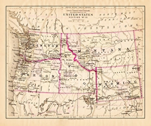
Montana Washington Oregon Idaho map 1881Coltons Common School Geography 1881 New York Sheldon and Co
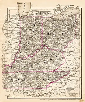
indiana Ohio Kentucky map 1881Coltons Common School Geography 1881 New York Sheldon and Co
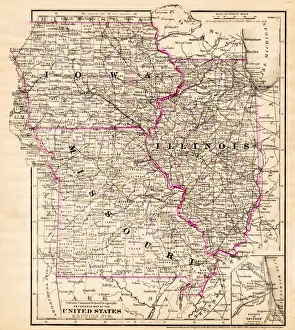
Iowa Missouri Illinois map 1881Coltons Common School Geography 1881 New York Sheldon and Co
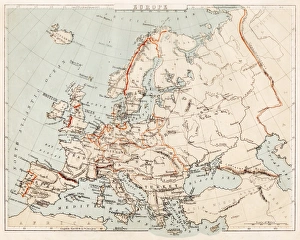
Map of Europe 1869Cornells Grammars-School Geography - S.S. Cornell - New York D. Appleton and Company 1869
Victorian Map of EuropeEngraved illustrations of Europe in the Time of Charlemagne from Iconographic Encyclopedia of Science, Literature and Art, Published in 1851. Copyright has expired on this artwork. Digitally restored
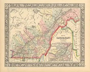
Victorian Map of Eastern Canada Circa 1850Engraved illustration of a Map of Eastern Canada in counties from Iconographic Encyclopedia of Science, Literature and Art, Published in 1851. Copyright has expired on this artwork. Digitally restored
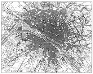
Paris, France Circa 1850 EngravingEngraved illustrations of the City of Paris from Iconographic Encyclopedia of Science, Literature and Art, Published in 1851. Copyright has expired on this artwork. Digitally restored
London, England Circa 1850 EngravingEngraved illustrations of the city of London, England from Iconographic Encyclopedia of Science, Literature and Art, Published in 1851. Copyright has expired on this artwork. Digitally restored