mail_outline sales@mediastorehouse.com
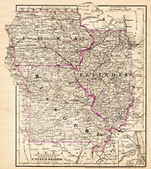
Iowa Missouri Illinois map 1881Coltons Common School Geography 1881 New York Sheldon and Co
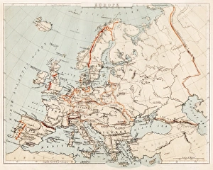
Map of Europe 1869Cornells Grammars-School Geography - S.S. Cornell - New York D. Appleton and Company 1869
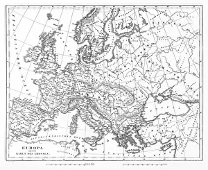
Victorian Map of EuropeEngraved illustrations of Europe in the Time of Charlemagne from Iconographic Encyclopedia of Science, Literature and Art, Published in 1851. Copyright has expired on this artwork. Digitally restored
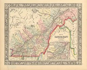
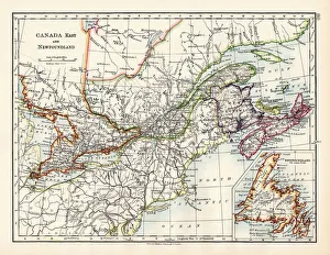
Victorian Map of Eastern Canada Circa 1850Engraved illustration of a Map of Eastern Canada in counties from Iconographic Encyclopedia of Science, Literature and Art, Published in 1851. Copyright has expired on this artwork. Digitally restored
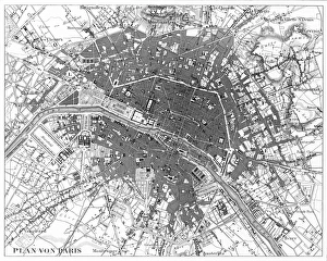
Paris, France Circa 1850 EngravingEngraved illustrations of the City of Paris from Iconographic Encyclopedia of Science, Literature and Art, Published in 1851. Copyright has expired on this artwork. Digitally restored
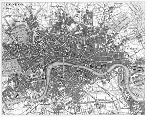
London, England Circa 1850 EngravingEngraved illustrations of the city of London, England from Iconographic Encyclopedia of Science, Literature and Art, Published in 1851. Copyright has expired on this artwork. Digitally restored
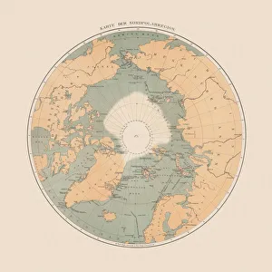
Ancient map of the Arctic Region, lithograph, published in 1883Ancient map of the Arctic Region. Lithograph, published in 1883
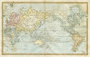
map of the world 1823map of the world - 1823 very detailed lithography
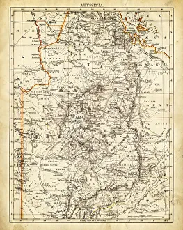
Map of Abyssinia 1897
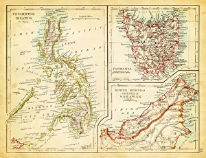
Map of Philippines Tasmania Borneo 1897Map of Tasmania Borneo Philippines
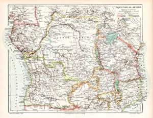
Equatorial Guinea map 1895Meyers Konversations-Lexikon. Ein Nachschlagewerk des allgemeinen Wissens, 5th edition 17 volumes Bibliographisches Institut - Leipzig 1895-1897
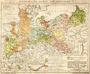
Prussia historical mapIllustration of a Prussia historical development map
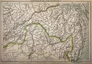
Siberia map, the Amur regionIllustration of a Siberia map, the Amur region
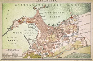
Alexandria mapAntique illustration of a Mediterranean Sea
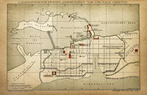
Alexandria in the first century before and after ChristAntique illustration of a Alexandria in the first century before and after Christ
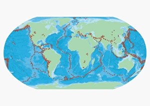
Map of the World with red dots marking earthquake zones
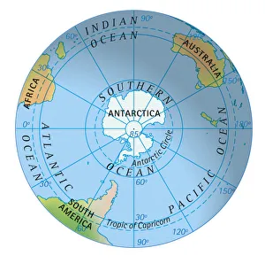
Digital illustration of map of southern hemisphere
Cube with a map of America being put together from smaller cubes, 3D illustration
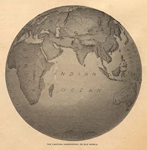
Old, Black and White Illustration of Eastern Hemisphere, From 1800 sOld black and white illustration of the Old World (Eastern Hemisphere), from 1875
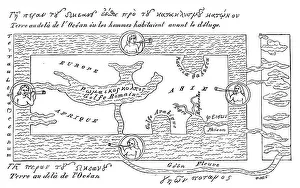
Antique illustration of VERY old world map (around year 600)
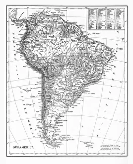
The Continent of South America, Circa 1850Engraved illustrations of the Map of South America from Iconographic Encyclopedia of Science, Literature and Art, Published in 1851. Copyright has expired on this artwork. Digitally restored
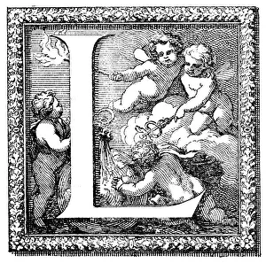
Antique illustration of ornate letter L, with four little angelsAntique illustration of capital letter L, illustrated within an ornate frame (decorated with vegetal motifs) and featuring a scene with four naked little angels in the clouds behind the body of
Canada map 1883The World-Wide Atlas of Modern Geography, Political and Physical W. & A.K. Johnston - London 1897
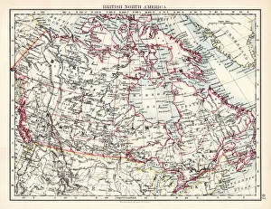
British North America map 1897The World-Wide Atlas of Modern Geography, Political and Physical W. & A.K. Johnston - London 1897
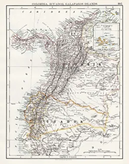
Colombia Ecuador Galapagos map 1897The World-Wide Atlas of Modern Geography, Political and Physical W. & A.K. Johnston - London 1897
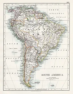
South America map 1897The World-Wide Atlas of Modern Geography, Political and Physical W. & A.K. Johnston - London 1897
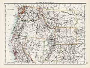
United States North West map 1897The World-Wide Atlas of Modern Geography, Political and Physical W. & A.K. Johnston - London 1897
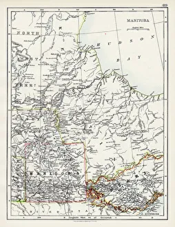
Manitoba map 1897The World-Wide Atlas of Modern Geography, Political and Physical W. & A.K. Johnston - London 1897
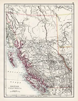
British Columbia map 1897The World-Wide Atlas of Modern Geography, Political and Physical W. & A.K. Johnston - London 1897
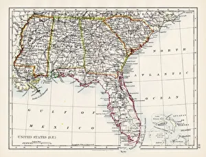
United States South East map 1897The World-Wide Atlas of Modern Geography, Political and Physical W. & A.K. Johnston - London 1897
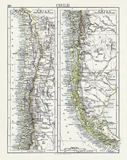
Chile map 1897The World-Wide Atlas of Modern Geography, Political and Physical W. & A.K. Johnston - London 1897
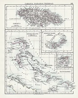
Jamaica Bahamas Trinidad map 1897The World-Wide Atlas of Modern Geography, Political and Physical W. & A.K. Johnston - London 1897
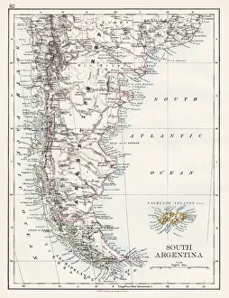
South Argentina map 1897The World-Wide Atlas of Modern Geography, Political and Physical W. & A.K. Johnston - London 1897
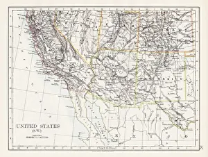
United States South West map 1897The World-Wide Atlas of Modern Geography, Political and Physical W. & A.K. Johnston - London 1897
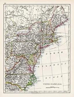
United States North East map 1897The World-Wide Atlas of Modern Geography, Political and Physical W. & A.K. Johnston - London 1897
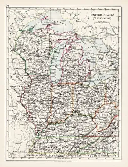
United States North East Central map 1897The World-Wide Atlas of Modern Geography, Political and Physical W. & A.K. Johnston - London 1897
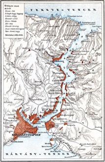
Bosporus mapIllustration of a Bosporus map
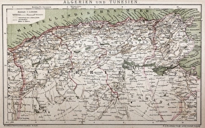
Antique map of Algeria and TunisiaIllustration of a Antique map of Algeria and Tunisia
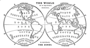
World in zones hemispheres 1881Coltons Common School Geography 1881 New York Sheldon and Co
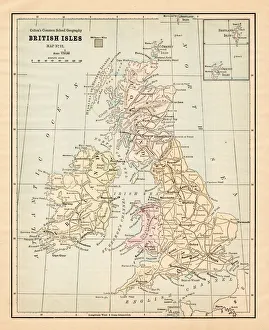
Biritsh Isles map 1881Coltons Common School Geography 1881 New York Sheldon and Co
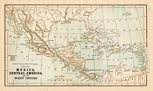
Mexico and Central America map 1881Coltons Common School Geography 1881 New York Sheldon and Co
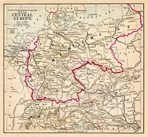
Central Europe map 1881Coltons Common School Geography 1881 New York Sheldon and Co
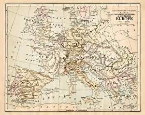
Europe map 1881Coltons Common School Geography 1881 New York Sheldon and Co
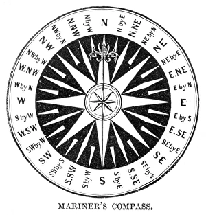
Old Compass Windrose 1881Coltons Common School Geography 1881 New York Sheldon and Co
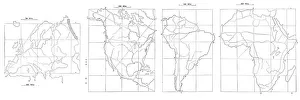
Map drawing technique 1881Coltons Common School Geography 1881 New York Sheldon and Co
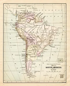
South America map 1881Coltons Common School Geography 1881 New York Sheldon and Co
Dominion of Canada map 1881Coltons Common School Geography 1881 New York Sheldon and Co
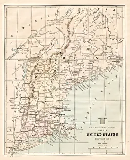
North Eastern States USA map 1881Coltons Common School Geography 1881 New York Sheldon and Co