mail_outline sales@mediastorehouse.com
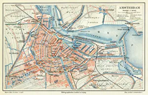
Amsterdam city map 1895Meyers Konversations-Lexikon. Ein Nachschlagewerk des allgemeinen Wissens, 5th edition 17 volumes Bibliographisches Institut - Leipzig 1895-1897
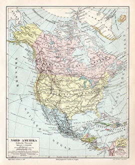
North America political map 1895Meyers Konversations-Lexikon. Ein Nachschlagewerk des allgemeinen Wissens, 5th edition 17 volumes Bibliographisches Institut - Leipzig 1895-1897
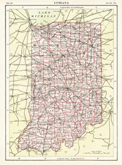
Indiana USA map 1881Encyclopedia Britannica 9th Edition Vol XII Philadelphia j.M. Stoddart & Co 1881
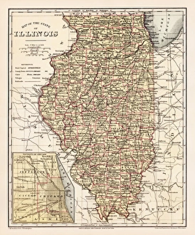
Illinois map 1881Encyclopedia Britannica 9th Edition Vol XII Philadelphia j.M. Stoddart & Co 1881
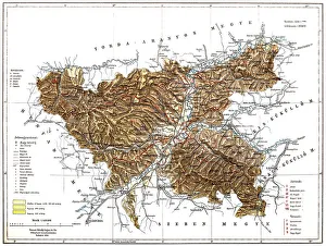
RomaniaAntique map of Romania
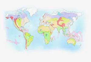
Illustration of Biomes (climatic variation) on world map
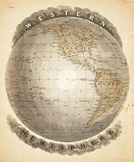
World western hemispheres 1883Warrens Common School Geography
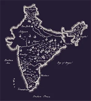
Antique India MapIndia Map, - Antique style. Includes mountains and water bodies. High detail - vector illustration
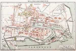
Wilhelmshaven. GermanyAntique illustration of a Wilhelmshaven, Germany map
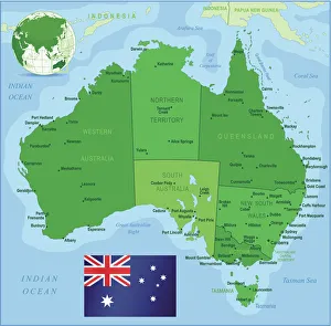
Map of Australia with states, cities and flagHighly detailed vector map of Australia with states, capitals and big cities
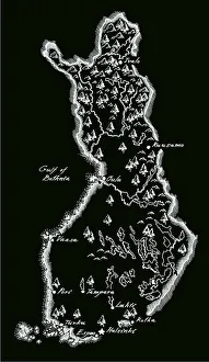
Antique Finland MapFinland Map, - Antique style. Includes mountains and water bodies. High detail - vector illustration
World mapthe dissemination of human races by Muller and Peschel
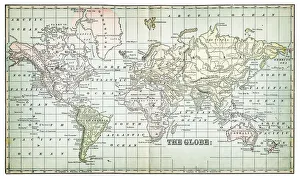
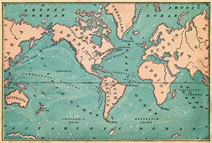
world map 1883map of the world - 1883
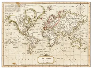
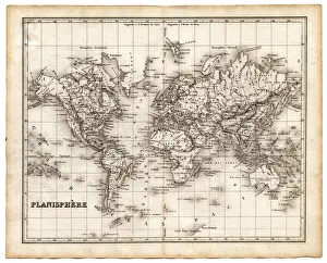
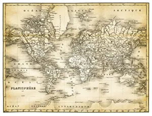
map of the world 1814antique map showing the world with all the latest discovery of 1814
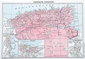
Antique map of Algeria and Tunisia
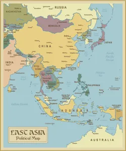
Vintage Map of East Asia
Development of the British Empire, lithograph, published 1897Map of the territorial development of the British Empire from the 17th century to the end of the 19th century. Lithograph, published in 1897
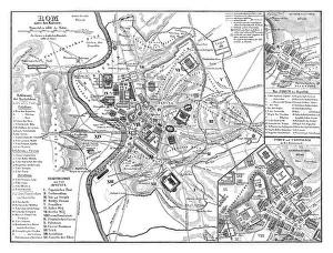
Old map showing Rome arround 1st century BCOld map showing Rome circa 1st century bc Original edition from my own archives Source : Illustriertes Konversations Lexikon 1878
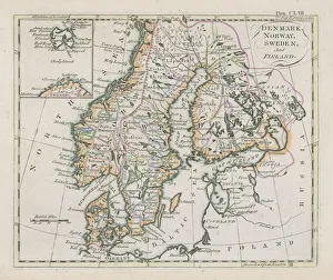
Antique map of Denmark, Norway, Sweden and FinlandWonderful hand coloured antique map, circa 1780 - 1800
Antique illustration of 31 december 1861 eclipse map
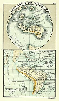
Antique Map by Leonardo Da Vinci 1515 and the Hauslab Globe
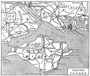
Antique map of Isle of Wight
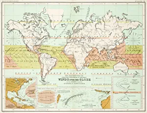
Winds - Map of the world 1861Map of the world - Winds over the globe - storms and hurricanes
map of the world 1842map of the world from an old french atlas, with its original stained borders - 1842
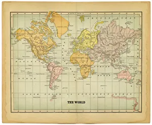
the world 1877antique map of the world - 1877
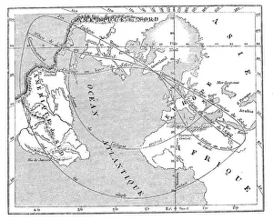
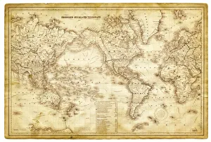
map of the world 1864map of the world - 1864, showing proposed overland telegraph lines
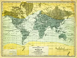
map of the world 1867meteorological map of the world 1867 - showing isothermal lines
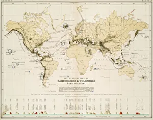
Map of the world 1861Map of the world - The distribution of Earthquakes and Volcanoes over the globe
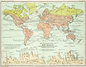
Animals - Map of the world 1861Map of the world - The distributions of animals
map of the world 1873antique map of the world - from a french atlas - 1872
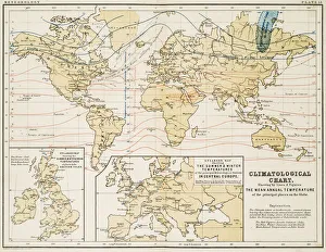
Climate map of the world 1861Map of the world - Climatological Chart
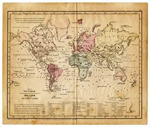
map of the world 1855map of the world illustrating the principal features of the land and the co-tidal lines - 1855
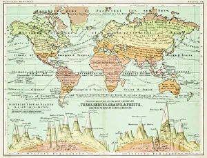
Agricultural Map of the world 1861map of the world showing the distribution of the most important Tress, Shrubs, Grains and Fruits according to zones of climate and moisture plants
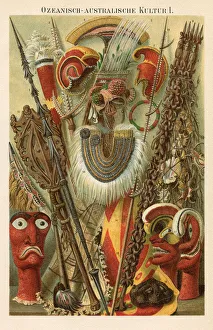
Oceania Australia Culture 1896Oceania Australia Traditional Culture Chromolithograph
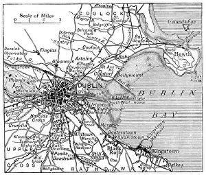
Antique map of Dublin
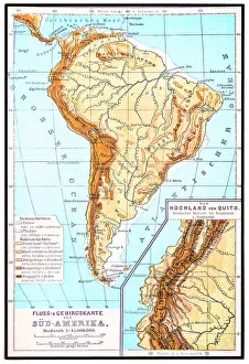
South America, river and mountains mapIllustrator of a South America, river and mountains map
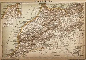
Map of Morocco
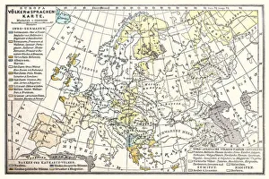
Europa map, Peoples and languages map 1896Illustration of a Europa map, Peoples and languages map 1896
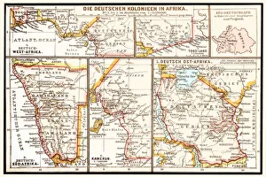
The six principal colonies of German AfricaIllustration of a The six principal colonies of German Africa
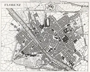
engraved illustrations of the city of FlorenceEngraved illustrations of the City of Florence from Iconographic Encyclopedia of Science, Literature and Art, Published in 1851. Copyright has expired on this artwork. Digitally restored
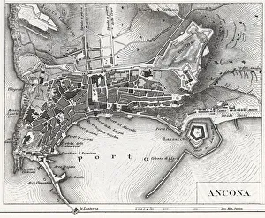
Engraving: Ancona, ItalyEngraved illustrations of the City of Ancona, Italy from Iconographic Encyclopedia of Science, Literature and Art, Published in 1851. Copyright has expired on this artwork. Digitally restored
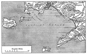
Antique map of Gulf of Naples
Ocean Currents Map 1876map to illustrate ocean currents dated 1876 showing the continuous, directed movement of sea water generated by a number of forces acting upon the water
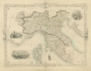
Northern Italy mapA highly decorative and finely engraved map of Northern Italy which appeared in John Tallis & co.s The Illustrated Atlas 1851
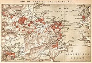
Map of Rio de Janeiro 1898Map of Rio de Janeiro - In German Language
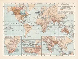
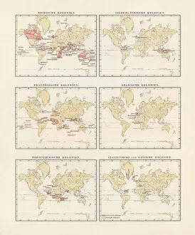
British, Dutch, French, Spanish, Portuguese, Italian, Danish colonies, lithograph, 1897British, Dutch, French, Spanish, Portuguese, Italian and Danish colonies at the end of the 19th century. Lithograph, published in 1897
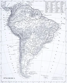
Engraving: South AmericaEngraved illustrations of South America from Iconographic Encyclopedia of Science, Literature and Art, Published in 1851. Copyright has expired on this artwork. Digitally restored
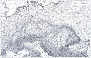
Engraving: Mountains and River Systems of EuropeEngraved illustrations of the Mountains and River Systems of Central Europe from Iconographic Encyclopedia of Science, Literature and Art, Published in 1851. Copyright has expired on this artwork