mail_outline sales@mediastorehouse.com
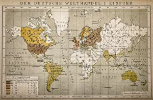
The German World Trade Import
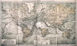
Overview map world traffic
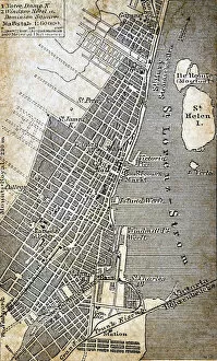
Montreal mapAntique illustration of Montreal map
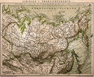
Siberia outline mapAntique illustration of Siberia outline map
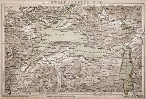
Lake LucerneAntique map of LAKE LUCERNE
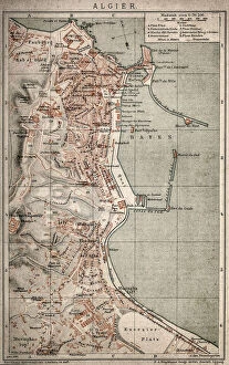
Algiers mapAntique illustration of a Algiers map
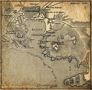
Cartagena, SpainAntique illustration of a Cartagena, Spain map
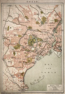
Vintage map of Tokyo
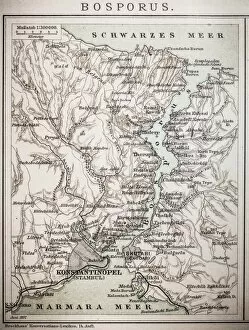
Bosporus mapAntique illustration map of Bosporus
Map of Korea, ChinaAntique illustration of a Map of Korea, China
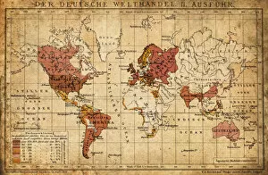
German world trade export map 1898Illustration engraving of the German world trade export map from 1898
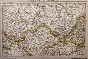
Siberia - lake of Baikal mapAntique illustration map of Siberia - lake of Baikal
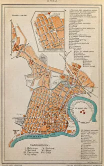
Arad City MapIllustration of a Arad City Map
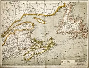
Eastern Canada and NewfoundlandIllustration of a Eastern Canada and Newfoundland
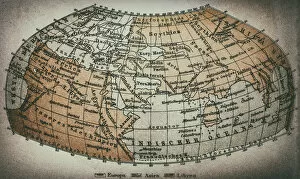
Earth map according to Claudius PtolemaeusAntique illustration of a earth map according to Claudius Ptolemaeus
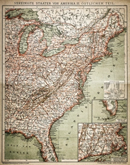
United States of America, eastern partAntique illustration of a United States of America, eastern part
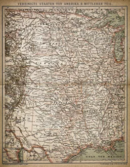
United States of America, Middle sectionAntique illustration of a United States of America, Middle section
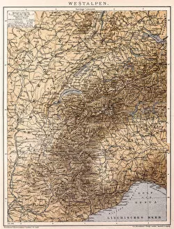
Western AlpsAntique illustration of a Western Alps
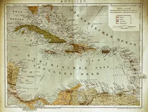
West indies, Antilles mapIllustration of a West indies, Antilles map
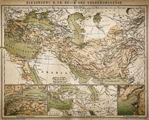
Map of Alexanders empire and conquestsAntique illustration Map of Alexanders empire and conquests
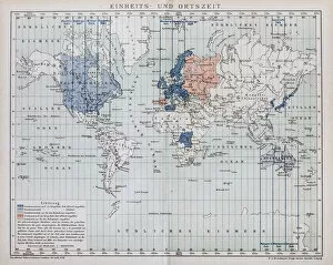
Local time world mapAntique illustration of a local time world map
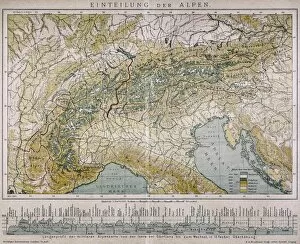
Classification of the AlpsAntique illustration of a classification of the Alps
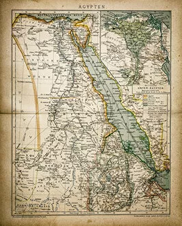
EgyptAntique illustration of a map of Egypt
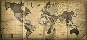
The World mapAntique illustration of a map of the World
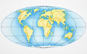
Globe of the World
Illustration of showing distribution of oil and gas shown on world map
Illustration showing distribution of coal producing countries shown on world map
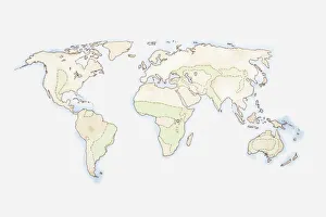
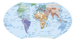
Map of the World
Illustration of the map of the world created by Dicaearchus of Messana, 300 BCE
Illustration of ground, ship and air tracking stations, called the Manned Spaceflight Network, installed as part of Apollo 11 space mission
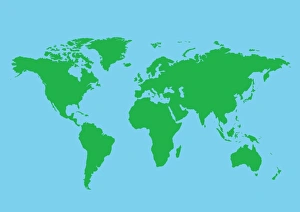
Digital illustration of world map
Illustration of world map
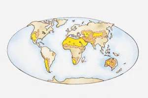
Illustration, map of the world showing desert regions (yellow) and regions in danger of desertification (orange)
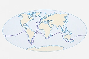
Illustration of world map showing route of Darwins HMS Beagle in purple
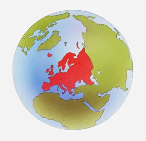
Illustration of world map with Europe highlighted in red
Digital illustration of map showing world population areas
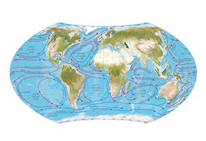
Digital illustration of world map showing ocean currents
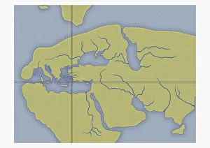
Illustration of ancient view of the world, based on Roman map from 1st century BC
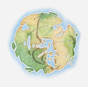
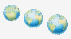
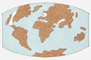
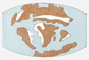
Illustration of three globes and development of continents, 200 million years ago, 50 million years ago, and present day
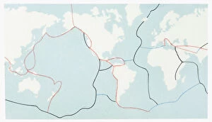
Illustration of the world today, showing the main lithospheric plates
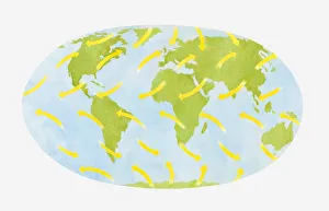
Illustration showing global wind patterns around the Earth
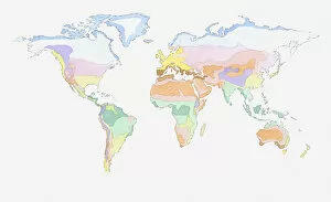
Illustration of global weather zones on world map
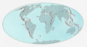
Illustration of volcanic zones dotted across the globe
Illustration of location of chalk (limestone) today
Illustration of location of chalk (limestone) 50 million years ago
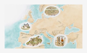
Illustration of Novgorod, Chateau de Saumur, Granada and Gutenberg Press during Medieval era
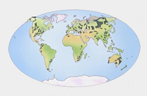
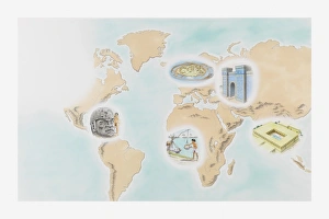
Illustration showing the first cities around the world at Wasserburg Bachau, Babylon, Mohenjo-daro, Shadoof irrigation, and the Olmecs La Venta
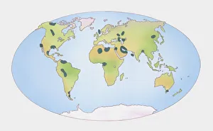
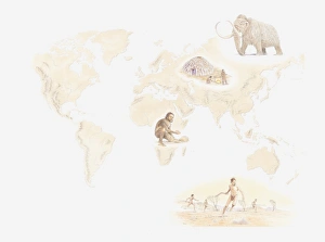
Illustration of distribution early human hunter-gatherers across the world from Mezherich in Ukraine, Mammoth, Lake Mungo settlement in Australia, and Olduvai Gorge, Tanzania