Home > Map > Historical Maps
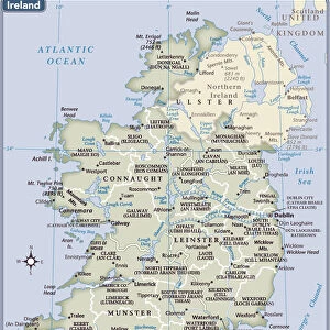
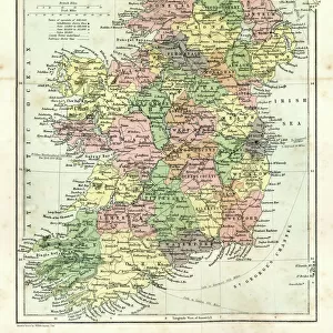
Antique Ireland Map

![]()
Wall Art and Photo Gifts from Fine Art Storehouse
Antique Ireland Map
Ireland Map, - Antique style. Includes mountains and water bodies. High detail - vector illustration
Media ID 13666567
Cartographer Computer Graphics Geographical Border Globe Intricacy Land National Northern Ireland Pencil Drawing Planet Space Republic Of Ireland Sketch Topography Vector World Map
FEATURES IN THESE COLLECTIONS
> Map
> Historical Maps
> Map
MADE IN THE USA
Safe Shipping with 30 Day Money Back Guarantee
FREE PERSONALISATION*
We are proud to offer a range of customisation features including Personalised Captions, Color Filters and Picture Zoom Tools
SECURE PAYMENTS
We happily accept a wide range of payment options so you can pay for the things you need in the way that is most convenient for you
* Options may vary by product and licensing agreement. Zoomed Pictures can be adjusted in the Cart.