Framed Print > Art
Framed Print : Dutch Trade Map of the Baltic Sea


![]()
Framed Photos from Fine Art Storehouse
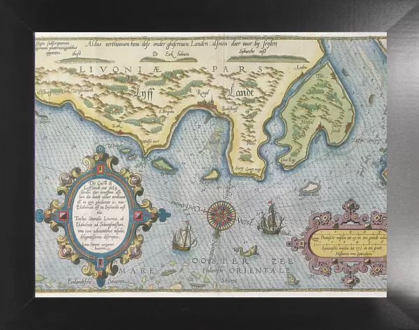
Dutch Trade Map of the Baltic Sea
Dutch Trade map of the Baltic Sea (hand-coloured engraving)
During the last decades of the 16th century and throughout the 17th century Dutch merchants and mariners dominated European trade in the Baltic area. In the Republic of the United Netherlands this trade was mainly concentrated in Amsterdam. The most frequently visited Baltic ports of call were Lübeck, Danzig, Koningsbergen and Riga
(Photo by Art Images via Getty Images)
Bridgeman Art Library/Image Partner
Media ID 32062999
© www.bridgemanart.com
17th Century Baltic Sea Cartouche Compass Rose Estuary Finland Fish Geography Industry Island Land Scandinavia Shipping Ships Whale
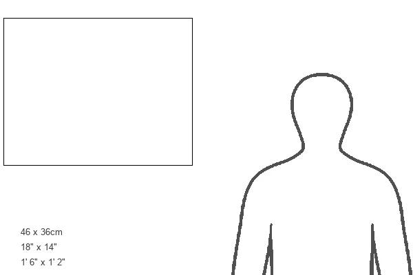
18"x14" Modern Frame
16x12 Print in an MDF Wooden Frame with 180 gsm Satin Finish Paper. Glazed using shatter proof thin plexiglass. Frame thickness is 1 inch and depth 0.75 inch. Fluted cardboard backing held with clips. Supplied ready to hang with sawtooth hanger and rubber bumpers. Spot clean with a damp cloth. Packaged foam wrapped in a card.
Contemporary Framed and Mounted Prints - Professionally Made and Ready to Hang
Estimated Image Size (if not cropped) is 40.6cm x 35.6cm (16" x 14")
Estimated Product Size is 45.7cm x 35.6cm (18" x 14")
These are individually made so all sizes are approximate
Artwork printed orientated as per the preview above, with landscape (horizontal) orientation to match the source image.
FEATURES IN THESE COLLECTIONS
> Art
> Map
> Historical Maps
> Map
MADE IN THE USA
Safe Shipping with 30 Day Money Back Guarantee
FREE PERSONALISATION*
We are proud to offer a range of customisation features including Personalised Captions, Color Filters and Picture Zoom Tools
SECURE PAYMENTS
We happily accept a wide range of payment options so you can pay for the things you need in the way that is most convenient for you
* Options may vary by product and licensing agreement. Zoomed Pictures can be adjusted in the Cart.