Home > Map > USA Maps
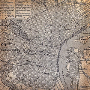
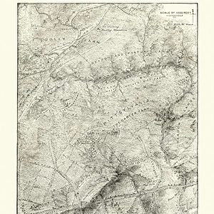
City map of Chicago, Illinois, USA, lithograph, published in 1897

![]()
Wall Art and Photo Gifts from Fine Art Storehouse
City map of Chicago, Illinois, USA, lithograph, published in 1897
City map of Chicago, Illinois, USA. Lithograph, published in 1897
Media ID 14756172
© This content is subject to copyright
American Culture Chicago City Map Colorful Downtown District Illinois Lake Michigan North America Shore Topographic Map Topography
FEATURES IN THESE COLLECTIONS
> Map
> Historical Maps
> Map
MADE IN THE UK
Safe Shipping with 30 Day Money Back Guarantee
FREE PERSONALISATION*
We are proud to offer a range of customisation features including Personalised Captions, Color Filters and Picture Zoom Tools
SECURE PAYMENTS
We happily accept a wide range of payment options so you can pay for the things you need in the way that is most convenient for you
* Options may vary by product and licensing agreement. Zoomed Pictures can be adjusted in the Basket.