Metal Print > Map > Italian Maps
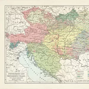
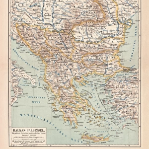
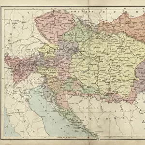
Metal Print : Austro-Hungarian Empire, Habsburg Monarchy, lithograph, published in 1877

![]()
Metal Prints from Fine Art Storehouse
Austro-Hungarian Empire, Habsburg Monarchy, lithograph, published in 1877
Ancient map of Austro-Hungarian Empire. Habsburg Monarchy. Lithograph, published in 1877
Media ID 13666769
© ZU_09
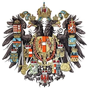
Adriatic Sea Albania Austria Austria Hungary Austrian Culture Balkans Bohemia Bosnia And Hercegovina Contour Drawing Country Geographic Area Croatia Galicia Hapsburg Dynasty Hungarian Culture Hungary Mediterranean Sea Montenegro Moravia Romania Royalty Serbia Serbian Culture Slovenia Topographic Map Topography Transylvania
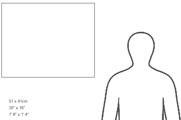
16"x20" (51x41cm) Metal Print
Made with durable metal and luxurious printing techniques, our metal photo prints go beyond traditional canvases, adding a cool, modern touch to your space. Wall mount on back. Eco-friendly 100% post-consumer recycled ChromaLuxe aluminum surface. The thickness of the print is 0.045". Featuring a Scratch-resistant surface and Rounded corners. Backing hangers are attached to the back of the print and float the print 1/2-inch off the wall when hung, the choice of hanger may vary depending on size and International orders will come with Float Mount hangers only. Finished with a brilliant white high gloss surface for unsurpassed detail and vibrance. Printed using Dye-Sublimation and for best care we recommend a non-ammonia glass cleaner, water, or isopropyl (rubbing) alcohol to prevent harming the print surface. We recommend using a clean, lint-free cloth to wipe off the print. The ultra-hard surface is scratch-resistant, waterproof and weatherproof. Avoid direct sunlight exposure.
Made with durable metal and luxurious printing techniques, metal prints bring images to life and add a modern touch to any space
Estimated Image Size (if not cropped) is 50.8cm x 40.6cm (20" x 16")
Estimated Product Size is 51.4cm x 41.2cm (20.2" x 16.2")
These are individually made so all sizes are approximate
Artwork printed orientated as per the preview above, with landscape (horizontal) orientation to match the source image.
FEATURES IN THESE COLLECTIONS
> Map
> Historical Maps
> Map
> Italian Maps
> Map
MADE IN THE USA
Safe Shipping with 30 Day Money Back Guarantee
FREE PERSONALISATION*
We are proud to offer a range of customisation features including Personalised Captions, Color Filters and Picture Zoom Tools
SECURE PAYMENTS
We happily accept a wide range of payment options so you can pay for the things you need in the way that is most convenient for you
* Options may vary by product and licensing agreement. Zoomed Pictures can be adjusted in the Cart.