Framed Print > Map > Historical Maps
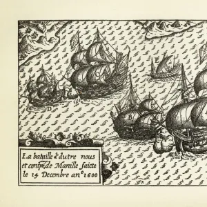
Framed Print : Historical Map of Dutch Navigators Island of Bali Illustration


![]()
Framed Photos from Fine Art Storehouse
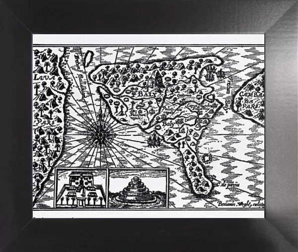
Historical Map of Dutch Navigators Island of Bali Illustration
Very Rare, Beautifully Illustrated Antique Engraved Victorian Illustration of Historical Map of Dutch Navigators on the Island of Bali. Copyright has expired on this artwork. Digitally restored
bauhaus1000
Media ID 13667025
© bauhaus1000
16th Century 16th Century Style 78273 Bali Chart Commercial Dock Compass Diagram Direction Discovery Dutch Culture European Culture Exploration Explorer Guidance Harbor Image Created 16th Century Indigenous Culture Indonesia Island Journey Navigational Compass Navigational Equipment Pacific Ocean Passenger Craft Passenger Ship Sailing Ship Sea Passage Ship South Pacific Ocean Sumatra Sumatra Indonesia Tropical Climate
12"x10" Modern Frame
10x8 Print in an MDF Wooden Frame with 180 gsm Satin Finish Paper. Glazed using shatter proof thin plexi glass. Frame thickness is 1 inch and depth 0.75 inch. Fluted cardboard backing held with clips. Supplied ready to hang with sawtooth hanger and rubber bumpers. Spot clean with a damp cloth. Packaged foam wrapped in a card.
Contemporary Framed and Mounted Prints - Professionally Made and Ready to Hang
Estimated Image Size (if not cropped) is 25.4cm x 25.4cm (10" x 10")
Estimated Product Size is 30.5cm x 25.4cm (12" x 10")
These are individually made so all sizes are approximate
Artwork printed orientated as per the preview above, with landscape (horizontal) or portrait (vertical) orientation to match the source image.
FEATURES IN THESE COLLECTIONS
> Map
> Historical Maps
> Map
MADE IN THE USA
Safe Shipping with 30 Day Money Back Guarantee
FREE PERSONALISATION*
We are proud to offer a range of customisation features including Personalised Captions, Color Filters and Picture Zoom Tools
SECURE PAYMENTS
We happily accept a wide range of payment options so you can pay for the things you need in the way that is most convenient for you
* Options may vary by product and licensing agreement. Zoomed Pictures can be adjusted in the Cart.