Photographic Print > Map > Historical Maps
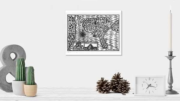
Photographic Print : Historical Map of Dutch Navigators Island of Bali Illustration

![]()
Photo Prints from Fine Art Storehouse
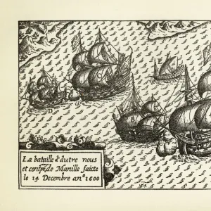
Historical Map of Dutch Navigators Island of Bali Illustration
Very Rare, Beautifully Illustrated Antique Engraved Victorian Illustration of Historical Map of Dutch Navigators on the Island of Bali. Copyright has expired on this artwork. Digitally restored
bauhaus1000
Media ID 13667025
© bauhaus1000
16th Century 16th Century Style 78273 Bali Chart Commercial Dock Compass Diagram Direction Discovery Dutch Culture European Culture Exploration Explorer Guidance Harbor Image Created 16th Century Indigenous Culture Indonesia Island Journey Navigational Compass Navigational Equipment Pacific Ocean Passenger Craft Passenger Ship Sailing Ship Sea Passage Ship South Pacific Ocean Sumatra Sumatra Indonesia Tropical Climate
10"x8" Photo Print
Photo prints are produced on Kodak professional photo paper resulting in timeless and breath-taking prints which are also ideal for framing. The colors produced are rich and vivid, with accurate blacks and pristine whites, resulting in prints that are truly timeless and magnificent. Whether you're looking to display your prints in your home, office, or gallery, our range of photographic prints are sure to impress. Dimensions refers to the size of the paper in inches.
Our Photo Prints are in a large range of sizes and are printed on Archival Quality Paper for excellent colour reproduction and longevity. They are ideal for framing (our Framed Prints use these) at a reasonable cost. Alternatives include cheaper Poster Prints and higher quality Fine Art Paper, the choice of which is largely dependant on your budget.
Estimated Image Size (if not cropped) is 25.4cm x 18.2cm (10" x 7.2")
Estimated Product Size is 25.4cm x 20.3cm (10" x 8")
These are individually made so all sizes are approximate
Artwork printed orientated as per the preview above, with landscape (horizontal) orientation to match the source image.
FEATURES IN THESE COLLECTIONS
> Map
> Historical Maps
> Map
MADE IN THE USA
Safe Shipping with 30 Day Money Back Guarantee
FREE PERSONALISATION*
We are proud to offer a range of customisation features including Personalised Captions, Color Filters and Picture Zoom Tools
SECURE PAYMENTS
We happily accept a wide range of payment options so you can pay for the things you need in the way that is most convenient for you
* Options may vary by product and licensing agreement. Zoomed Pictures can be adjusted in the Cart.