mail_outline sales@mediastorehouse.com
3,671 items
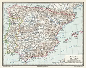
Spain and Portugal map 1895Meyers Konversations-Lexikon. Ein Nachschlagewerk des allgemeinen Wissens, 5th edition 17 volumes Bibliographisches Institut - Leipzig 1895-1897
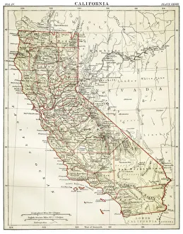
Map of California 1878Encyclopedia Britannica 9th Edition Vol II New York, Samuel Hall 1878
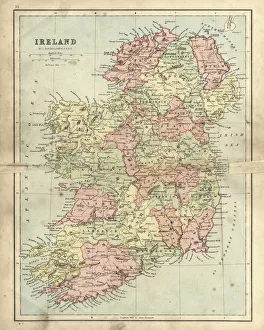
Antique damaged map of Ireland in the 19th CenturyVintage engraving of a Antique damaged map of Ireland in the 19th Century, 1873
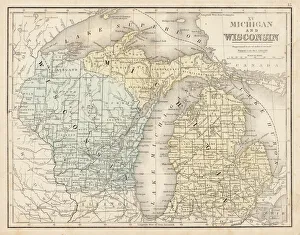
Wisconsin MIchigan map 1867Mitchellas Modern Atlas - Published by E.H. Butler and Co - Philadelphia 1867
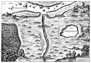
Carte du Tendre: imaginary map by a character in the novel Cl├®lieMadeleine de Scudery, often known simply as Mademoiselle de Scudery, was a French writer. Illustration of a Carte du Tendre
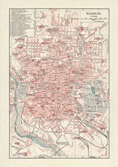
City map of Madrid, capital of Spain, lithograph, published 1897City map of Madrid, capital and largest city of Spain. Lithograph, published in 1897
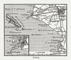
City map of Lima and surroundings, Peru, woodcut, published 1897City map of Lima and surroundings, capital and the largest city of Peru. Wood engraving, published in 1897
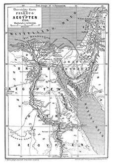
Map of Napoleons Campaign in Egypt 1798 - French campaign in Egypt and SyriaIllustration of a Map of Napoleons Campaign in Egypt 1798 - French campaign in Egypt and Syria
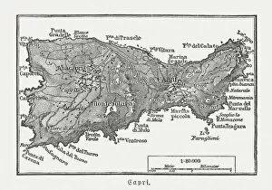
Map of Capri, Italian island, wood engraving published in 1897Map of Capri, Italian island. Wood engraving, published in 1897
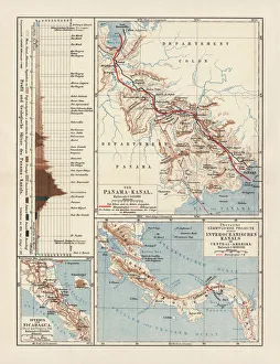
Panama Canal Project, lithograph, published in 1880Ancient map of the Panama Canal Project. Lithograph, published in 1880
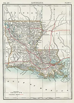
Map of Louisiana 1883Encyclopedia Britannica 9th Edition New York Samuel L. Hall 1883 Vol XV
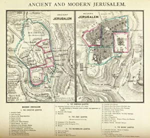
Ancient and Modern Jerusalem Map EngravingEngraved illustration of Ancient and Modern Jerusalem Map Engraving from The Popular Pictorial Bible, Containing the Old and New Testaments, Published in 1862. Copyright has expired on this artwork
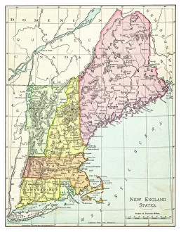
Map of New England states 1895The Rand-McNally Grammar School Geography 1895 - Chicago & New York
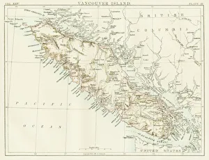
Vancouver island map 1885Encyclopedia Britannica 9th Edition New York Charles Scribners and Sons 1885 Vol XXIV
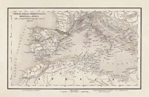
Roman Republic and Carthage during the Second Punic War (218-201-BC)Ancient map of the Roman Republic and Carthage during the Second Punic War (218 to 201 BC). Legend in Latin language. Steel engraving with hand colored borderlines, published in 1861
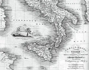
Vintage map of Magna Graecia, showing the settlements of the ancient greeks in Italy. Magna GrA|cia is the name of the coastal areas of Southern Italy on the Tarentine Gulf that was extensively
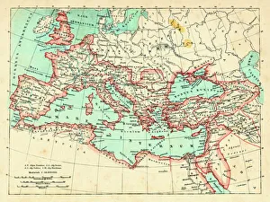
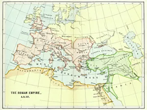
Roman Empire at its height under emperor Trajan 117 ADMap of ancient rome The Roman Empire at its height Emperor Trajan (ruled 98 - 117 AD) was Romes most expansionist ruler, his death marking the high water mark of Romes size
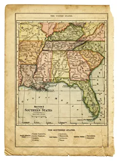
the southern states usa mapsouthern states usa - east coast, mexican gulf and atlantic ocean (1876)
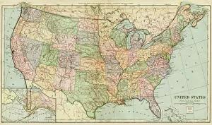
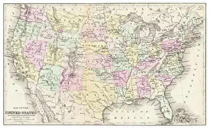
Map of United States 1899Maurys Geographical Series Manual of Geography - New York 1899
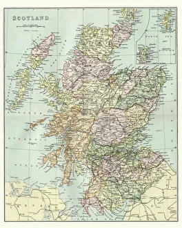
Antique Map of Scotland and Shetland IslandsVintage engraving of Antique Map of Scotland and Shetland Islands, 19th Century
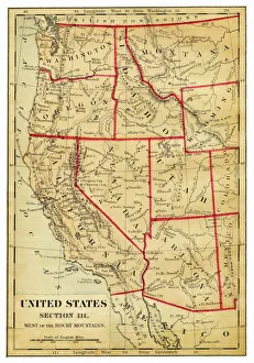
Map of Western states USA 1876Maurys Geographical Series - The Word we live in by M.F. Maury LLD - New York and Baltimore 1876
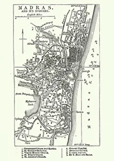
Map of Madras (Chennai), India, 19th CenturyVintage engraving of Map of Madras (Chennai), India, 19th Century
Map of USA 1877Warrens Common School Geography 1877
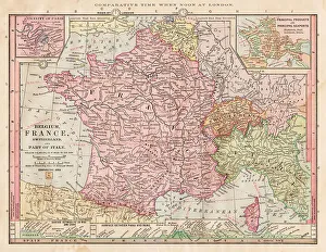
Map of France 1886Map of France Maps Monteith Physical Geography 1886
Historical map of Palestine with the twelve tribes of Israel. Colored steel engraving, published in 1886
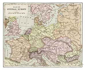
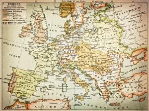
Map of central Europe 1889Indiana Educational Series The Complete Geography - Indianapolis 1889
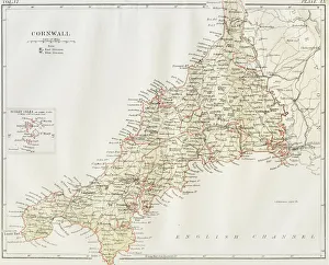
Cornwall map 1884Encyclopedia Britannica 9th Edition New York Charles Scribners and Sons 1884 Vol VI
Antique map of Hadrians wall
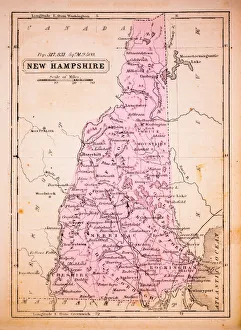
New Hampshire 1852 Map
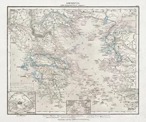
Greece at the beginning of the Peloponnesian War (431-404 BC)Antique Map of Greece at the beginning of the Peloponnesian War (431 - 404 BC) with the different tribal groups. Steel engraving with hand colored borderlines, published in 1861
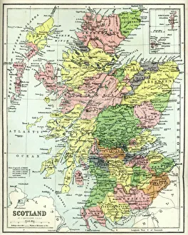
Antique map of Scotland, 1864
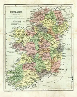
Antique map of Ireland, 1864
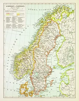
Map of Sweden and Norway 1897Map of Sweden and Norway
Map of Europe 1721
Map of the Roman Empire in AD 117Vintage engraving of a Map of the Roman Empire in AD 117
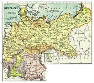
Map of Germany 1889Comprehensive Geography by James Monteith - American Book Company 1882, 1889
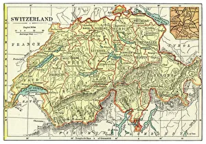
Map of Switzerland 1889Comprehensive Geography by James Monteith - American Book Company 1882, 1889
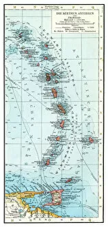
Lesser Antilles map 1896Andres Allgemeiner Handatlas - Bielefeld und Leipzig 1896
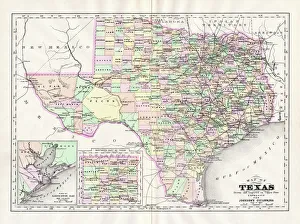
Map of Texas 1894Johnsons Universal Cyclopedia - Volume VIII New York - A. J. Johnson Company 1894
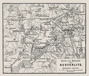
Map of the Battle of Austerlitz also known as the Battle of the Three EmperorsIllustration of a Map of the Battle of Austerlitz also known as the Battle of the Three Emperors
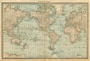
map of the world 1882map of the world - 1882
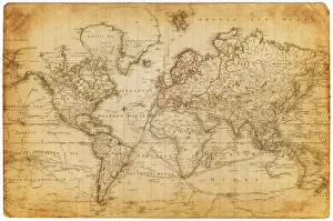
Map of the world 1800
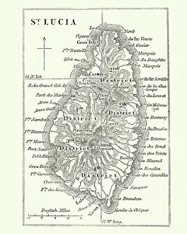
Map of Saint Lucia, 19th CenturyVintage engraving of Map of Saint Lucia, 19th Century
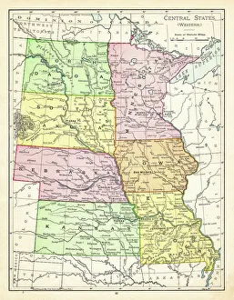
Map of central states USA 1895The Rand-McNally Grammar School Geography 1895 - Chicago & New York
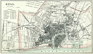
Map of HullVintage map from 1880 of Hull in the East Riding of Yorkshire, England. The city of Hull has served as market town, military supply port, trading hub, fishing and whaling centre
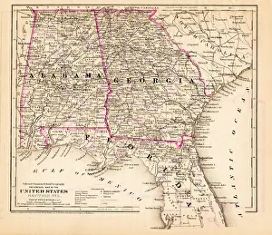
Alabama Florida Georgia map 1881Coltons Common School Geography 1881 New York Sheldon and Co
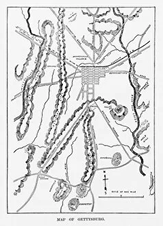
Battle of Gettysburg Map, July 3, 1863 Civil War EngravingEngraving of the Map of the Battle of Gettysburgs, Pennsylvania, July 3, 1863 Civil War Engraving from Famous Leaders and Battle Scenes of the Civil War, Published in 1864
Old Map ElementsOld map icons, eps 9