mail_outline sales@mediastorehouse.com
3,669 items
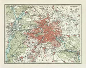
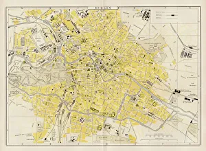
City map of Berlin and surrounding, Germany, lithograph, published 1897City map of Berlin and surrounding, capital of Germany. Lithograph, published in 1897
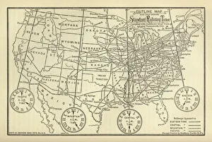
Engraved Chart of United States Time Zones, Circa 1883Beautifully Illustrated Antique Engraved Victorian Illustration of an Engraved Chart of United States Time Zones and Standard Railway Time, Circa 1883. Source: The Popular Science Monthly, By E.L
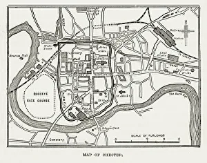
Map of the City of Chester, England Victorian Engraving, 1840Very Rare, Beautifully Illustrated Antique Engraving of Map of the City of Chester, England Victorian Engraving, 1840. Source: Original edition from my own archives
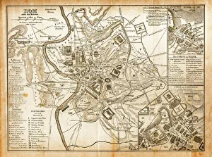
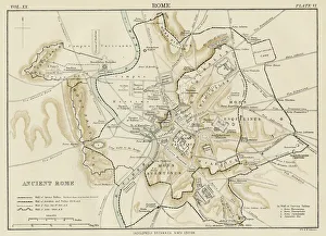
Antique Map of Romeillustration of a Antique Map of Rome
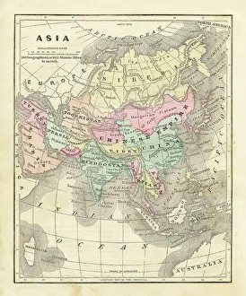
Map of Asia 1856Colton and Fitchs Modern School Geography by George W. Fitch - New York 1856
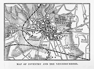
Map of Coventry in Warwickshire, England Victorian Engraving, 1840Very Rare, Beautifully Illustrated Antique Engraving of Map of Coventry in Warwickshire, England Victorian Engraving, 1840. Source: Original edition from my own archives
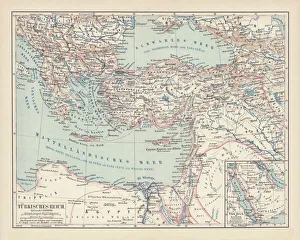
Ottoman Empire, lithograph, published in 1878Ancient map of Ottoman Empire. Lithograph, published in 1878
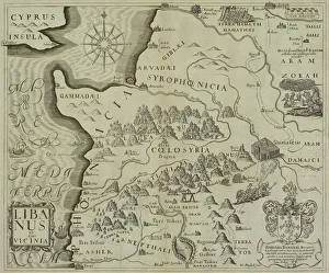
Antique map of holy land including Syria and Lebanon
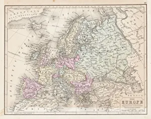
Europe map 1867Mitchellas Modern Atlas - Published by E.H. Butler and Co - Philadelphia 1867
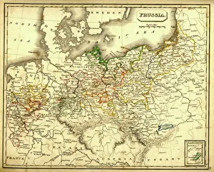
Antquie Map of PrussiaVintage map of Prussia from 1837
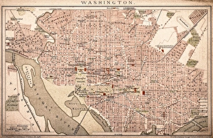
Map of Washington 1898Antique illustration of a Map of Washington 1898
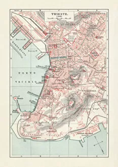
Historical city map of Trieste, Italy, lithograph, published in 1897Historical city map of Trieste, Italy (formerly Austria). Lithograph, published in 1897
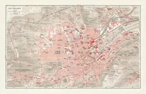
City map of Stuttgart, Baden-WAOErttemberg, Germany, lithograph, published in 1897Historical city map of Stuttgart, capital of Baden-Wurttemberg in Germany. Lithograph, published in 1897
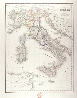
Italy Before UnificationAntique Maps, TR002313
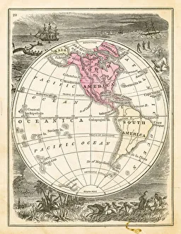
Map of Eastern hemisphere 1871Colton and Fitchs Introductory School Geography - New York: Sheldon and Company 1871
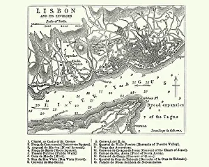
Map of Lisbon, Portugal, 19th CenturyVintage engraving of a Map of Lisbon, Portugal, 19th Century
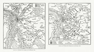
Maps of Battle of Leipzig, Napolionic wars, 1813, published 1897Maps of the Battle of the Nations near Leipzig from 16 to 19 October 1813, Saxony, Germany. Wood engravings, published in 1897
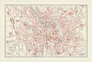
City map of Graz, Styria, Austria, lithograph, published in 1897City map of Graz, capital of Styria, Austria. Lithograph, published in 1897
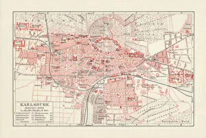
City map of Karlsruhe, Baden-WAOErttemberg, Germany, lithograph, published in 1897City map of Karlsruhe, Baden-WAOErttemberg, Germany. Lithograph, published in 1897
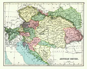
Antique map of Austrian Empire, 1897, late 19th CenturyVintage engraving of a Antique map of Austrian Empire, 1897, late 19th Century
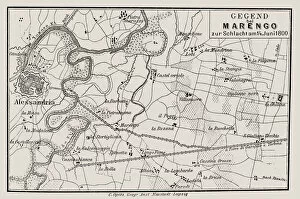
Map of Battle of Marengo, Morning 14 June1800illustration of a Map of Battle of Marengo, Morning 14 June1800
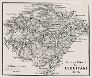
Map of the Battle of Jena and Auerstedt (AuerstAÔé¼dt) 1806Illustration of a Map of the Battle of Jena and Auerstedt (AuerstAÔé¼dt) 1806
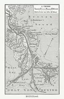
Mouth of the Mississippi river, Louisiana, USA, woodcut, published 1897Map of the mouth of the Mississippi river, Louisiana, USA. Wood engraving, published in 1897
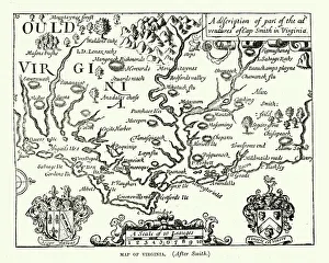
Map of Virginia, 17th Century After Captain John SmithVintage engraving of a Map of Virginia, 17th Century After Captain John Smith
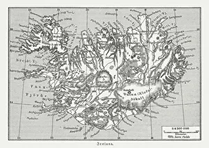
Map of Iceland, wood engraving, published in 1897Map of Iceland. Wood engraving, published in 1897
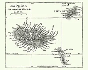
Map of Madeira, 19th CenturyVintage engraving of a Map of Madeira, 19th Century a Portuguese archipelago situated in the north Atlantic Ocean, southwest of Portugal
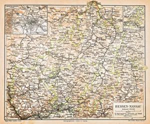
Hesse-Nassau Map IllustrationIllustartion of the Province of Hesse-Nassau (German: Provinz Hessen-Nassau). It was a province of the Kingdom of Prussia from 1868 to 1918, then a province of the Free State of Prussia until 1944
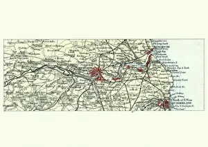
Antique map, Newcastle upon Tyne and Sunderland, 19th CenturyVintage engraving of a Antique map, Newcastle upon Tyne and Sunderland and surrounding area, England. 19th Century
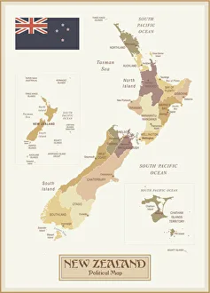
Vintage Map of New ZealandNew Zealand - Retro Vector Map
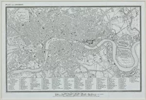
antiquity, archival, cartography, city, england, europe, geographical, geography, great britain, historical, london, map, nobody, old-fashioned, roads, streets, text, thames river, uk, urban
Map of ancient Rome 1883Encyclopedia Britannica 9th Edition New York Samuel L. Hall 1883 Vol XX
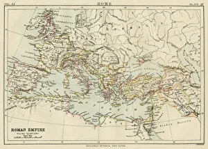
Map of the roman empire 1883Encyclopedia Britannica 9th Edition New York Samuel L. Hall 1883 Vol XX
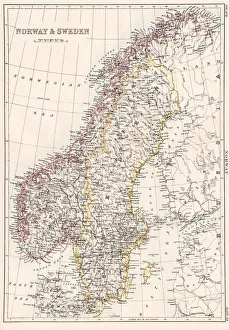
Norway and Sweden map 1884Encyclopedia Britannica 9th Edition New York Charles Scribners and Sonsl 1884 Vol XVII
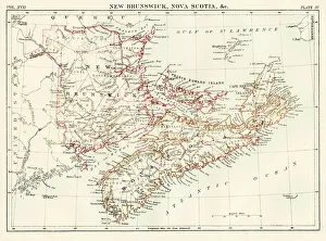
New Brunswick Nova Scotia map 1884Encyclopedia Britannica 9th Edition New York Charles Scribners and Sonsl 1884 Vol XVII
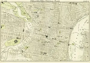
Philadelphia map 1885Encyclopedia Britannica 9th Edition New York Charles Scribners and Sons 1885 Vol XVIII
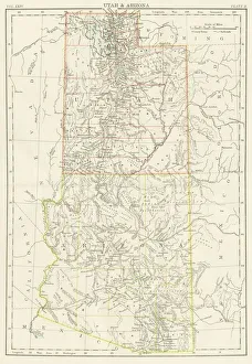
Utah Arizona map 1885Encyclopedia Britannica 9th Edition New York Charles Scribners and Sons 1885 Vol XXIV
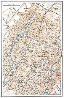
Berlin city map 1893Johnsonas Universal Cyclopedia - Charles Kendall - New York 1893
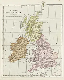
Map of the British isles 1889Indiana Educational Series The Complete Geography - Indianapolis 1889
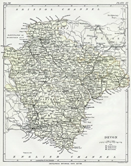
Map of Devon 1883Encyclopedia Britannica 9th Edition New York Samuel L. Hall 1883 Vol VII
Brussels mapIllustration of a Brussels map
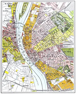
Budapest city mapIllustration of a Budapest city map
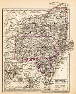
New York Maryland Pennsylvania map 1881Coltons Common School Geography 1881 New York Sheldon and Co
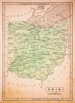
Ohio 1852 Map
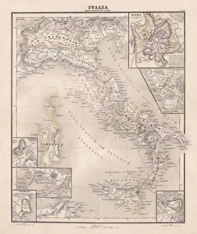
Ancent Italy, c. 450 BC, steel engraving, published in 1861The territory of Italy around 450 BC with separate maps of Rome, Roman Forum, surrounding area of Rome, Syracuse, Carthage and surrounding area of Pompeji and Naples. Legend in Latin language
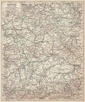
German federal state of Bavaria, lithograph, published in 1874Map of German federal state of Bavaria. Lithograph, published in 1874
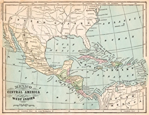
Mexico and West indies map 1875The Independent Course Comprehensive Geography by James Monteith, A.S. Barnes & Co, New York & Chicago 1875
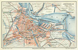
Amsterdam city map 1895Meyers Konversations-Lexikon. Ein Nachschlagewerk des allgemeinen Wissens, 5th edition 17 volumes Bibliographisches Institut - Leipzig 1895-1897
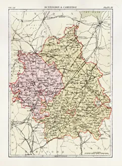
Huntingdon and Cambridge map 1881Encyclopedia Britannica 9th Edition Vol XII Philadelphia j.M. Stoddart & Co 1881