mail_outline sales@mediastorehouse.com
3,669 items
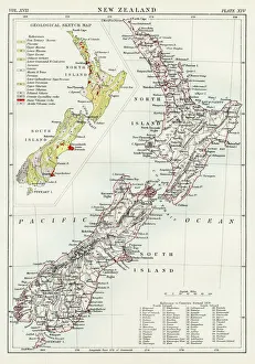
New Zealand map 1884Encyclopedia Britannica 9th Edition New York Charles Scribners and Sonsl 1884 Vol XVII
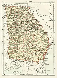
Georgia map 1884Encyclopedia Britannica 9th Edition New York Charles Scribners and Sonsl 1884 Vol X
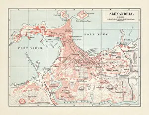
City map of Alexandria, Egypt, lithograph, published in 1897City map of Alexandria, Egypt. Lithograph, published in 1897
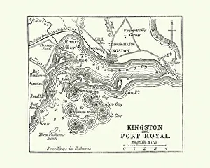
Map of Kingston and Port Royal, Jamaica, 19th CenturyVintage engraving of a Map of Kingston and Port Royal, Jamaica, 19th Century
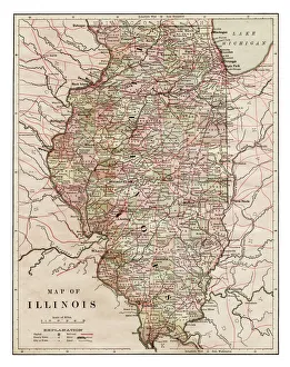
Map of Illinois 1889Indiana Educational Series The Complete Geography - Indianapolis 1889
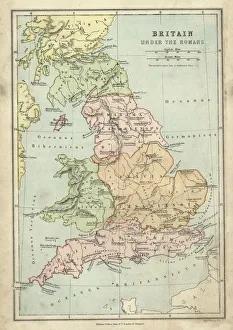
Antique map of Britain under the Ancient Romans
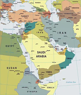
Map of Middle East - illustrationColored Map of Middle East Asia with Country Names and Capital Cities
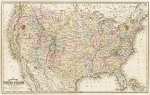
Map of United States 1867Mitchells Modern Atlas - Published by E.H. Buttler & Co - Philadelphia 1867
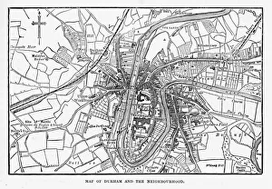
Map of the City of Durham, England Victorian Engraving, 1840Very Rare, Beautifully Illustrated Antique Engraving of Map of the City of Durham, England Victorian Engraving, 1840. Source: Original edition from my own archives
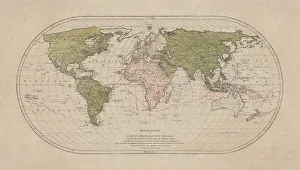
World map by Mathieu Albert Lotter, Augsburg, 1778World map from 1778. Original hand-colored copper engraving by Matthieu Albert Lotter (1741 - 1810, Augsburg) with route of James Cooks First Circumnavigation (1770), through Tahiti
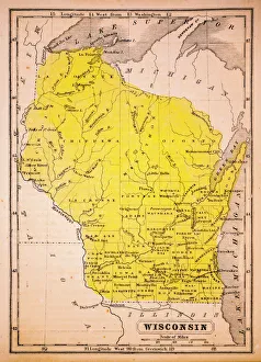
Wisconsin 1852 Map
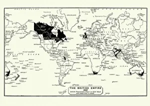
Map of the British Empire in 1837. At its height, the British Empire was the largest empire in history and, for over a century, was the foremost global power
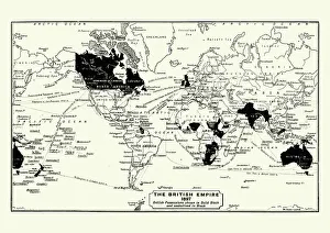
Map of the British Empire in 1897. At its height, the British Empire was the largest empire in history and, for over a century, was the foremost global power
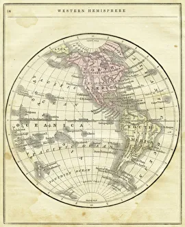
Western Hemisphere map 1856Colton and Fitchs Modern School Geography by George W. Fitch - New York 1856
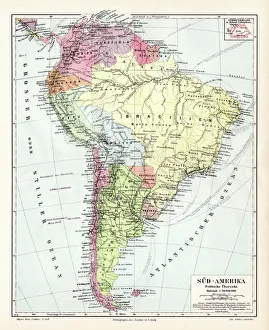
South America political map 1895Meyers Konversations-Lexikon. Ein Nachschlagewerk des allgemeinen Wissens, 5th edition 17 volumes Bibliographisches Institut - Leipzig 1895-1897
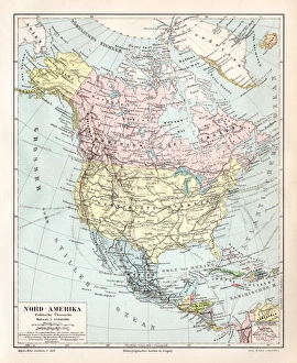
North America political map 1895Meyers Konversations-Lexikon. Ein Nachschlagewerk des allgemeinen Wissens, 5th edition 17 volumes Bibliographisches Institut - Leipzig 1895-1897
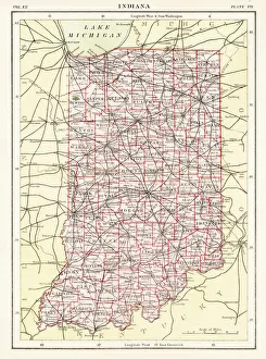
Indiana USA map 1881Encyclopedia Britannica 9th Edition Vol XII Philadelphia j.M. Stoddart & Co 1881
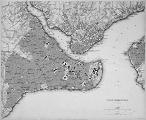
Antique map of Constantinople, present day Istanbul
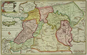
Antique map of the Middle East by Halma
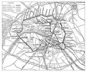
Antique engraving illustration: Paris Subway Metro map
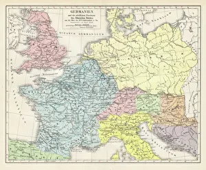
Germany and the northern provinces of the roman empire map 1895Encyclopedia Britannica 9th Edition Vol I New York, Samuel Hall 1878
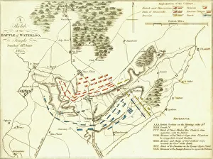
Battle Of WaterlooA plan of the Battle of Waterloo in present-day Belgium during the Napoleonic Wars, 18th June 1815. Here an Anglo-Allied army under the command of the Duke of Wellington defeated the Imperial French
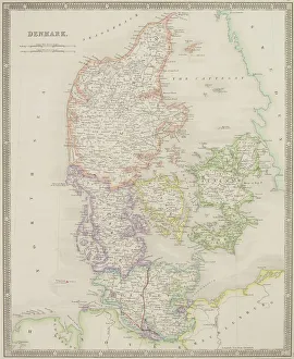
Antique map of Denmark
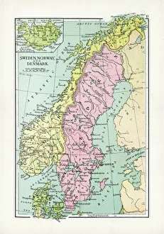
Antique Map of Sweden, Norway and DenmarkVintage map of Sweden, Norway and Denmark, from 1894
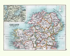
Antique Map of Northern Ireland, detail of Londonderry, 19th CenturyAntique Map of Northern Ireland, detail of Londonderry area, 19th Century
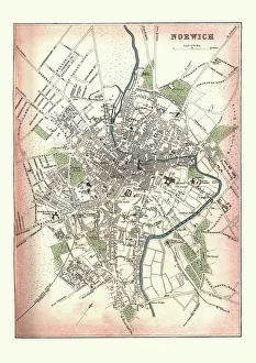
Antique Map of Norwich, England, 1880Vintage Antquie Map of the city of Norwich, Norfolk, England in 1880
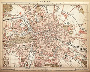
Map of Berlin 1898Historic city map of Berlin, Germany. Lithograph, published in 1898
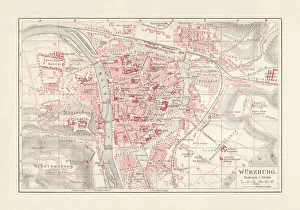
City map of WAOErzburg, Bavaria, Germany, lithograph, published in 1897City map of Wurzburg, Bavaria, Germany. Lithograph, published in 1897
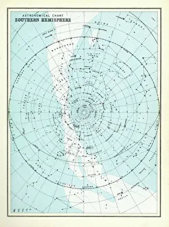
Astronomical Chart - Southern HemisphereAntique Astronomical Chart of the Southern Hemisphere from 1891
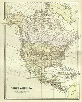
Antique map, North America, Canada and USA, 1884, 19th CenturyVintage engraving of Antique map, North America, Canada and USA, 1884, 19th Century
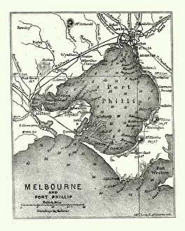
Map of Melbourne and Port Phillip, Australia, 19th CenturyVintage engraving of Map of Melbourne and Port Phillip, Australia, 19th Century
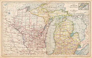
Map of Michigan and Wisconsin 1877The Eclectic Elementary Geography by Wilson & Hinkle / Cincinnati -New York 1881
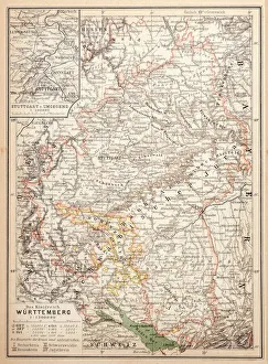
Map of Wurttemberg, historical German territoryIllustration of a Map of Wurttemberg, historical German territory
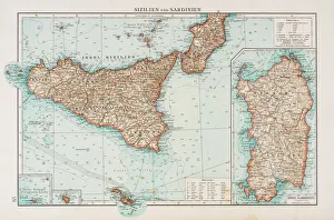
Sardinia and Sicily map 1896Andres Allgemeiner Handatlas - Bielefeld und Leipzig 1896
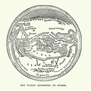
Map of the Ancient World according to HomerVintage engraving of a Map of the Ancient World according to Homer. Homer is best known as the author of the Iliad and the Odyssey
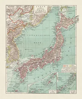
Topographic map of Japan and Corea, lithograph, published 1897Topographic map of Japan and Corea. Lithograph, published in 1897
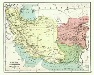
Antique map of Persia, Afghanistan, Beloochistan, 1897, late 19th CenturyVintage engraving of a Antique map of Persia, Afghanistan, Beloochistan, 1897, late 19th Century
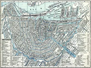
Map of city Amsterdam Netherlands from 1881 Original edition from my own archives Source : Illustriertes Konversations Lexikon 1881
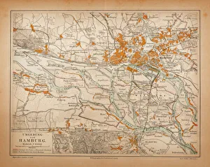
Map of HamburgIllustration of a Map of Hamburg
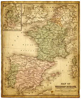
western europe 1867a map of Western europe from 1867, overlay with grunge burnt texture paper
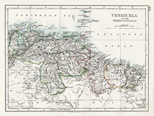
Venezuela and the Guayanas map 1897The World-Wide Atlas of Modern Geography, Political and Physical W. & A.K. Johnston - London 1897
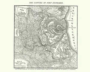
Map of the Battle of Fort Donelson, American Civil WarVintage engraving of a Map of the Battle of Fort Donelson, during the American Civil War
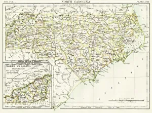
North Carolina map 1884Encyclopedia Britannica 9th Edition New York Charles Scribners and Sonsl 1884 Vol XVII
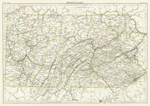
Pennsylvania map 1885Encyclopedia Britannica 9th Edition New York Charles Scribners and Sons 1885 Vol XVIII
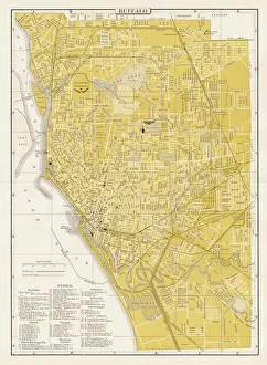
Buffalo city map 1893Johnsonas Universal Cyclopedia - Charles Kendall - New York 1893
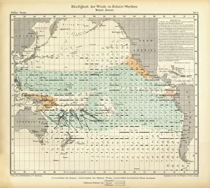
January Frequency of Winds in Relative Values Chart, Pacific Ocean, German Antique Victorian Engraving, 1896Very Rare, Beautifully Illustrated Antique Engraving of January Frequency of Winds in Relative Values Chart, Pacific Ocean, German Antique Victorian Engraving, 1896
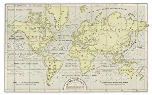
Wind chart map 1889Indiana Educational Series The Complete Geography - Indianapolis 1889
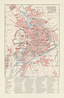
City map of Erfurt, Germany, lithograph, published in 1897City map of Erfurt with street directory, Thuringia, Germany. Lithograph, published in 1897