mail_outline sales@mediastorehouse.com
3,671 items
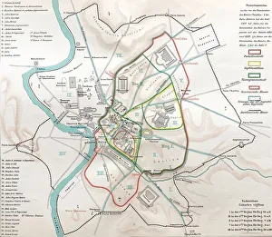
Ancient rome, regions map of RomeIllustration from 19th century
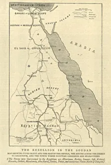
Mahdist War, Map of the rebellion in Sudan, 1884Vintage engraving of Mahdist War, Map of the rebellion in Sudan, 1884
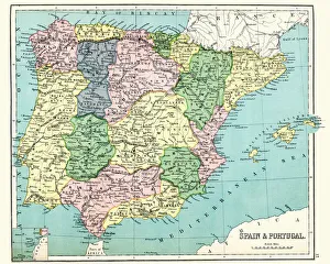
Antique map of Spain and Portugal, 1897, late 19th CenturyVintage engraving of a Antique map of Spain and Portugal, 1897, late 19th Century
Map of Thailand and Vietnam 1900Meyers hand-Atlas Leipzig und Wien Verlag des Bibliographischen Instituts 1900
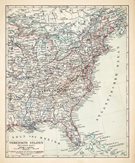
Map of USA Eastern States 1900Meyers hand-Atlas Leipzig und Wien Verlag des Bibliographischen Instituts 1900
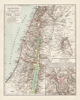
Map of Palestine 1900Meyers hand-Atlas Leipzig und Wien Verlag des Bibliographischen Instituts 1900
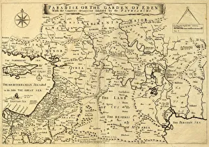
Middle East Ancient Map, Garden of Eden, 1675This may appear to be a straightforward map of the Middle East. However, closer inspection will reveal some extraordinary details, a number of descriptions on the map refer to stories from the Bible
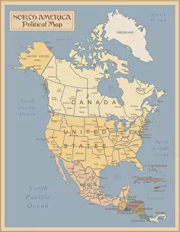
Vintage Map of North AmericaNorth America - Retro Map
Map of United States 1895The Rand-McNally Grammar School Geography 1895 - Chicago & New York
Map of Europe 1895The Rand-McNally Grammar School Geography 1895 - Chicago & New York
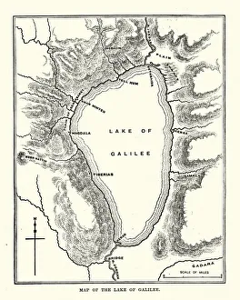
Map of the Sea of GalileeVintage engraving of a Map of the Sea of Galilee, 19th Century
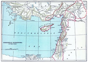
Old chromolithograph map of Christian Kingdoms in the EastAntique Illustration. Copyright has expired on this artwork. From my own archives, digitally restored
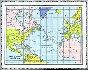
Old chromolithograph map of voyage and discovery - showing the principal routes of the early navigatorsAntique Illustration, Copyright has expired on this artwork. From my own archives, digitally restored
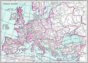
Old chromolithograph map of the feudal EuropeAntique Illustration. Copyright has expired on this artwork. From my own archives, digitally restored
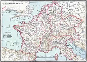
Old chromolithograph map of the Carolingian Empire (800-888) a Frankish-dominated empire in WesternAntique Illustration. Copyright has expired on this artwork. From my own archives, digitally restored
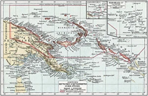
Old chromolithograph map of German South Sea coloniesAntique Illustration. Copyright has expired on this artwork. From my own archives, digitally restored
Old chromolithograph map of Mecklenburg, a historical region in northern Germany comprising the westernAntique Illustration, Copyright has expired on this artwork. From my own archives, digitally restored
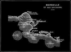
Old engraved illustration of Marseille, the second most populous city in FranceAntique Illustration, Copyright has expired on this artwork. From my own archives, digitally restored
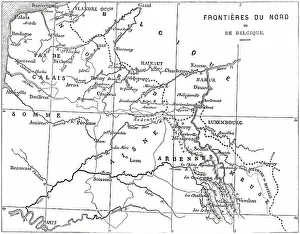
Old engraved illustration of France and Belgium border mapAntique Illustration, Copyright has expired on this artwork. From my own archives, digitally restored
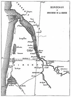
Old engraved map of Bordeaux, port city on the river Garonne in the Gironde department, Southwestern FranceAntique Illustration, Copyright has expired on this artwork. From my own archives, digitally restored
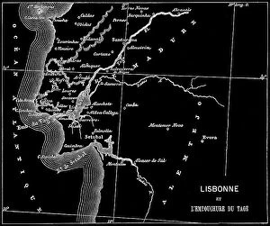
Old engraved map of Lisbon, Capital of Portugal and the Mouth of the Tagus riverCopyright has expired on this artwork. From my own archives, digitally restored
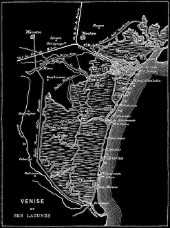
Old engraved map of Venice, ItalyCopyright has expired on this artwork. From my own archives, digitally restored
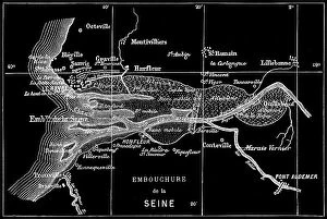
Old engraved map of Seine River, a 777-kilometre-long (483 mi) river in northern FranceCopyright has expired on this artwork. From my own archives, digitally restored
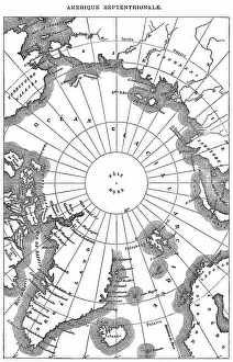
Old engraved map of North Polar RegionsAntique Illustration. Copyright has expired on this artwork. From my own archives, digitally restored
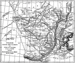
Old engraved illustration of France climate map of growing areas and wildlifeAntique Illustration. Copyright has expired on this artwork. From my own archives, digitally restored
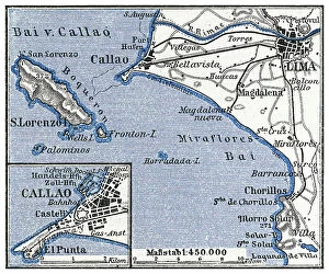
Old engraved map of Lima, the capital and largest city of Peru, located in the valleys of the ChillonCopyright has expired on this artwork. From my own archives, digitally restored
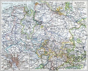
Old chromolithograph map of Hanover, capital and largest city of the German state of Lower SaxonyAntique Illustration, Copyright has expired on this artwork. From my own archives, digitally restored
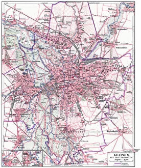
Old chromolithograph map of Leipzig (most populous city in the German state of Saxony) with its suburbsAntique Illustration, Copyright has expired on this artwork. From my own archives, digitally restored
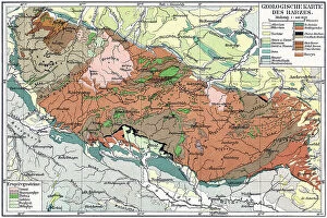
Old chromolithograph geological map of the Harz, a highland area in northern GermanyAntique Illustration, Copyright has expired on this artwork. From my own archives, digitally restored
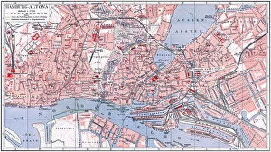
Old chromolithograph map of Altona or Hamburg-Altona, the westernmost urban borough of the German city state of HamburgAntique Illustration, Copyright has expired on this artwork. From my own archives, digitally restored
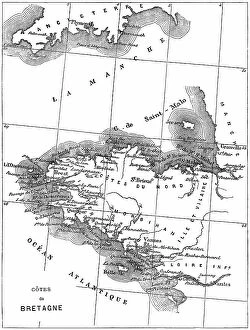
Old engraved map of Brittany, the westernmost region of Metropolitan FranceAntique Illustration, Copyright has expired on this artwork. From my own archives, digitally restored
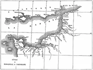
Old engraved map of the English Channel or La Manche, an arm of the Atlantic Ocean that separates Southern EnglandCopyright has expired on this artwork. From my own archives, digitally restored
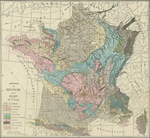
Old engraved illustration of France geological mapCopyright has expired on this artwork. From my own archives, digitally restored
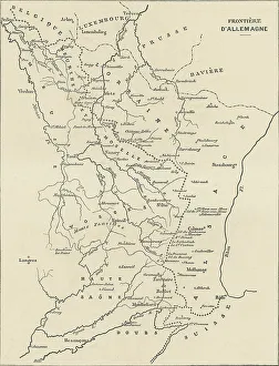
Old engraved illustration of France and Germany border mapAntique Illustration, Copyright has expired on this artwork. From my own archives, digitally restored
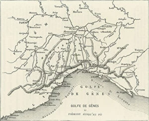
Old engraved map of the Gulf of Genoa, the northernmost part of the Ligurian Sea (largest city on its coast is Genoa)Copyright has expired on this artwork. From my own archives, digitally restored
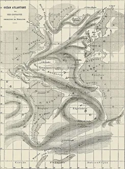
Old engraved map of Atlantic Ocean and its currentsAntique Illustration, Copyright has expired on this artwork. From my own archives, digitally restored
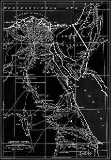
Old chromolithograph map of ancient EgyptCopyright has expired on this artwork. From my own archives, digitally restored
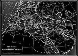
Old chromolithograph map of the World as know to the Mesopotamian NationsAntique Illustration. Copyright has expired on this artwork. From my own archives, digitally restored
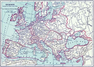
Old chromolithograph map of the Europe during the Thirty Years WarAntique Illustration. Copyright has expired on this artwork. From my own archives, digitally restored
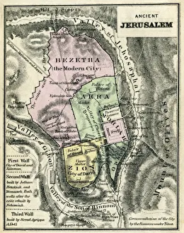
Map Of Ancient JerusalemEngraving From 1873 Featuring A Map Of Ancient Jerusalem
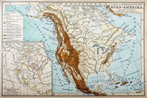
River and mountains map of North AmericaIllustration of a River and mountains map of North America
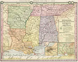
Map of Tennessee, Alabama, Louisiana states 1886Barnes Complete Geography by James Monteith - A.S. Barnes and Co. 1886
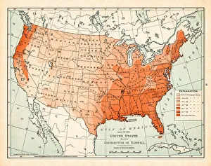
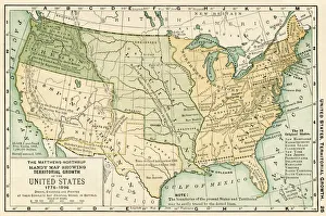
Map of USA 1898Map from the Complete Handy Atlas of the World - 1898
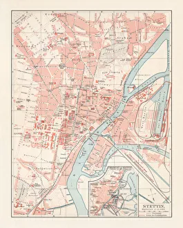
City map of Stettin, Germany (today Szczecin, Poland), lithograph, 1897Historical city map of Stettin, Germany (today Szczecin, Poland). Lithograph, published in 1897
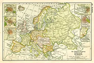
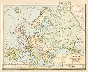
Map of Europe 1875Elementary Geography Course by William Swinton - New York 1875
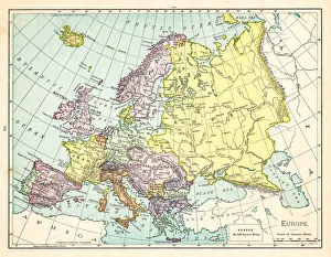
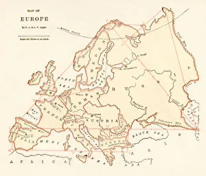
Europe map 1898Map from the Complete Handy Atlas of the World - 1898
Map of Europe 1888Butlers Elementary Geography by Jacques W. Redway - Philadelphia 1888
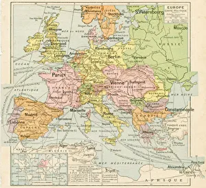
Europe map 1887Map from La Premiere Annee de Geographie par P. Foncin - Paris 1887