mail_outline sales@mediastorehouse.com
3,716 Items
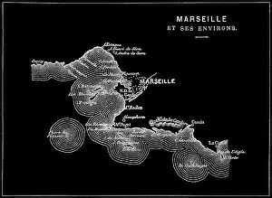
Old engraved illustration of Marseille, the second most populous city in FranceAntique Illustration, Copyright has expired on this artwork. From my own archives, digitally restored
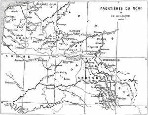
Old engraved illustration of France and Belgium border mapAntique Illustration, Copyright has expired on this artwork. From my own archives, digitally restored
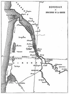
Old engraved map of Bordeaux, port city on the river Garonne in the Gironde department, Southwestern FranceAntique Illustration, Copyright has expired on this artwork. From my own archives, digitally restored
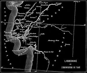
Old engraved map of Lisbon, Capital of Portugal and the Mouth of the Tagus riverCopyright has expired on this artwork. From my own archives, digitally restored
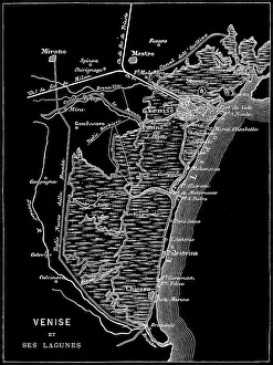
Old engraved map of Venice, ItalyCopyright has expired on this artwork. From my own archives, digitally restored
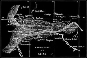
Old engraved map of Seine River, a 777-kilometre-long (483 mi) river in northern FranceCopyright has expired on this artwork. From my own archives, digitally restored
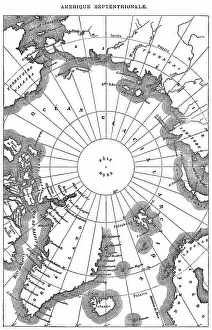
Old engraved map of North Polar RegionsAntique Illustration. Copyright has expired on this artwork. From my own archives, digitally restored
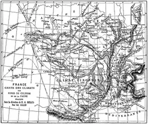
Old engraved illustration of France climate map of growing areas and wildlifeAntique Illustration. Copyright has expired on this artwork. From my own archives, digitally restored
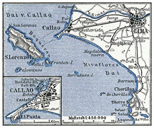
Old engraved map of Lima, the capital and largest city of Peru, located in the valleys of the ChillonCopyright has expired on this artwork. From my own archives, digitally restored
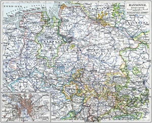
Old chromolithograph map of Hanover, capital and largest city of the German state of Lower SaxonyAntique Illustration, Copyright has expired on this artwork. From my own archives, digitally restored
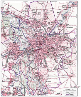
Old chromolithograph map of Leipzig (most populous city in the German state of Saxony) with its suburbsAntique Illustration, Copyright has expired on this artwork. From my own archives, digitally restored
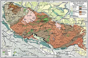
Old chromolithograph geological map of the Harz, a highland area in northern GermanyAntique Illustration, Copyright has expired on this artwork. From my own archives, digitally restored
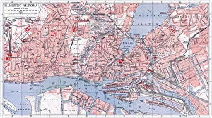
Old chromolithograph map of Altona or Hamburg-Altona, the westernmost urban borough of the German city state of HamburgAntique Illustration, Copyright has expired on this artwork. From my own archives, digitally restored
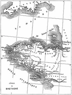
Old engraved map of Brittany, the westernmost region of Metropolitan FranceAntique Illustration, Copyright has expired on this artwork. From my own archives, digitally restored
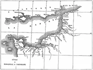
Old engraved map of the English Channel or La Manche, an arm of the Atlantic Ocean that separates Southern EnglandCopyright has expired on this artwork. From my own archives, digitally restored
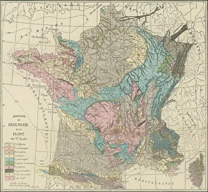
Old engraved illustration of France geological mapCopyright has expired on this artwork. From my own archives, digitally restored
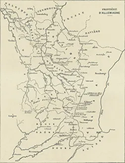
Old engraved illustration of France and Germany border mapAntique Illustration, Copyright has expired on this artwork. From my own archives, digitally restored
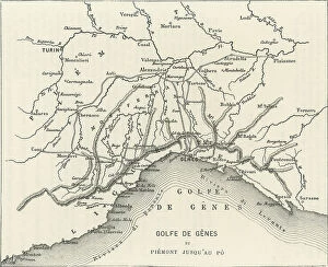
Old engraved map of the Gulf of Genoa, the northernmost part of the Ligurian Sea (largest city on its coast is Genoa)Copyright has expired on this artwork. From my own archives, digitally restored
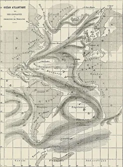
Old engraved map of Atlantic Ocean and its currentsAntique Illustration, Copyright has expired on this artwork. From my own archives, digitally restored
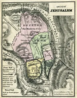
Map Of Ancient JerusalemEngraving From 1873 Featuring A Map Of Ancient Jerusalem
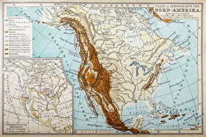
River and mountains map of North AmericaIllustration of a River and mountains map of North America
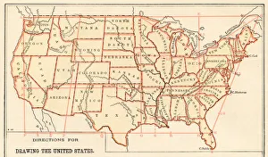
Map of the United States 1875Elementary Geography Course by William Swinton - New York 1875
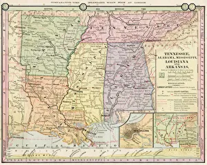
Map of Tennessee, Alabama, Louisiana states 1886Barnes Complete Geography by James Monteith - A.S. Barnes and Co. 1886
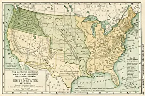
Map of USA 1898Map from the Complete Handy Atlas of the World - 1898
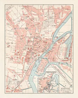
City map of Stettin, Germany (today Szczecin, Poland), lithograph, 1897Historical city map of Stettin, Germany (today Szczecin, Poland). Lithograph, published in 1897
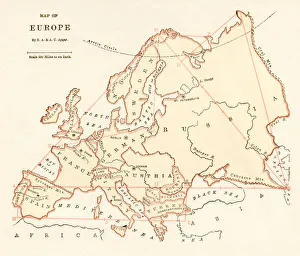
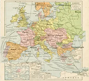
Map of Europe 1875Elementary Geography Course by William Swinton - New York 1875
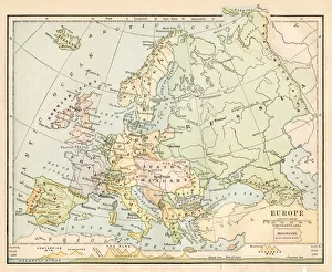
Europe map 1898Map from the Complete Handy Atlas of the World - 1898
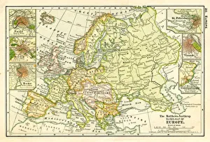
Map of Europe 1888Butlers Elementary Geography by Jacques W. Redway - Philadelphia 1888
Europe map 1887Map from La Premiere Annee de Geographie par P. Foncin - Paris 1887
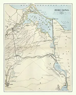
Antique map of Suez Canal, Egypt, 1880s, 19th CenturyVintage engraving of Antique map of Suez Canal, Egypt, 1880s, 19th Century. The Suez Canal is a sea-level waterway in Egypt, connecting the Mediterranean Sea to the Red Sea through the Isthmus of Suez
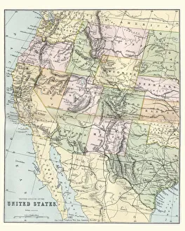
Map of the Western United States of America, 19th CenturyVintage engraving of a Map of the Western United States of America, 19th Century
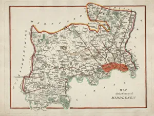
Antique Map of MiddlesexAn antique map of Middlesex engraved by R. Scott and published by Archibald Fullarton and Co. Glasgow. c. 1833. folding copy, later hand colouring
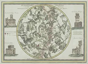
Antique star chart with zodiac signs18th century, antique, architecture, astrological, border, buildings, , Celestial Maps, 87671786
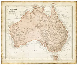
Old map of Australia 1899an old map of Australia 1899 - combined with several different textures and grunge papers
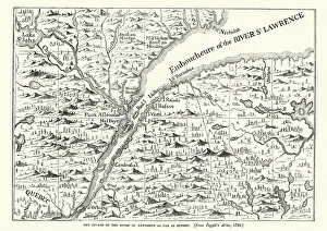
Map of the St Lawrence river, 18th CenturyVintage engraving of a Map of the St Lawrence river, 18th Century
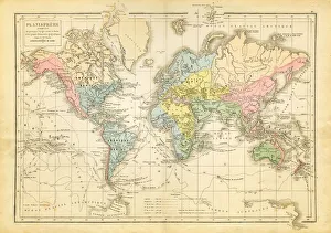
world map 1882french map of the world showing the trajectories of travels and discovery around 1780 and 1822 - map is from 1882
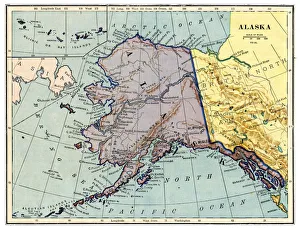
Map of Alaska 1889Comprehensive Geography by James Monteith - American Book Company 1882, 1889
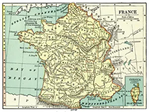
Map of France 1889Comprehensive Geography by James Monteith - American Book Company 1882, 1889
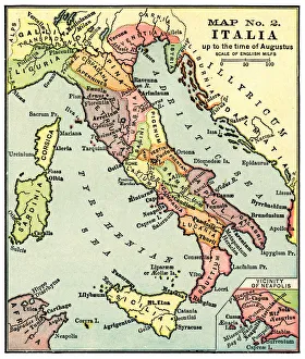
Map of Italy in the times of Augustus 1889Comprehensive Geography by James Monteith - American Book Company 1882, 1889
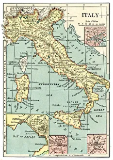
Map of Italy 1889Comprehensive Geography by James Monteith - American Book Company 1882, 1889
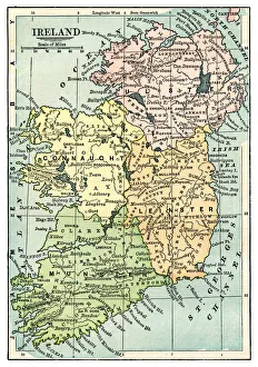
Map of Ireland 1889Comprehensive Geography by James Monteith - American Book Company 1882, 1889
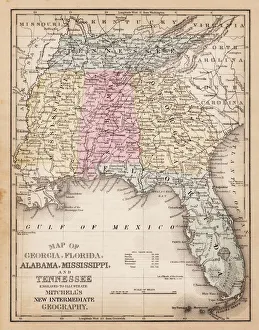
Map of USA Southern states 1881A System of Modern Geography designed for the use of schools and academies by Augustus Mitchell - Published by T. H. Butler / Philadelphia 1881
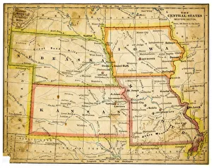
Map of USA Central states 1883The Eclectic Elementary Geography by Van Antwerp, Bragg & C0 / Cincinnati -New York 1883
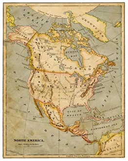
Map of North America 1883The Eclectic Elementary Geography by Van Antwerp, Bragg & C0 / Cincinnati -New York 1883
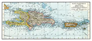
Haiti Puerto Rico map 1896Andres Allgemeiner Handatlas - Bielefeld und Leipzig 1896
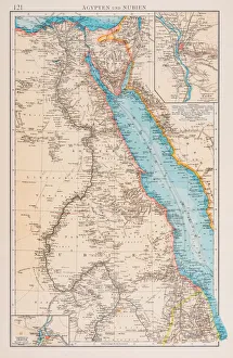
Map of Egypt and Sudan 1896Andres Allgemeiner Handatlas - Bielefeld und Leipzig 1896
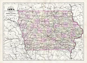
Map of Iowa USA 1894Johnsons Universal Cyclopedia - Volume IV New York - A. J. Johnson Company 1894
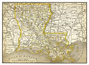
Map of Louisiana 1893New Pocket Atlas / Rand, McNally & Co -1893