Home > History > Battles & Wars > Historcal Battle Maps and Plans
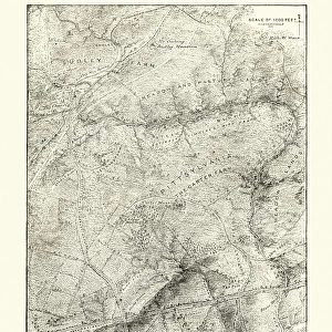
Battle of Port Royal

![]()
Wall Art and Photo Gifts from Fine Art Storehouse
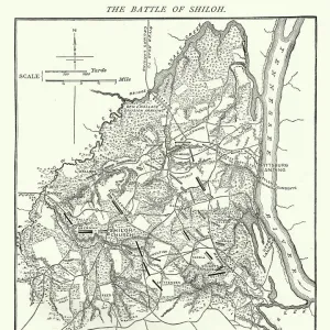
Battle of Port Royal
Vintage engraving from 1863 of a map of the Battle of Port Royal which was one of the earliest amphibious operations of the American Civil War, in which a United States Navy fleet and United States Army expeditionary force captured Port Royal Sound, South Carolina
duncan1890
Media ID 14757186
© duncan1890
Aggression American Civil War American Culture Amphibian Battle Battlefield Chart Civil War Coastal Feature Conflict Document Equipment Historical War Event Illustrations And Vector Art Image Created 1860 1869 Information Equipment Land Military Natural Phenomenon Navigational Equipment Navy North America North Carolina Objects Equipment Past Plan Printed Media South Carolina Southern Usa Styles The Americas Traditional Culture Travel Locations Us Military Us Navy
FEATURES IN THESE COLLECTIONS
> History
> Battles & Wars
> American Civil War (1860-1865)
> History
> Battles & Wars
> Historcal Battle Maps and Plans
> Map
> Historical Maps
> Map
> USA Maps
> USA Southern States Historical Maps
> Map
MADE IN THE UK
Safe Shipping with 30 Day Money Back Guarantee
FREE PERSONALISATION*
We are proud to offer a range of customisation features including Personalised Captions, Color Filters and Picture Zoom Tools
SECURE PAYMENTS
We happily accept a wide range of payment options so you can pay for the things you need in the way that is most convenient for you
* Options may vary by product and licensing agreement. Zoomed Pictures can be adjusted in the Basket.